67 Hwy D, Ironton, MO 63650


- Added:
- Jun 14, 2026
- Days on Market:
- 4
- Last Refresh:
- Jun 17 at 8:06 am
Property Features for 67 Hwy D
General Information
- Property type
- Land
- Property subtype
- Other
- Zoning
- See Remarks
- Exterior features
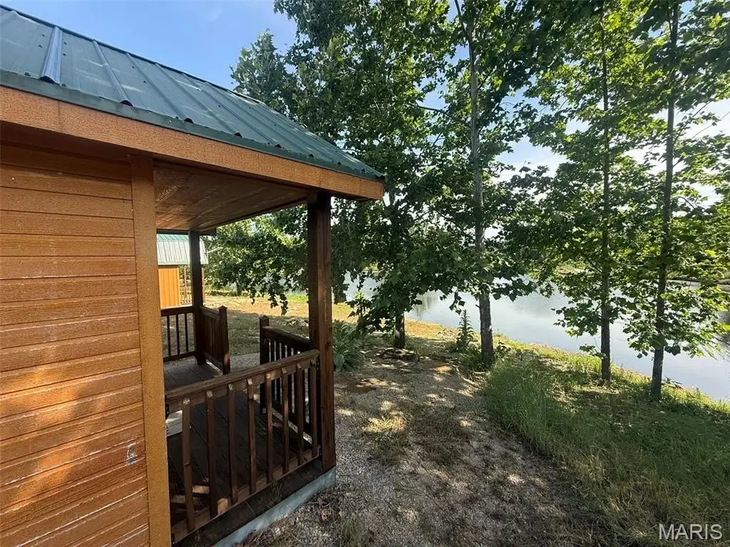
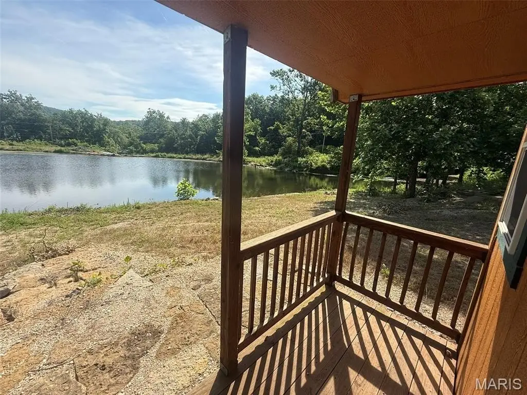
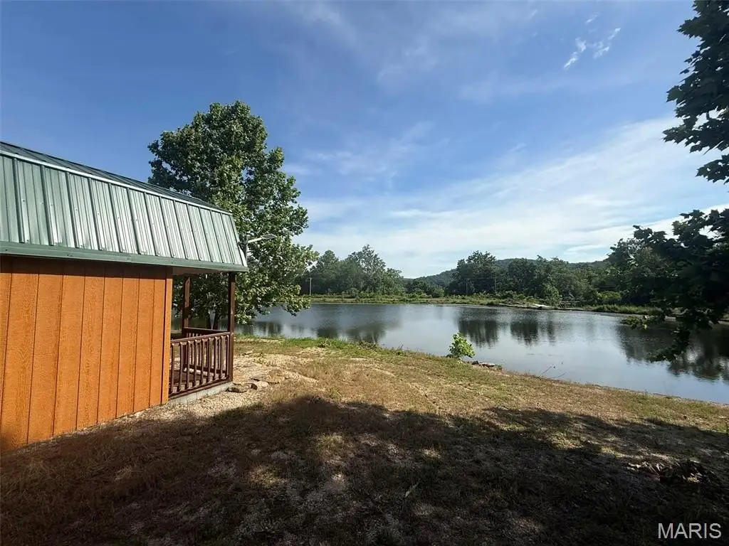
- Secluded, Views, Waterfront
- Standard status
- Active
- APN
- 12210320000000060000
- Lot size
- 15.30 Acres
Taxes and HOA fees
- Tax Year
- 2025
- Tax Annual Amount
- 6
Utilities
- Water front features
- Lake, Lake Front, Pond, Stream, Waterfront, Waterfront
- Water front
- 1
Building Details
- Architectural style
- Other

Listing agent Jared Smith (913) 908-8001
Listing office EXP Realty, LLC 3636 S Geyer Rd Ste 100, Overland Park, MO (866) 224-1761
Listing date Jun 14, 2026
Copyright © 2026 Mid America Regional Information Systems, Inc. All rights reserved. All information provided by the listing agent/broker is deemed reliable but is not guaranteed and should be independently verified.
HighLights
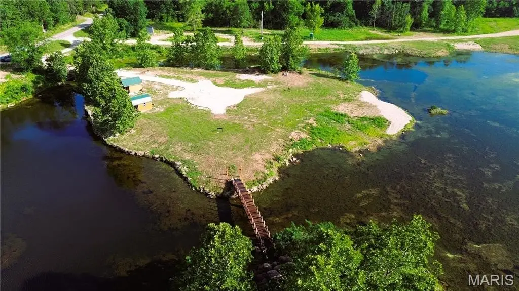
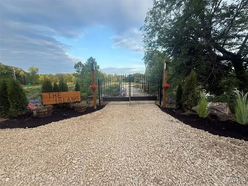
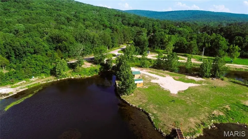
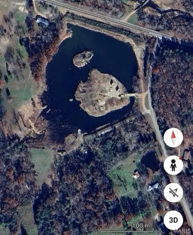
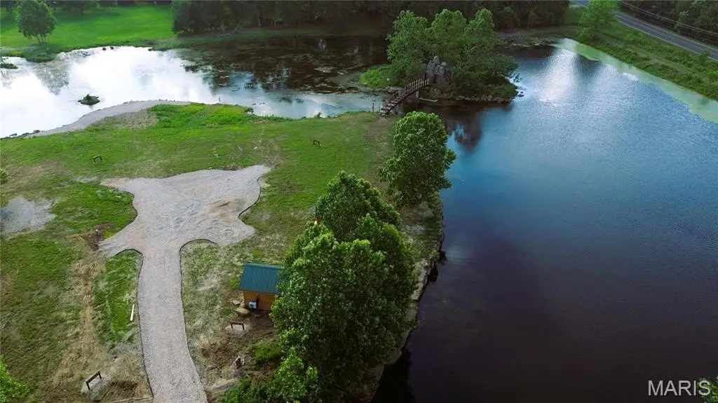
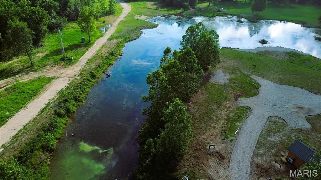
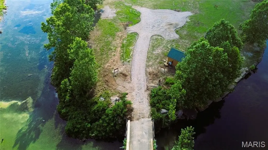
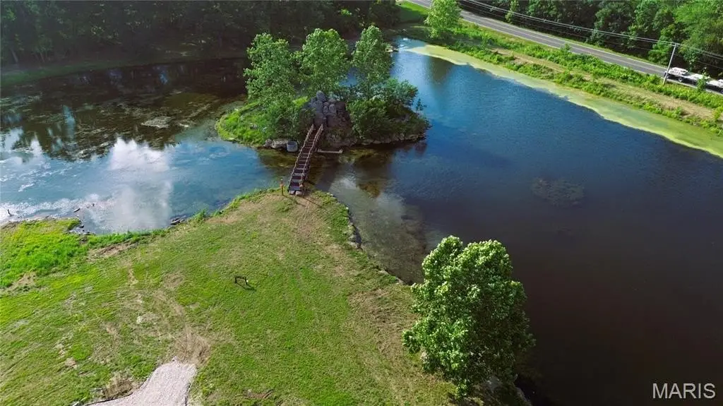
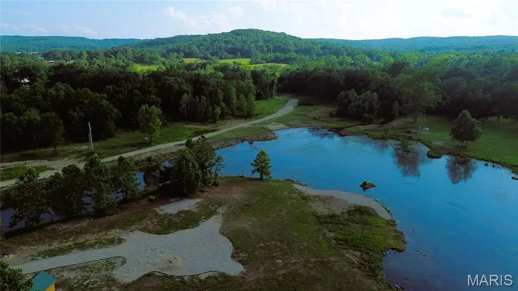
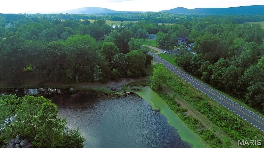
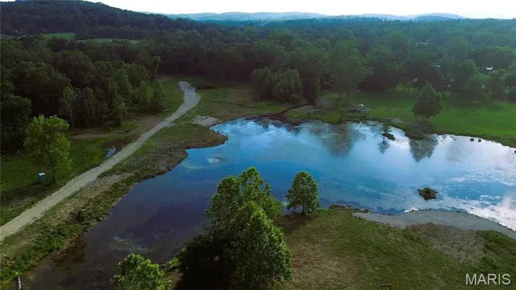
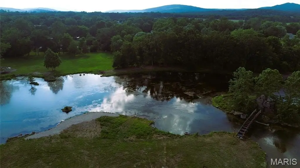
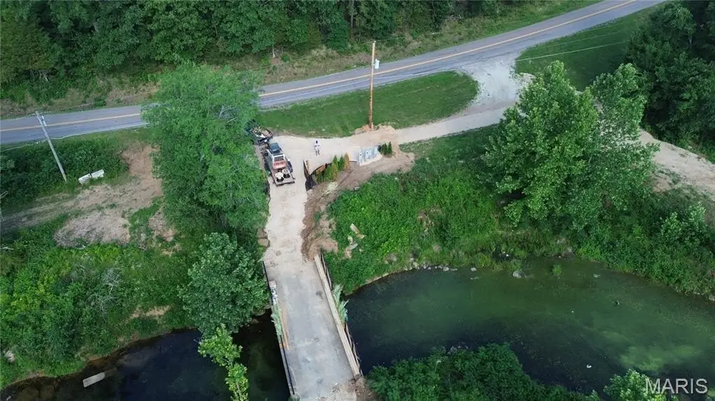
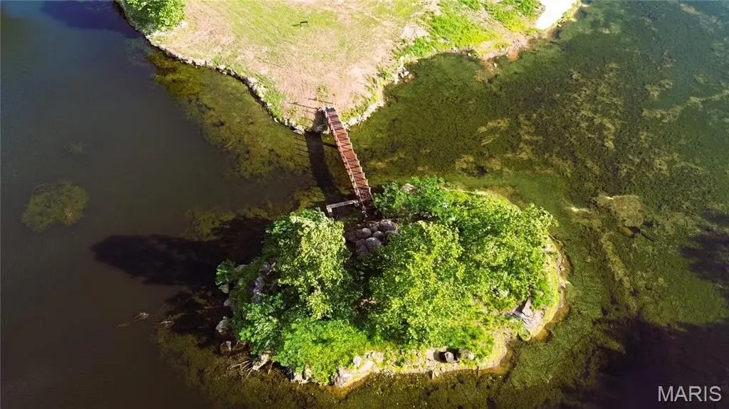
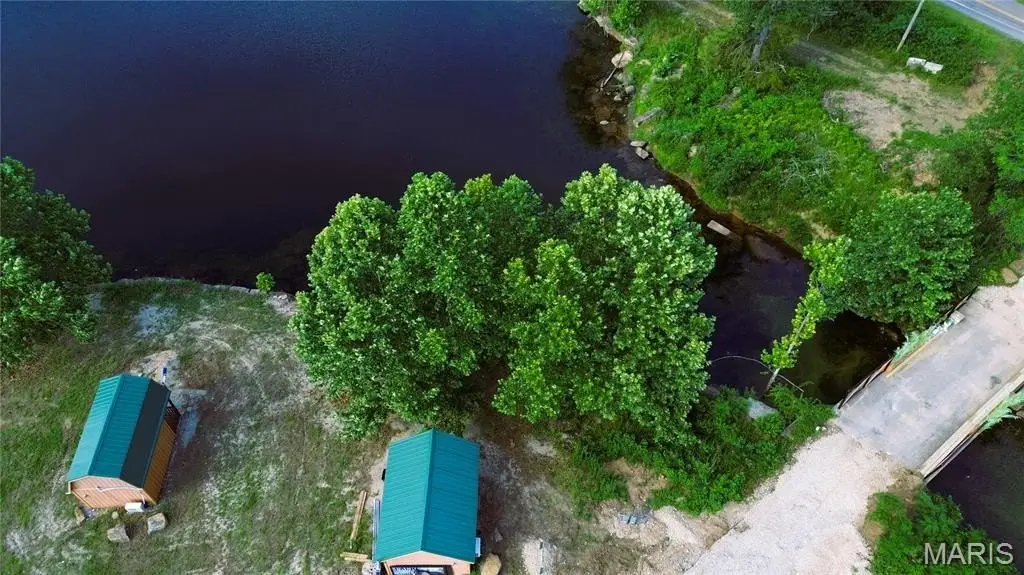
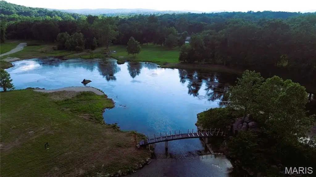
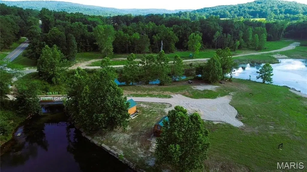
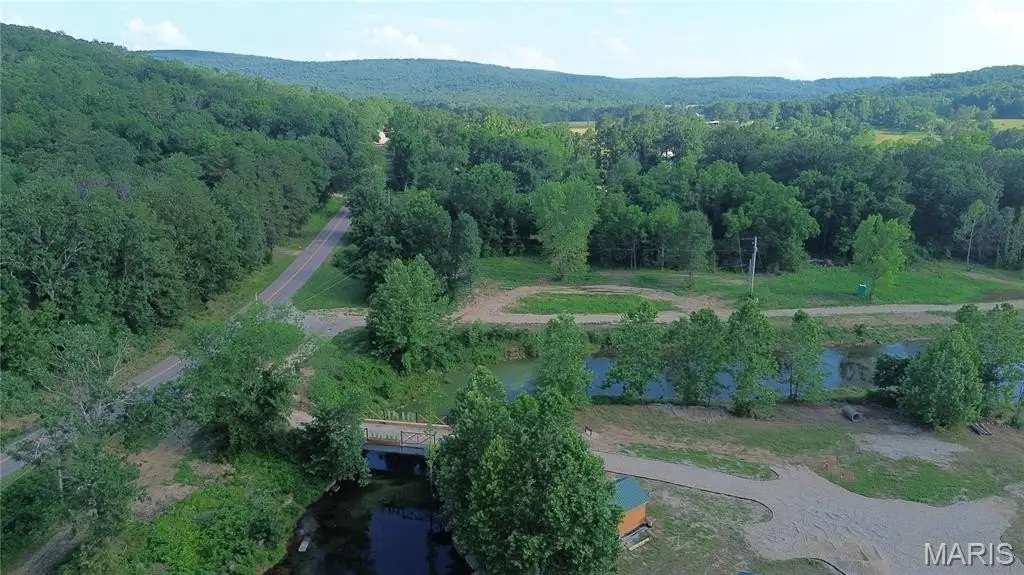
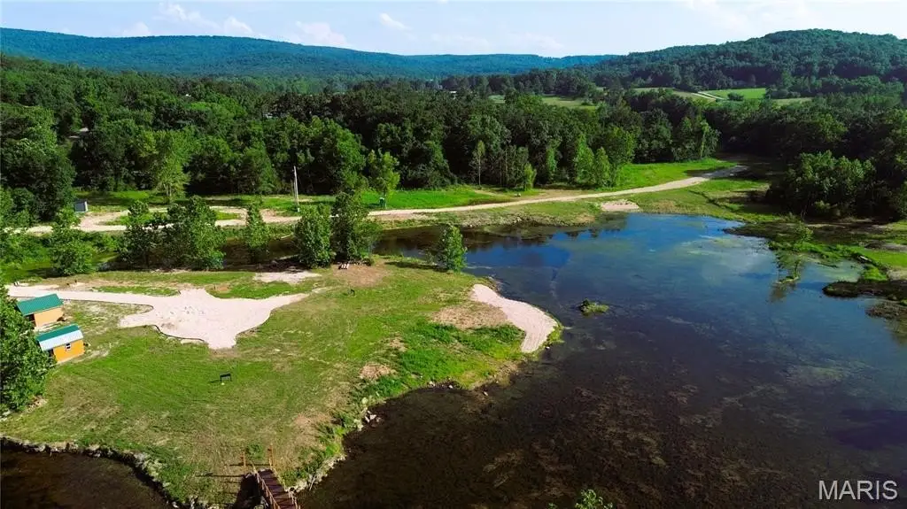
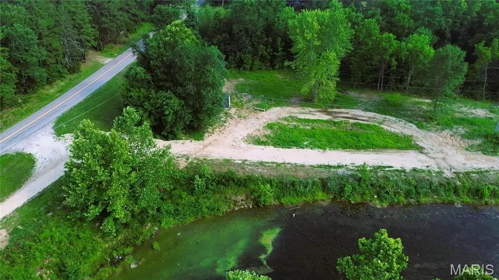
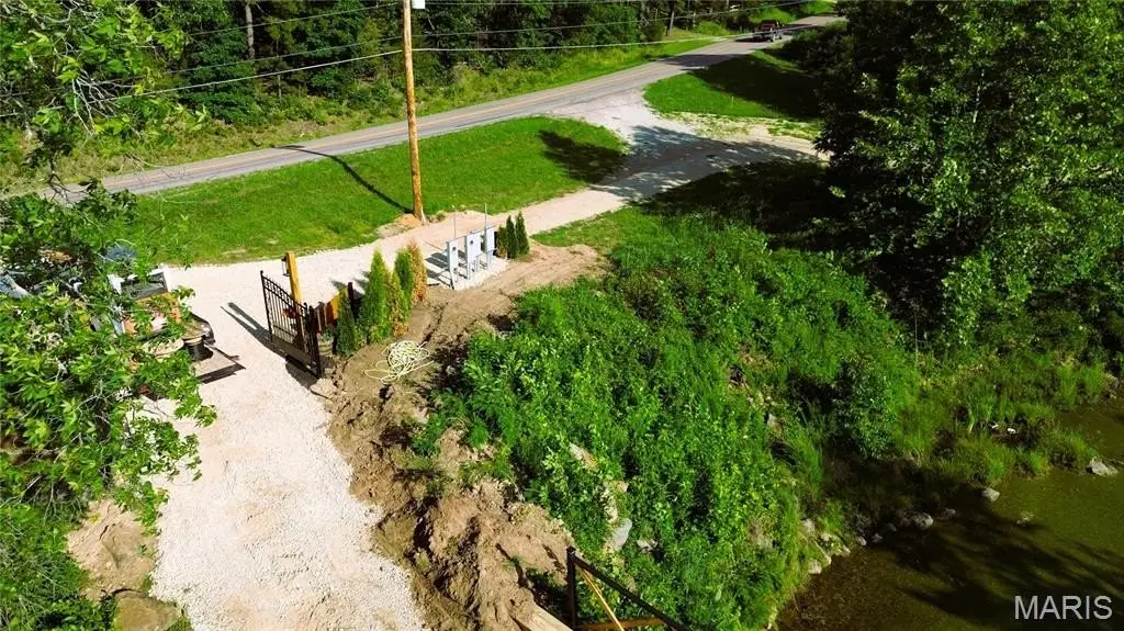
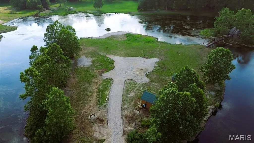
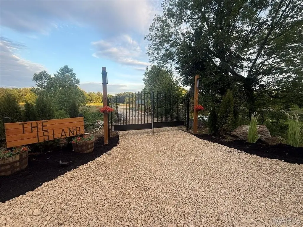
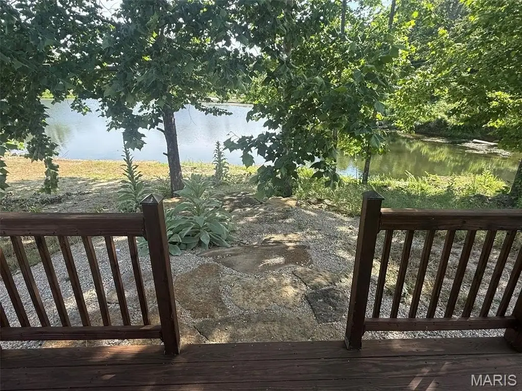
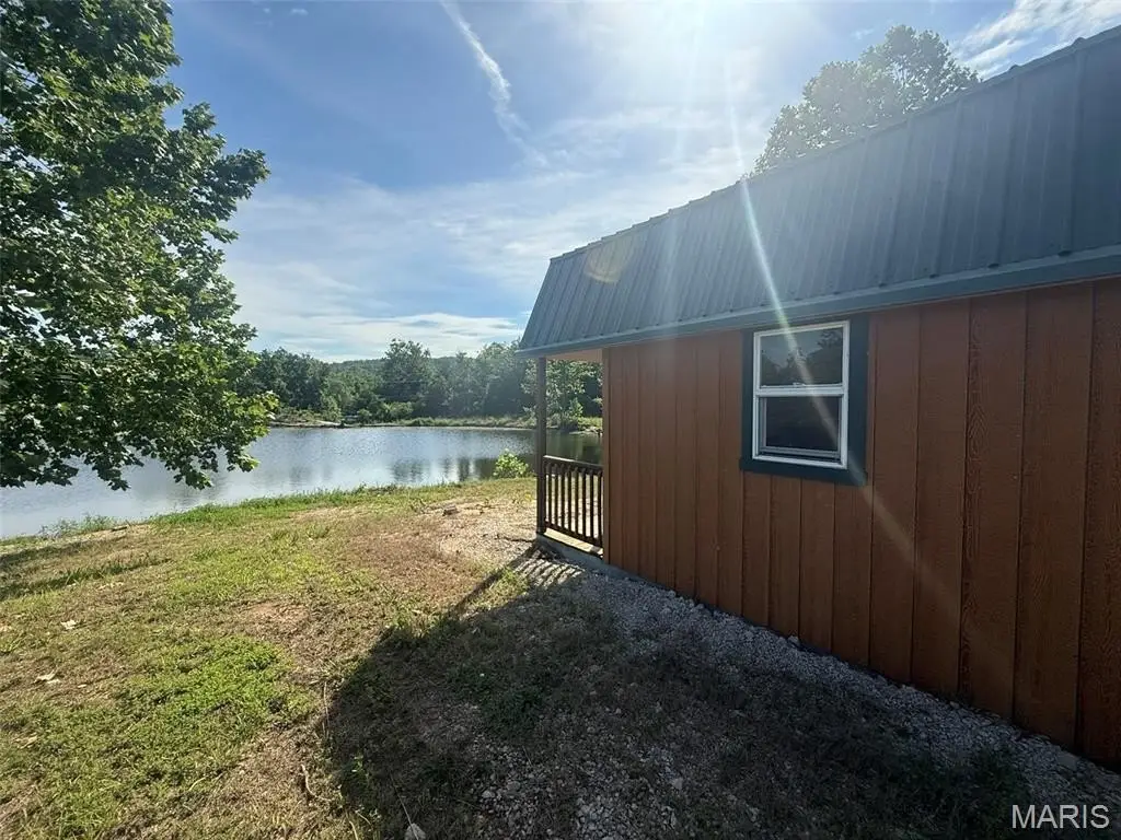
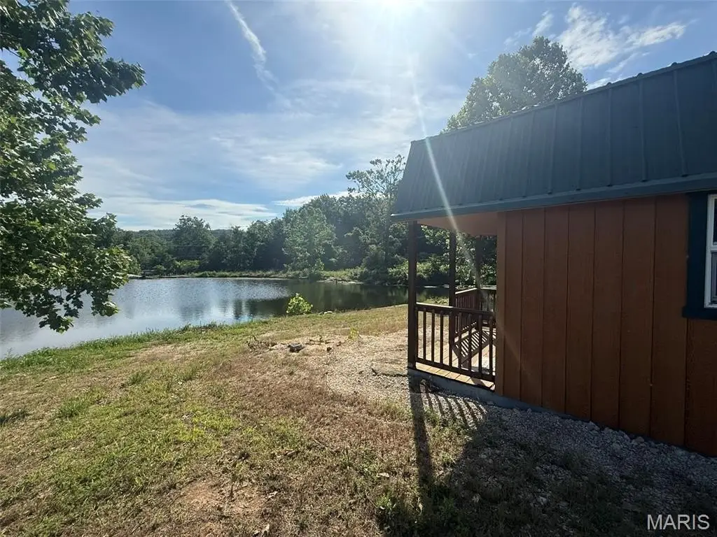
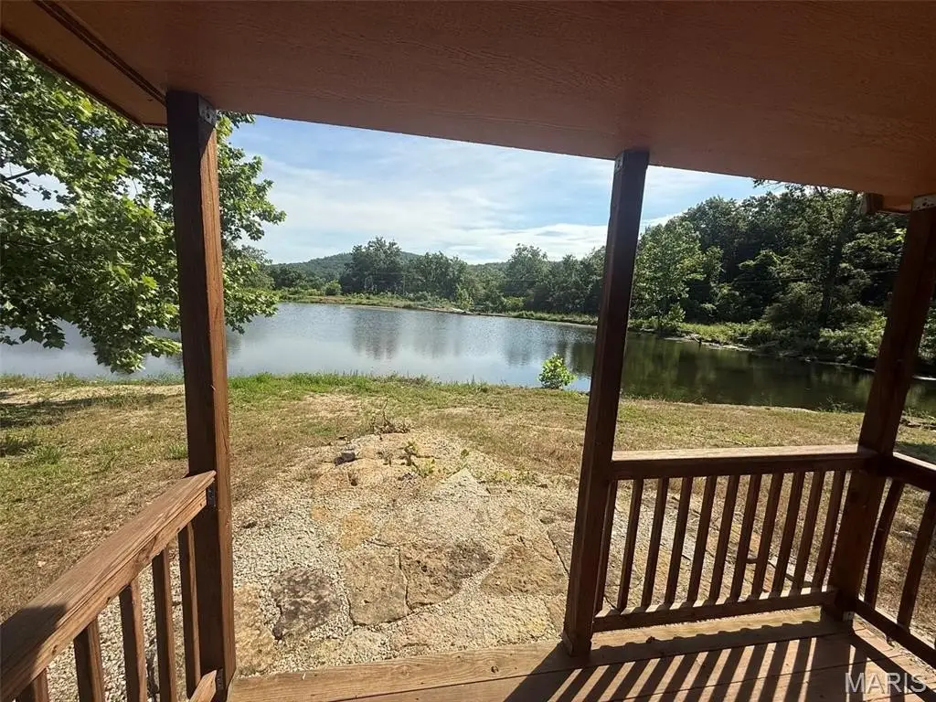
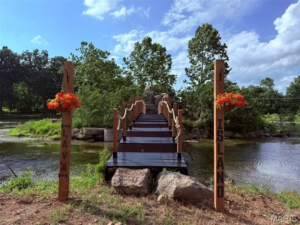
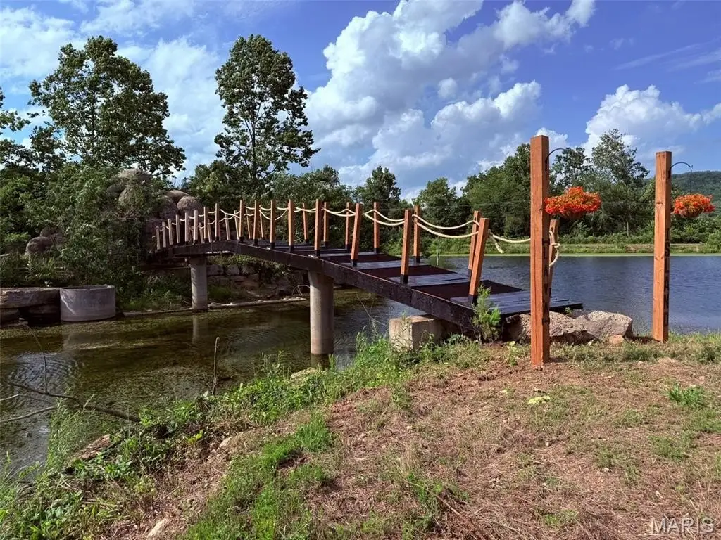
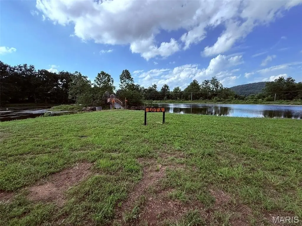
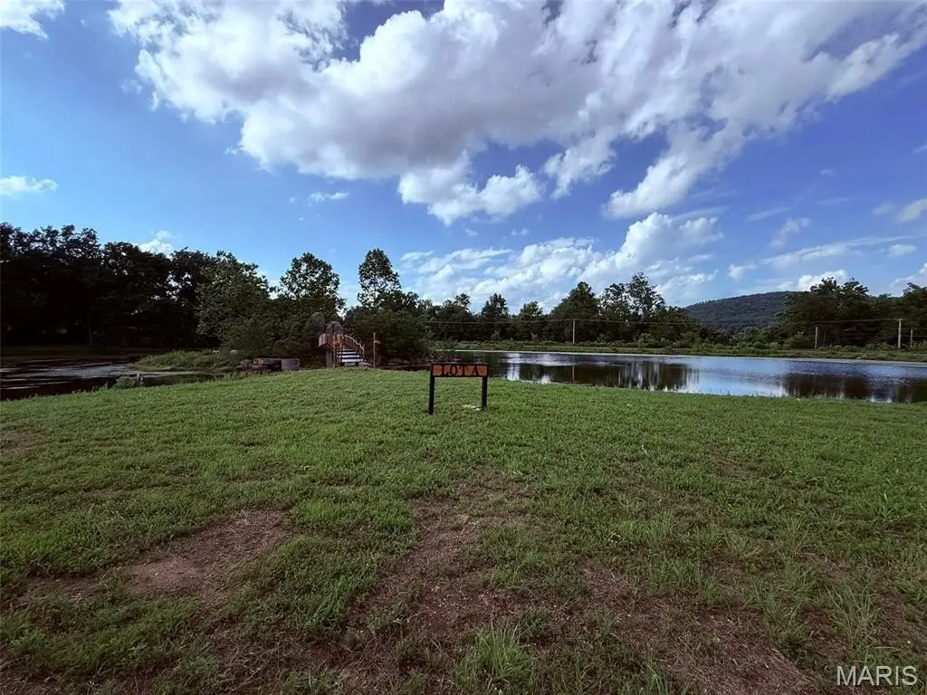
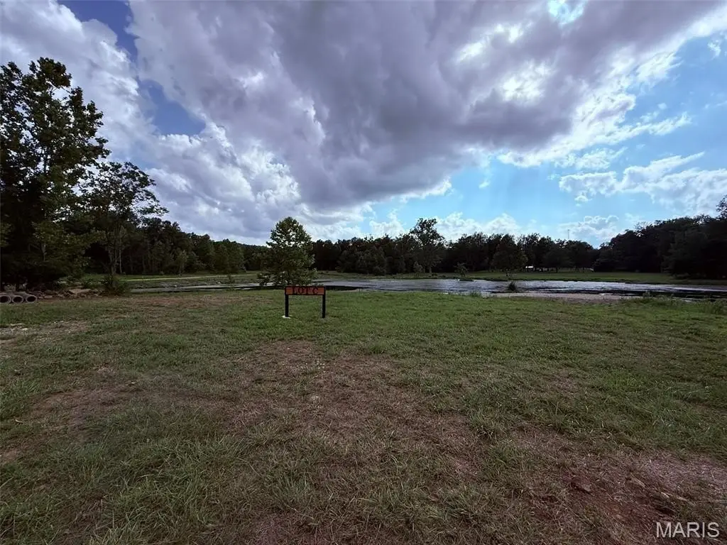
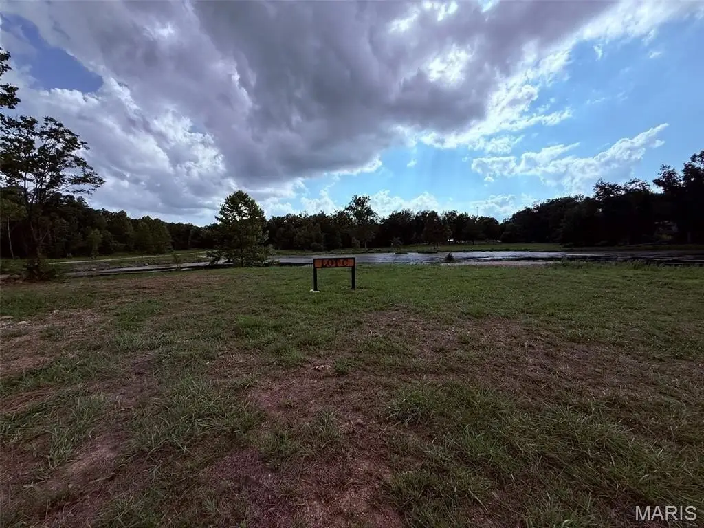
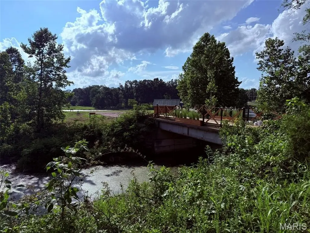
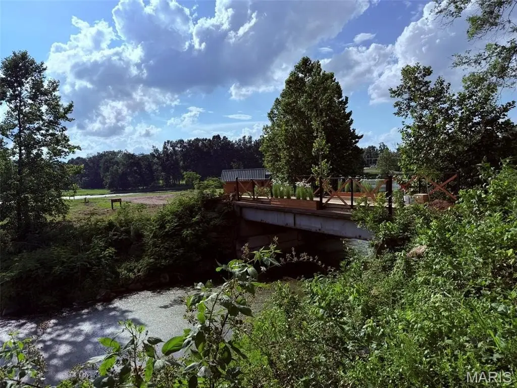
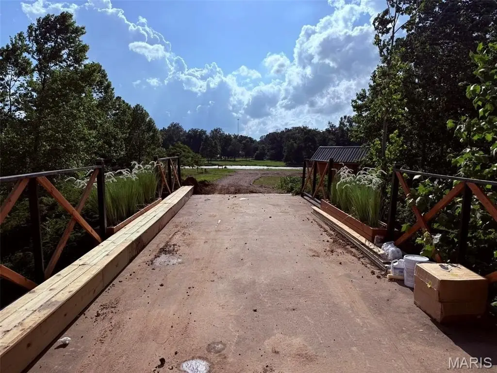
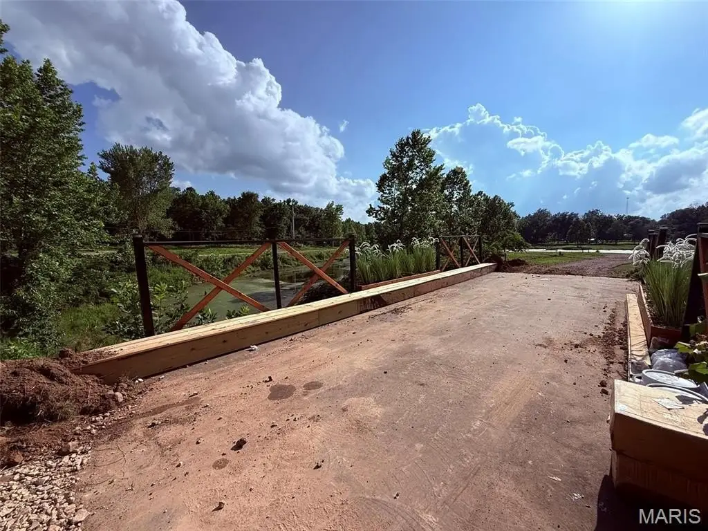
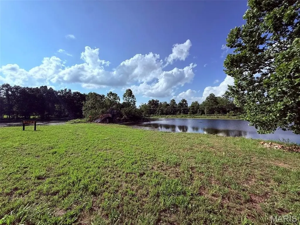
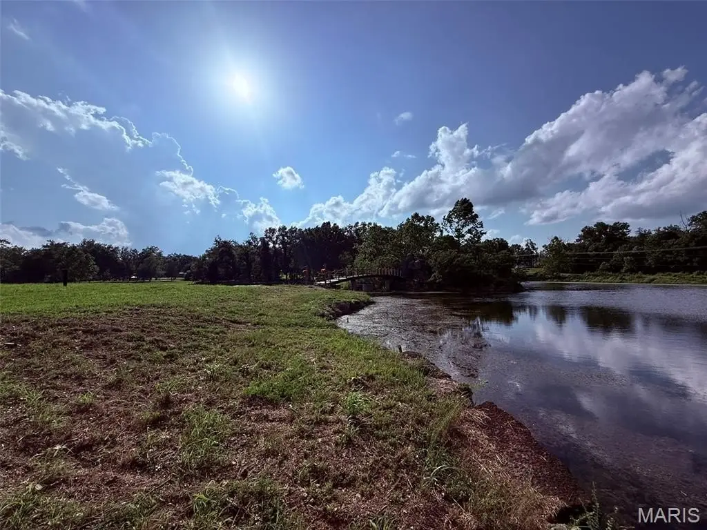
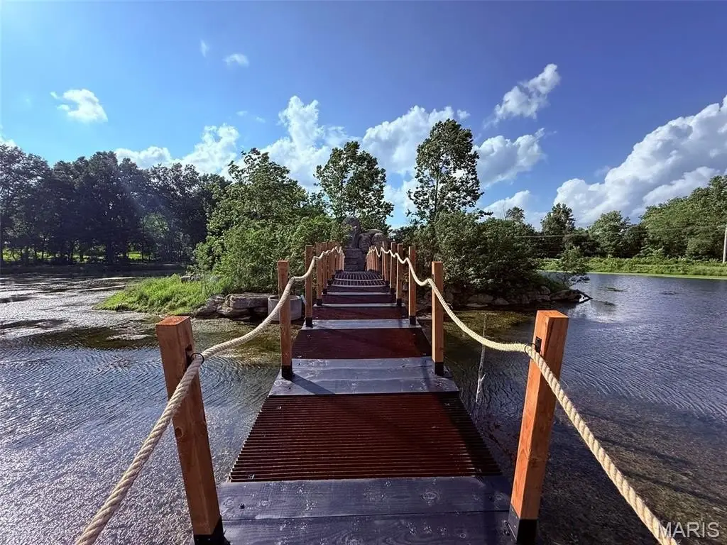
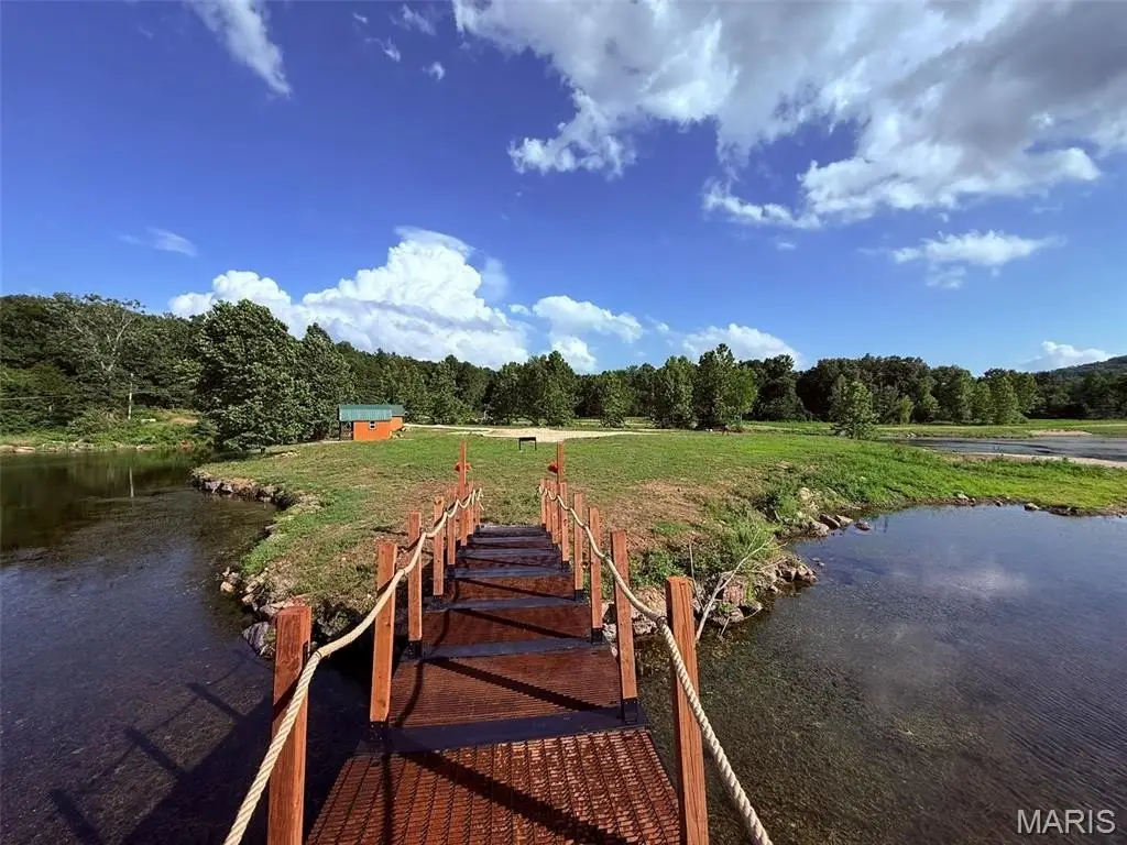
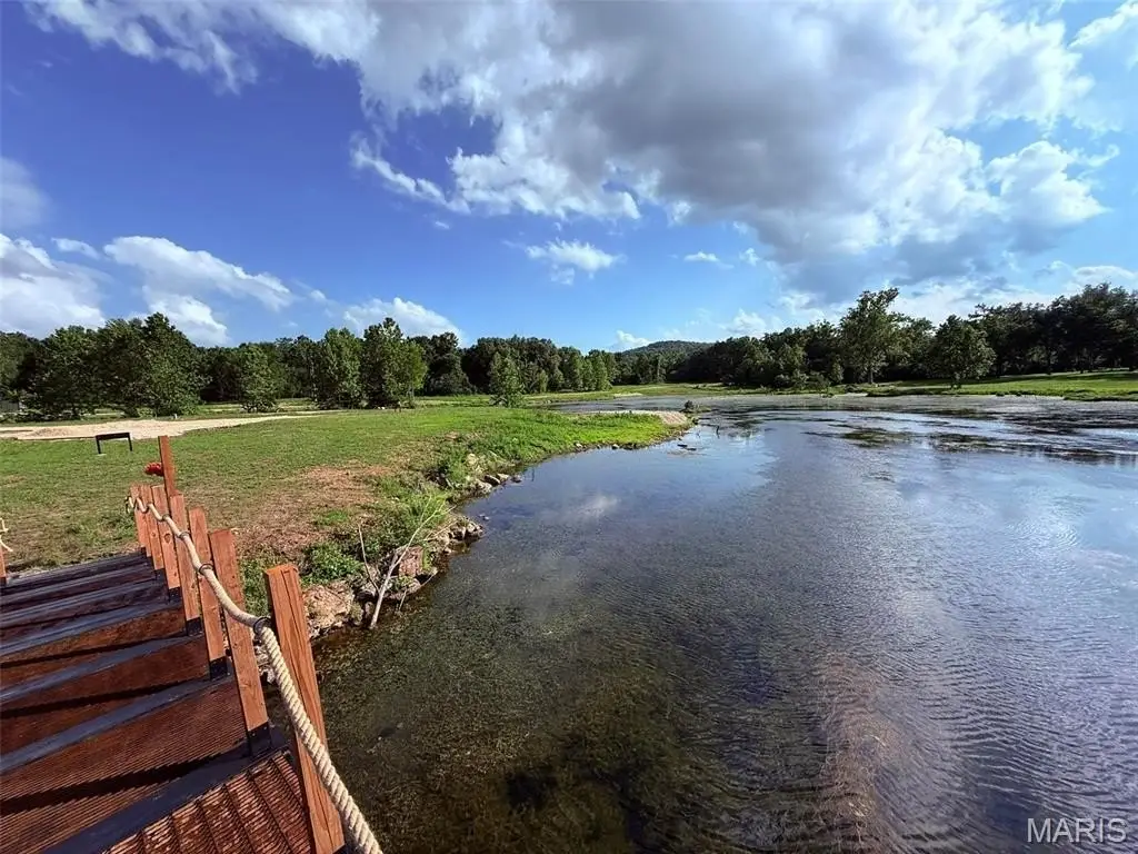
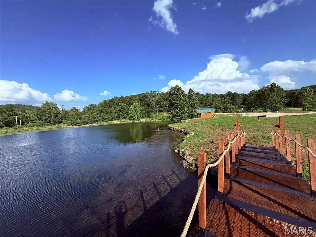
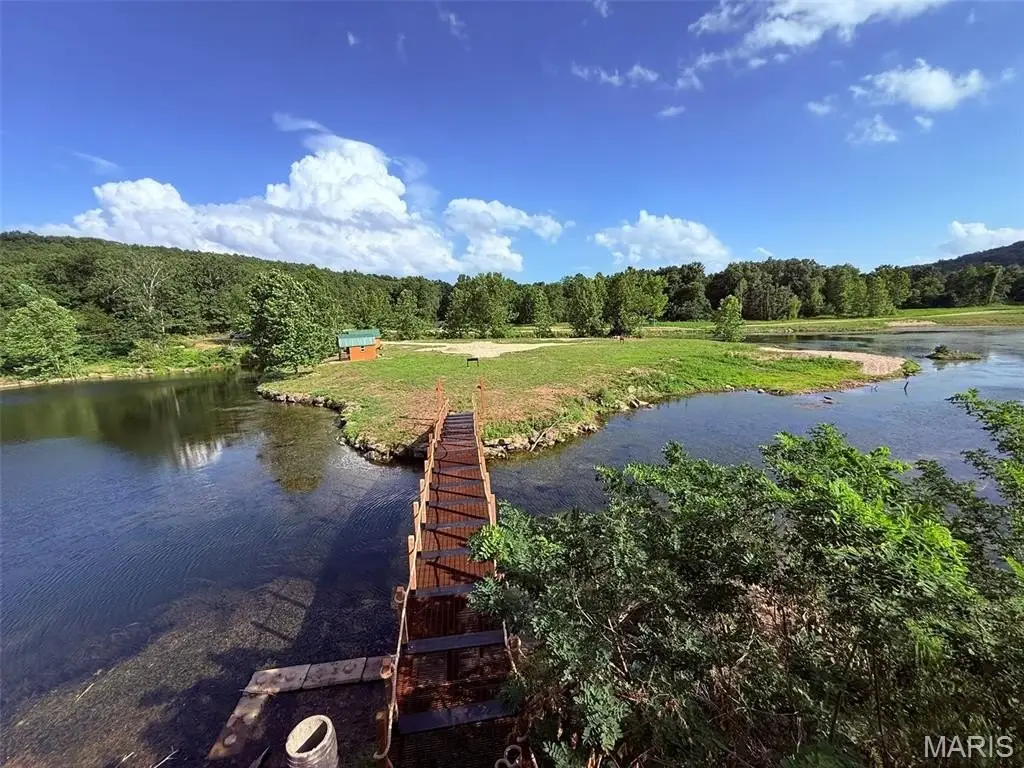
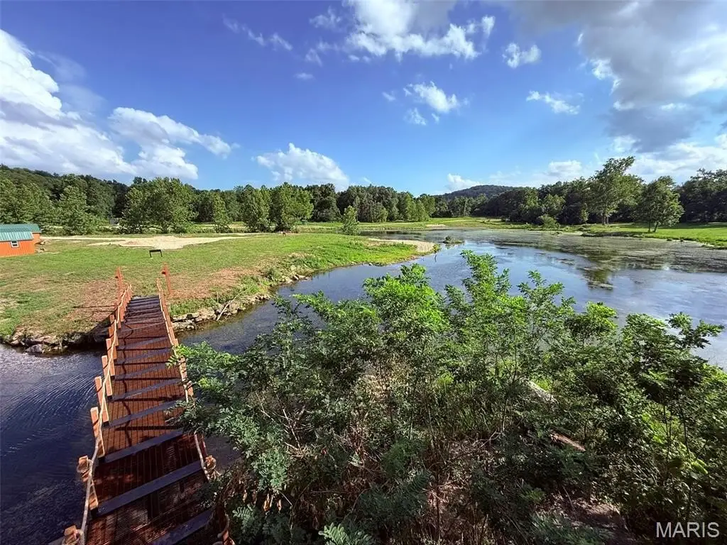
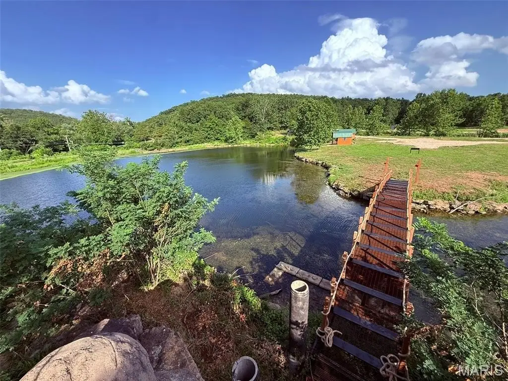
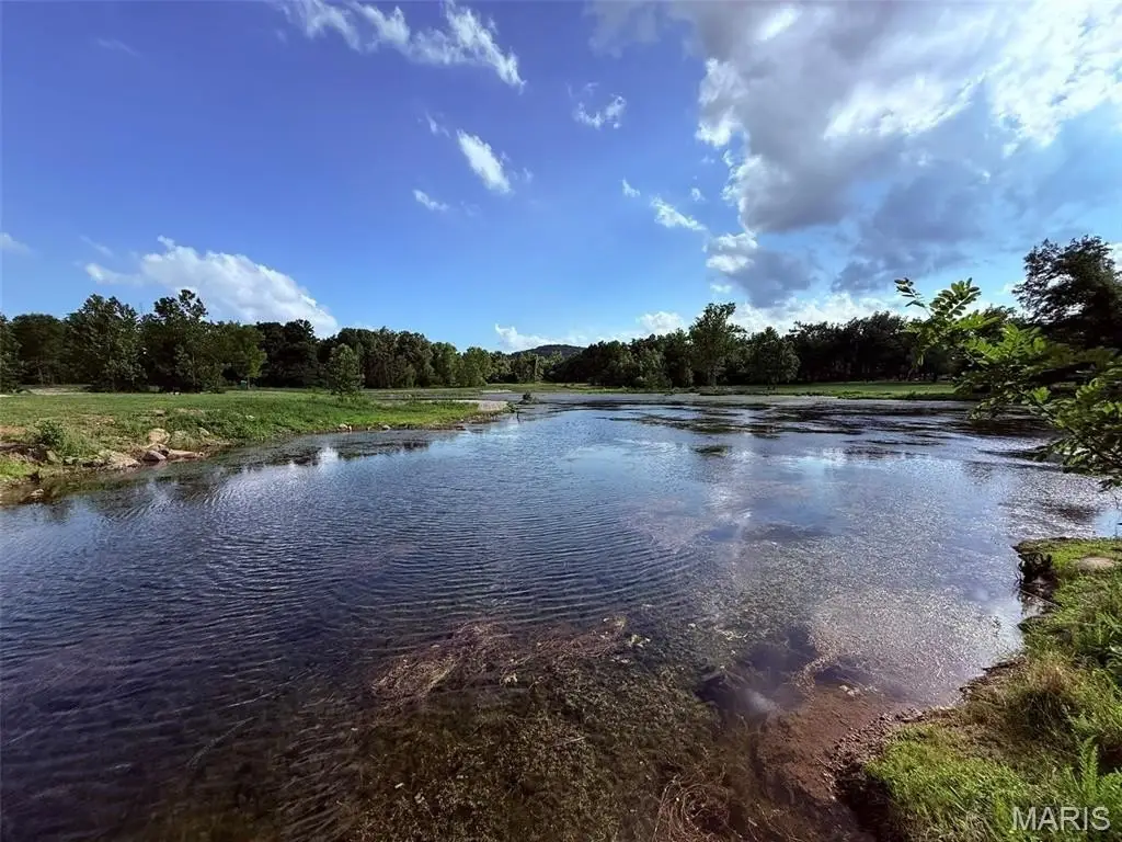
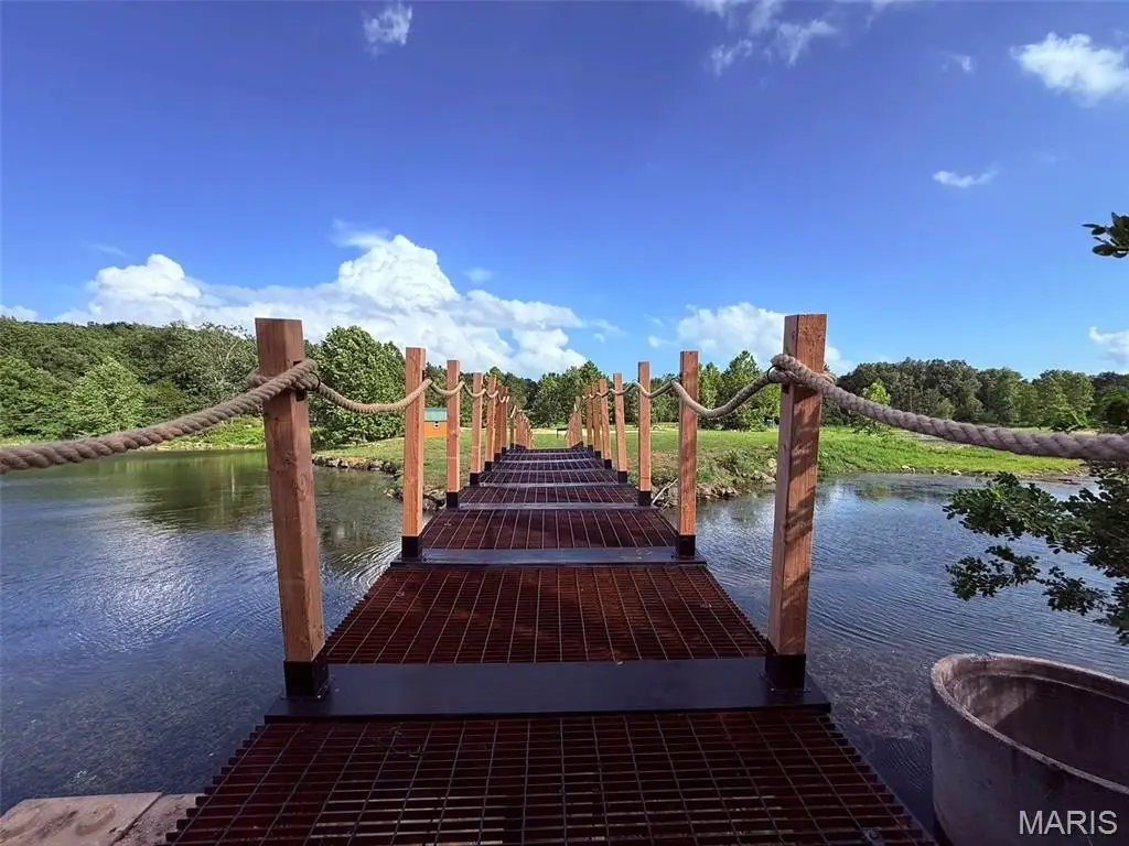
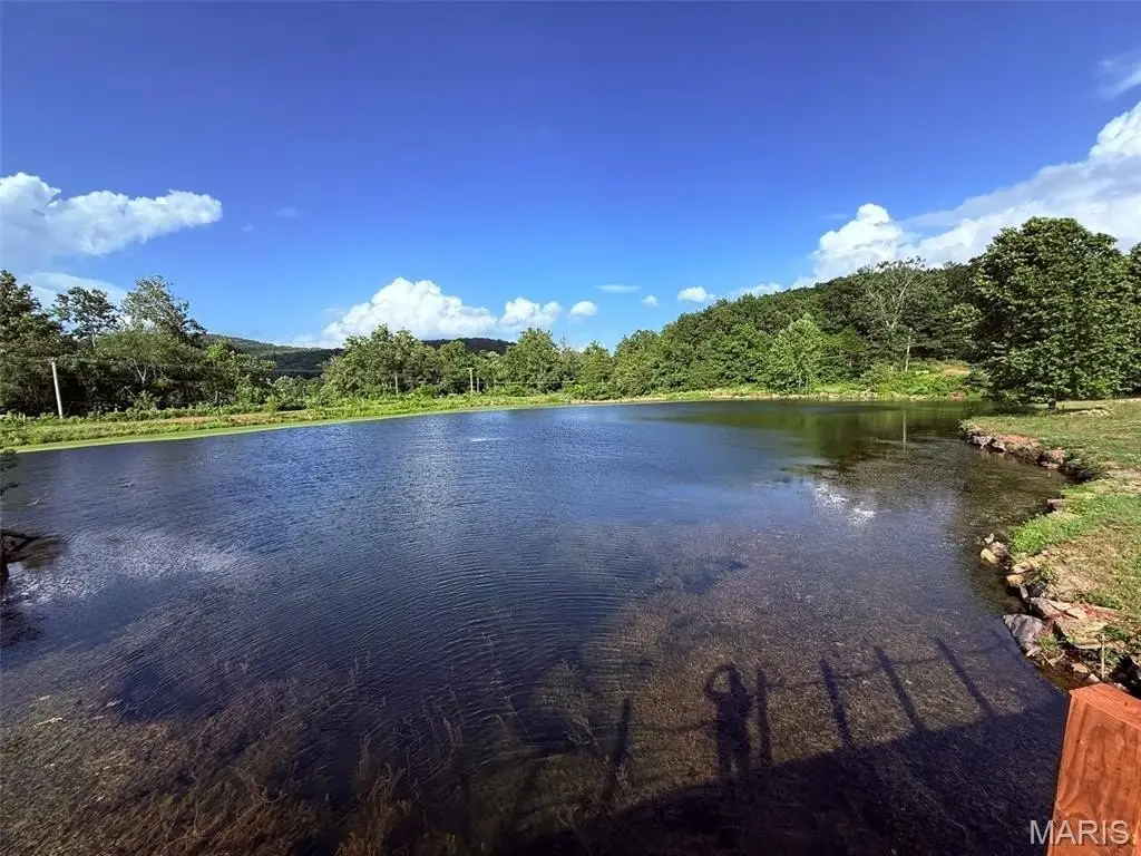
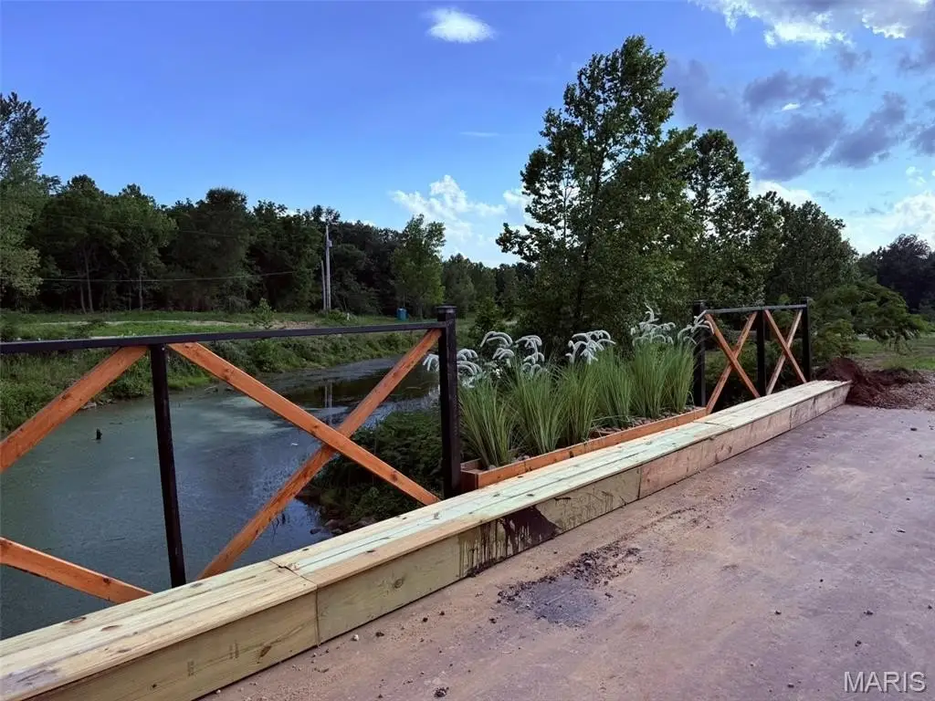
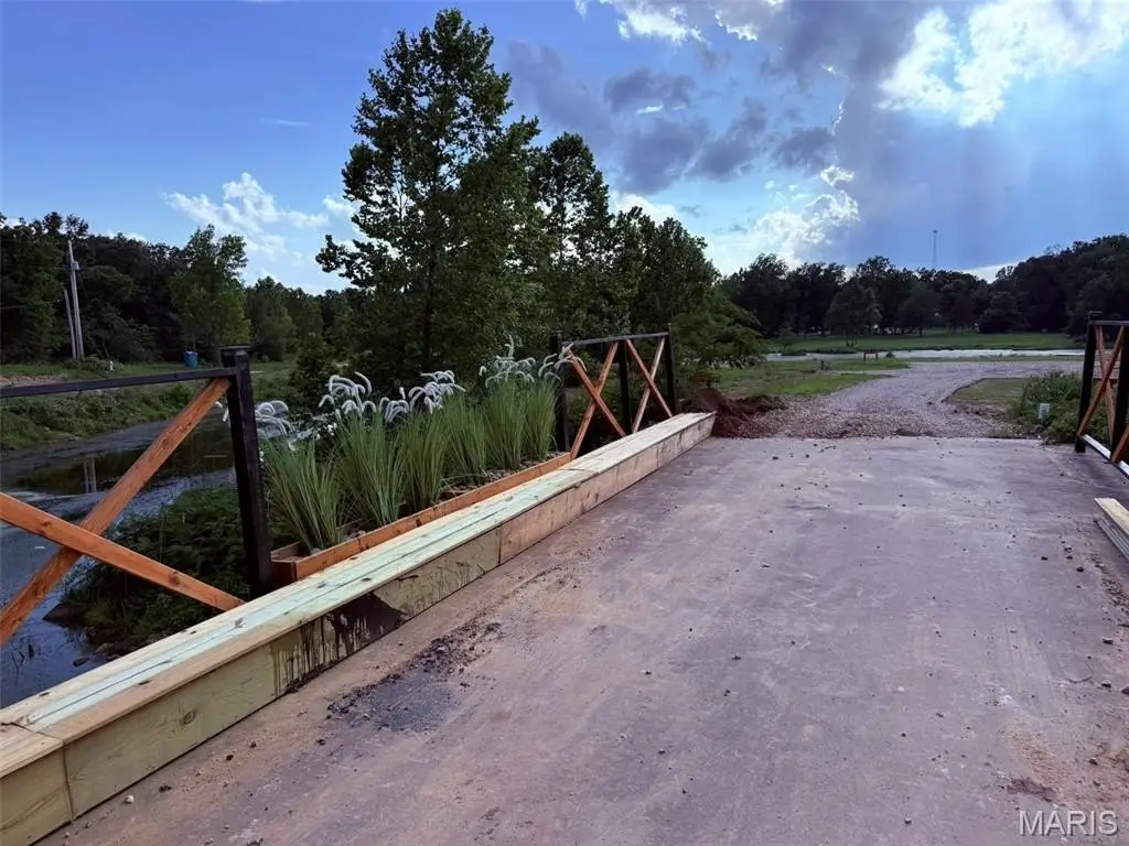
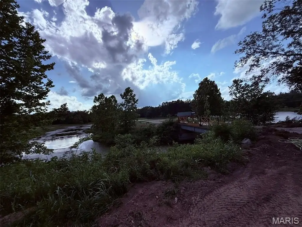
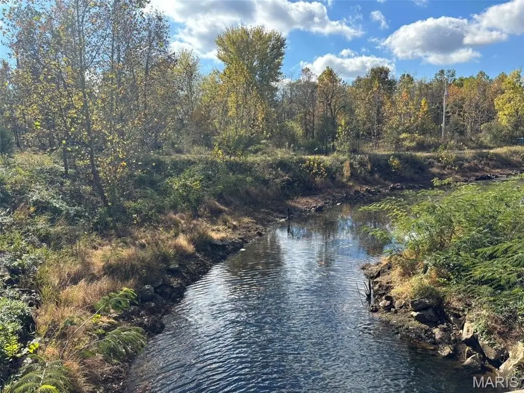
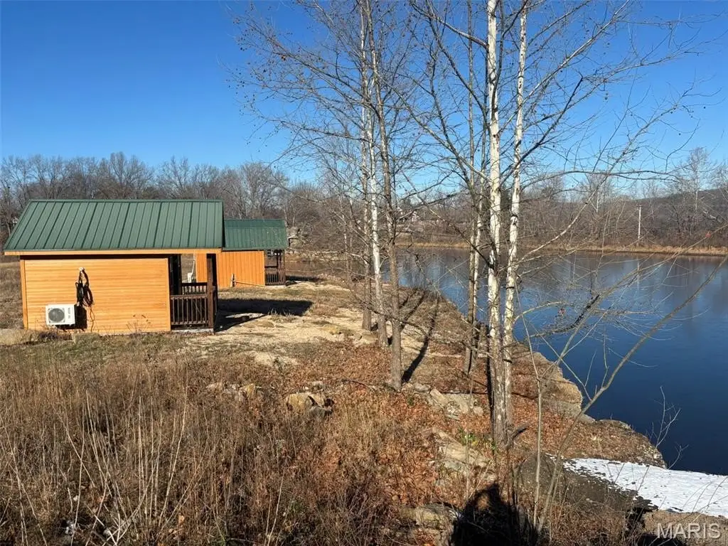
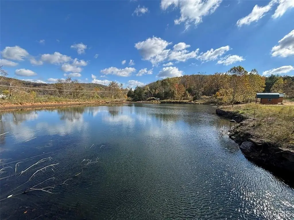
- 15.3 combined acres in Arcadia Valley with a private gated island and lake on site.
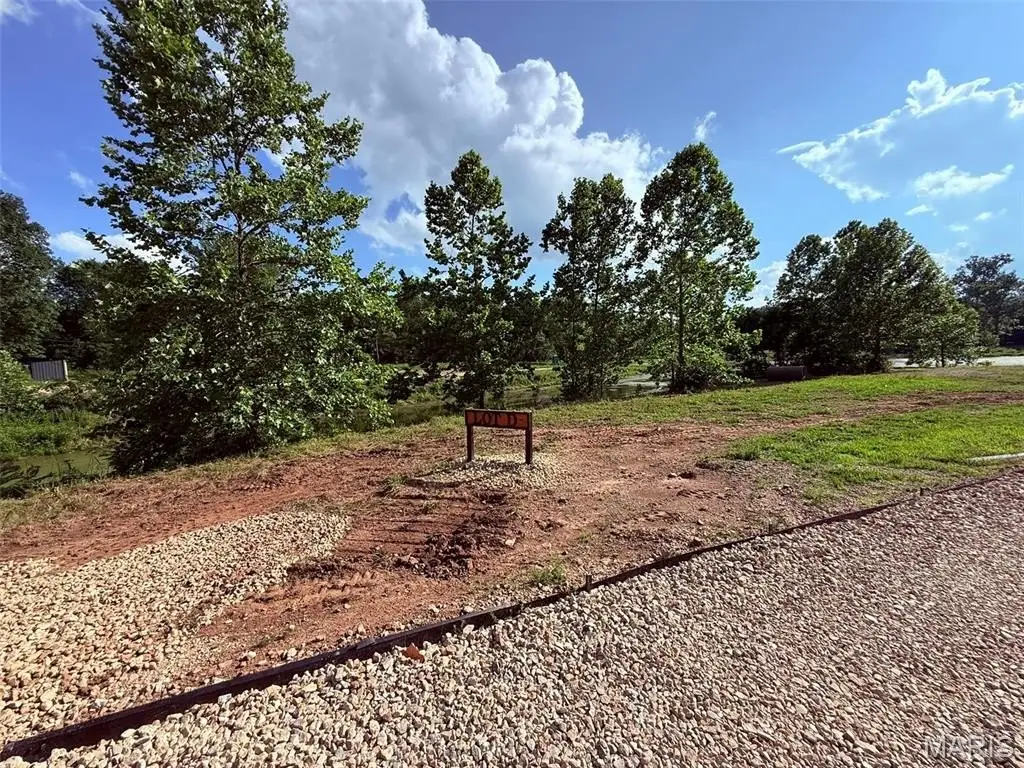
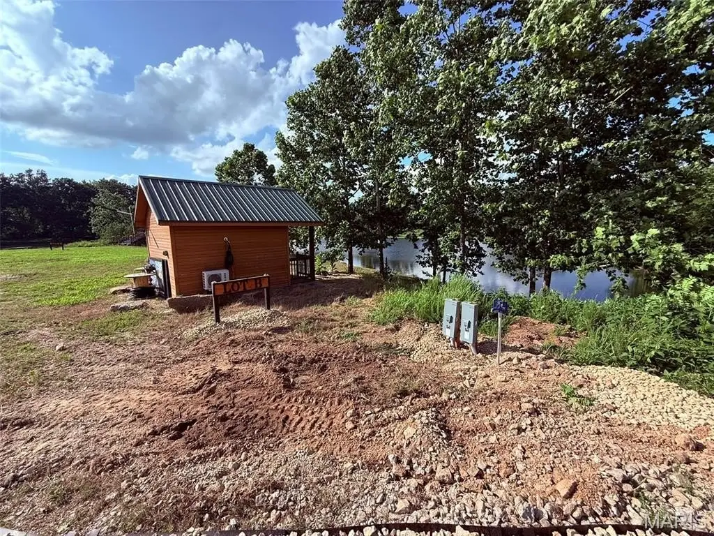
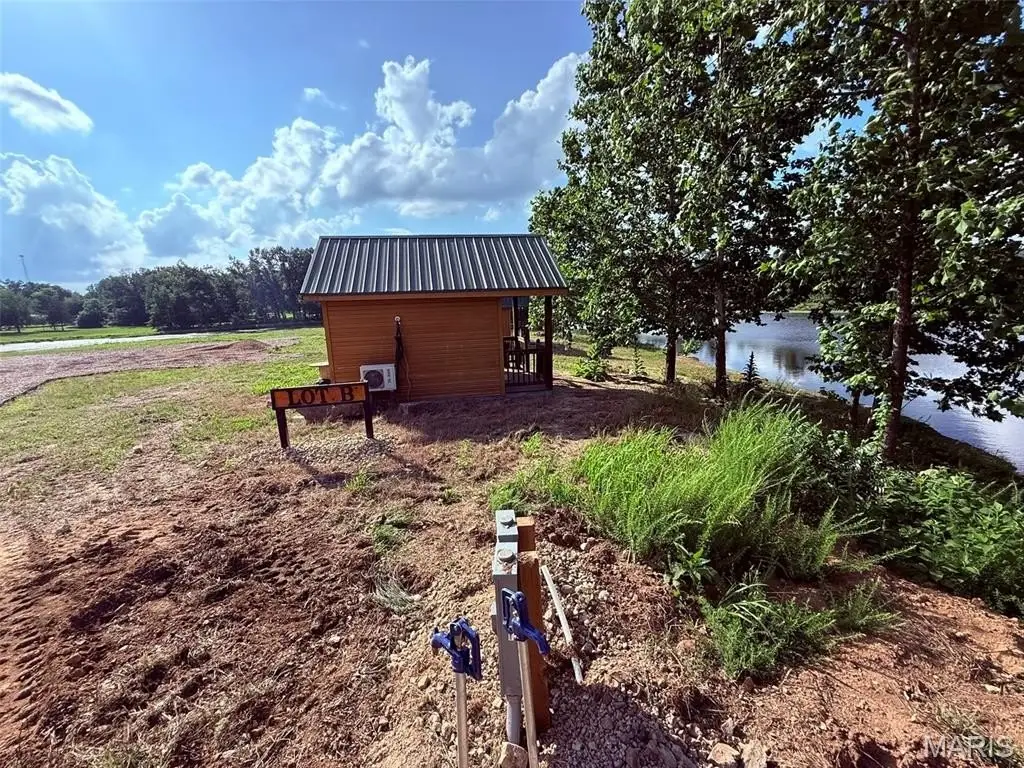
- Surveyed into 6 buildable homesites: four 3‑acre island lots and two 1‑acre waterfront lots.
- 3‑acre stocked lake with catfish, bass, and bluegill, plus waterfront/pond/stream features.
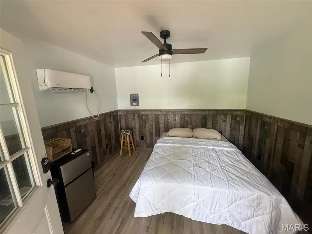
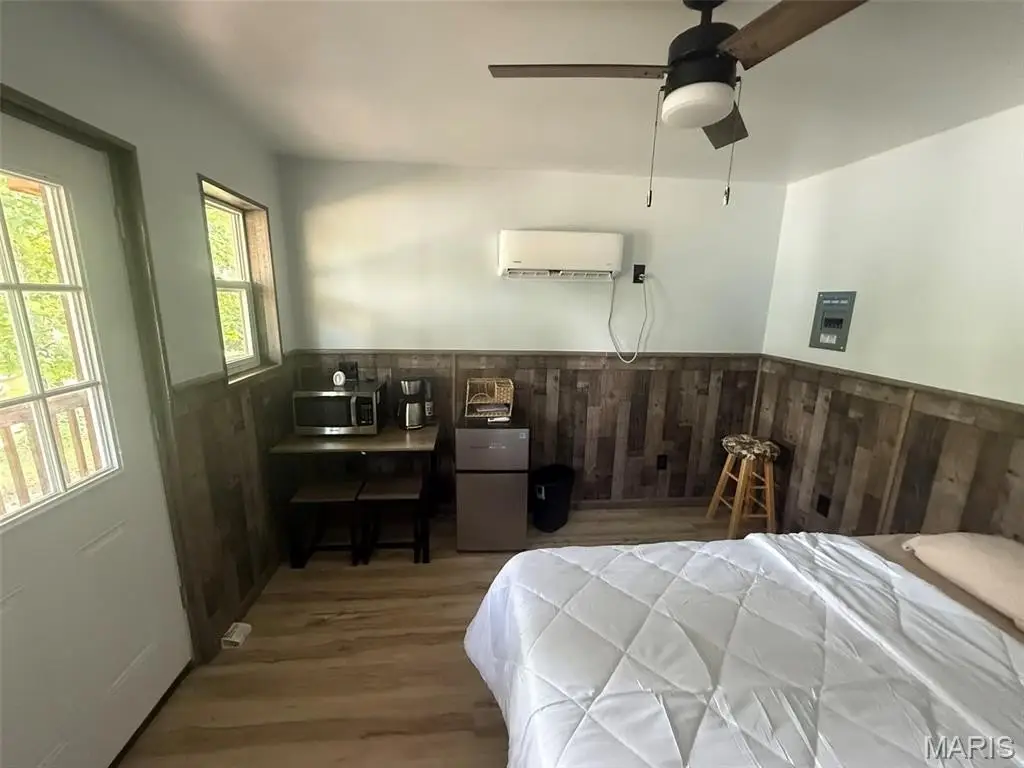
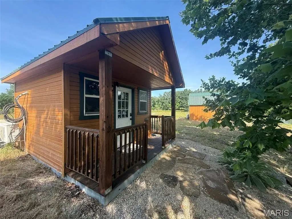
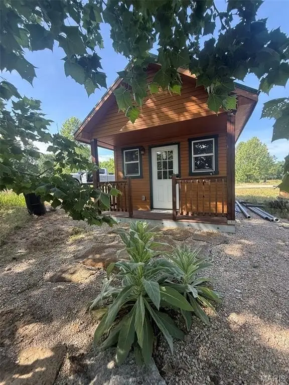
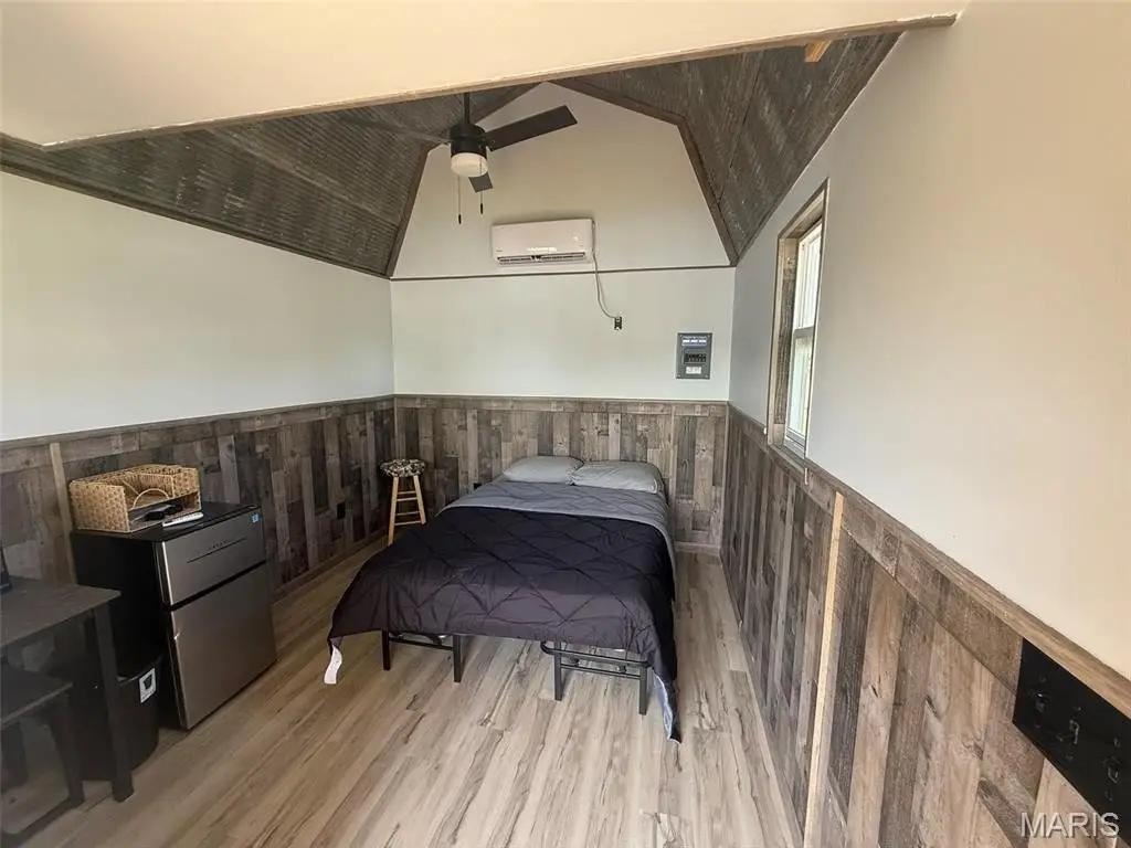
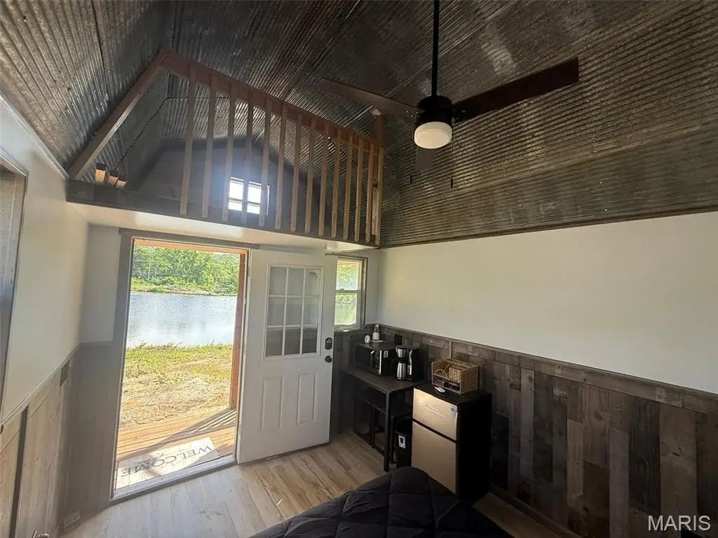
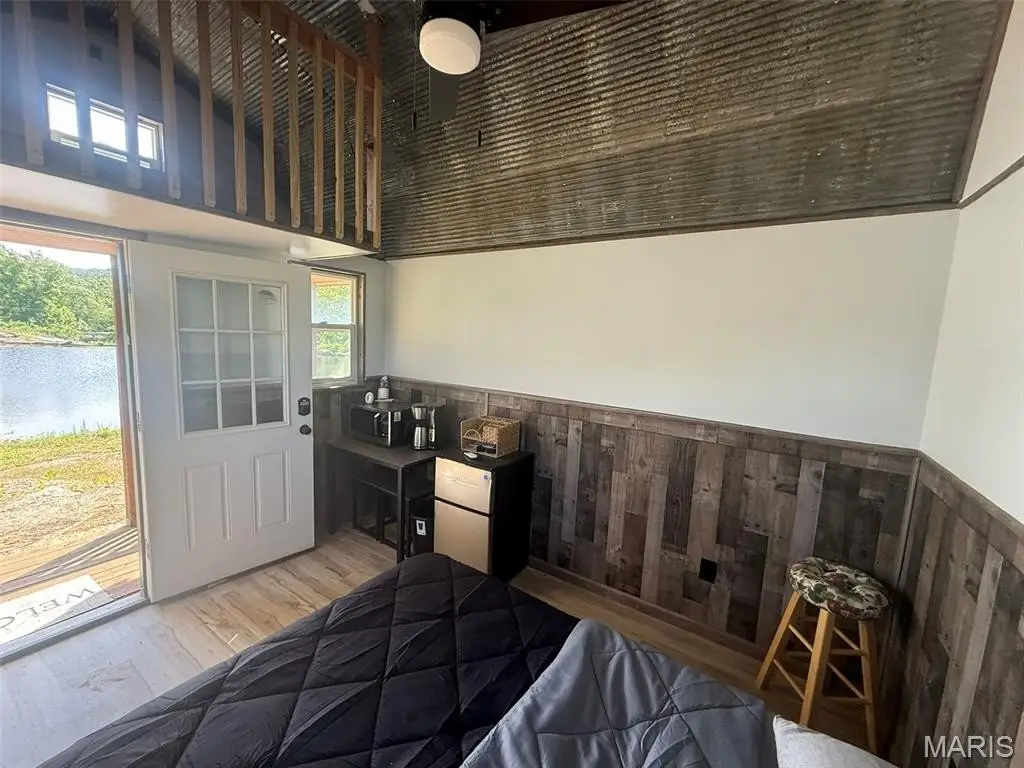
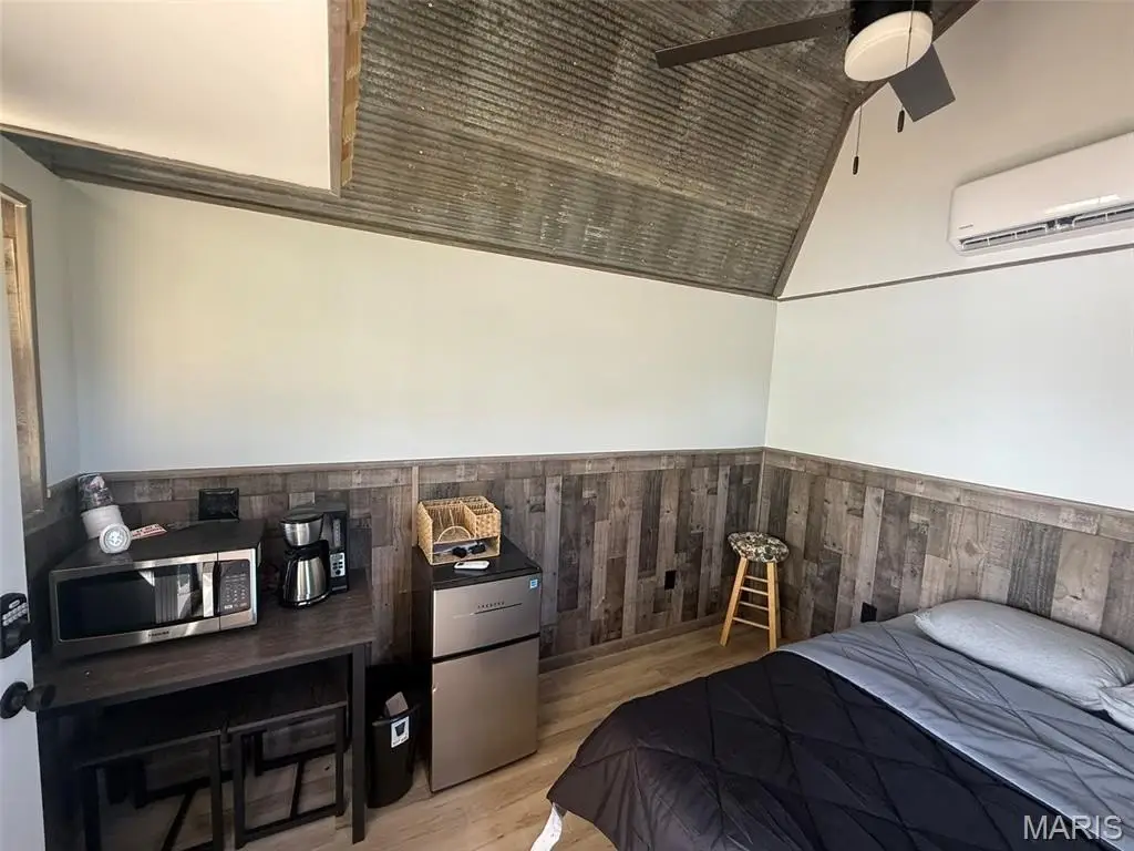
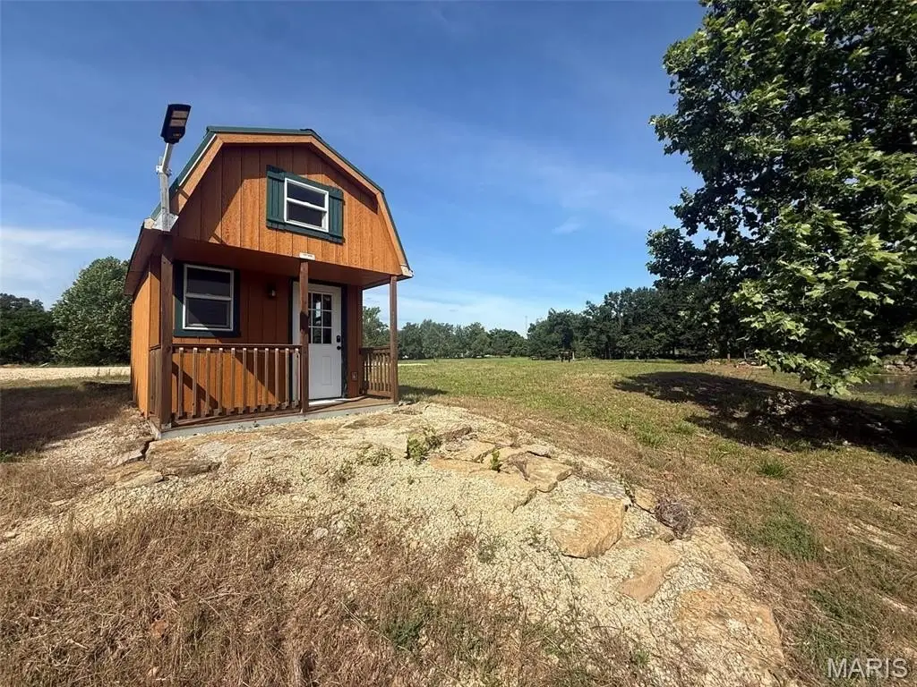
- Two finished overnight cabins on the island.
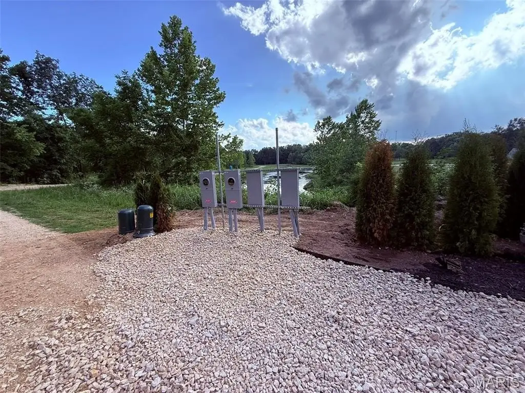
- Electric and water available at each lot; separately metered electric for each lot.
- Brand new community well installed January 2026; cleared, graded, and graveled with large level building areas.
Overview
The land is marketed as a whole before subdivision. A stocked, three-acre lake is included, with fish identified as catfish, bass, and bluegill. Seller disclosures state there is no county zoning and no restrictions, with build-to-suit development described for the site.
For buyers, the configuration supports a range of hospitality and lifestyle uses that fit the existing waterfront setting, including custom homesites or a planned RV park, retreat, wedding venue, tiny home community, or an airbnb-style resort concept. With utilities planned at each lot—separately metered electric and access to a community well—the site is positioned for straightforward development planning once the intended use is selected.
Current Use by Public Records
Location Insight
- Map
- Local Demand
- City
- Ironton
- County
- Iron
- State
- Missouri
- Longitude
- -90.58910464
- Latitude
- 37.58428222