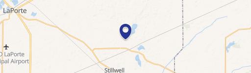
V/L E 50 N, Mill Creek, IN 46365
- Added:
- Jul 2, 2026
- Days on Market:
- 4
- Last Refresh:
- Jul 5 at 12:06 am
Property Features for V/L E 50 N
General Information
- Property type
- Land
- Property subtype
- Other
- Standard status
- Active
- APN
- 46-08-34-200-002.000-068
- Lot size
- 38.33 Acres
Taxes and HOA fees
- Tax Year
- 2025
- Tax Description
- 78-08-34-100-002 PT E1/2 NW1/4 & PT NE1/4 N IBL S34 T37 R1 38.330AC PER SURVEY
- Tax Annual Amount
- 574
Listing agent Brecken Kennedy (260) 578-7661
Listing office Mossy Oak Properties/Indiana Land and Lifestyle 190 S St. Rd. 66, Rockville, IN (812) 230-4503
Listing date Jul 2, 2026
Copyright © 2026 Northeastern Indiana Association of Realtors. All rights reserved. All information provided by the listing agent/broker is deemed reliable but is not guaranteed and should be independently verified.
HighLights
- 38+/- acre property south of Rolling Prairie in the Mills Creek area
- 36+/- acres of quality tillable ground for annual crop production
- Corn and soybean crop production commonly grown on the farm
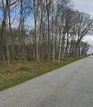
- Remaining acreage includes wooded fence rows and tree lines
- Wooded areas provide wildlife habitat with a healthy whitetail deer population
- Natural travel corridors make it suitable for hunting alongside its agricultural value
Overview
The property is located just south of Rolling Prairie in the Mills Creek area, within La Porte County, Indiana. The listing address is identified as V/L E 50 N in Mill Creek, IN 46365. No specific access details, road frontage, or utility information are provided in the materials.
For buyers seeking a combination of working farmland and recreational use, this layout offers both tillable production acreage and wooded cover for hunting. The mix of open field and tree-lined areas is intended to complement agricultural value while also providing wildlife habitat for deer hunting. Prospective buyers should review the acreage breakdown and confirm site conditions, planting history, and any intended management plans during due diligence.
Current Use by Public Records
Map
- City
- Mill Creek
- County
- LaPorte
- State
- Indiana
- Longitude
- -86.51473745
- Latitude
- 41.61939755