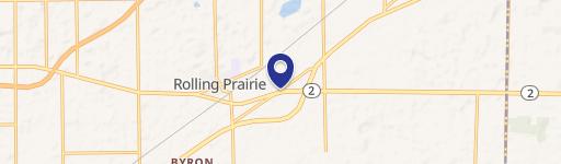
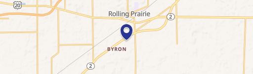
4747 E Oak Knoll Road, Rolling Prairie, IN 46371
- Added:
- Apr 19, 2026
- Days on Market:
- 78
- Last Refresh:
- Jul 5 at 3:06 am
Property Features for 4747 E Oak Knoll Road
General Information
- Property type
- Land
- Property subtype
- Other
- Standard status
- Active
- APN
- 46-01-11-451-001.000-052
- Lot size
- 44.00 Acres
Taxes and HOA fees
- Tax Year
- 2025
- Tax Description
- 32-07-11-451-001 IN MID PT SE 1/4 BTW US #20 & OAK KNOLL RD 46.67 AC
- Tax Annual Amount
- 3568
Listing agent Brecken Kennedy (260) 578-7661
Listing office Mossy Oak Properties/Indiana Land and Lifestyle 190 S St. Rd. 66, Rockville, IN (812) 230-4503
Listing date Apr 19, 2026
Copyright © 2026 Northeastern Indiana Association of Realtors. All rights reserved. All information provided by the listing agent/broker is deemed reliable but is not guaranteed and should be independently verified.
HighLights
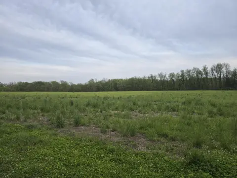
- +/-44‑acre property at 4747 Oak Knoll Rd in Rolling Prairie, IN
- Road frontage on three sides: north, west, and south
- Convenient access via Highway 20, East Oak Knoll Rd, and N 450 E
- Borders a Dollar General store on a lot previously sold by the current owner
- Located near the newly developed General Motors/Samsung EV Battery Plant and the Amazon Data Center Campus
Overview
The land is located near the Rolling Prairie area and is positioned in proximity to two large economic projects mentioned in the remarks: the newly developed General Motors/Samsung EV Battery Plant and the Amazon Data Center Campus. In addition, a Dollar General store borders the property on a lot previously sold by the current owner, providing an established retail adjacent use.
For developers, this acreage and three-sided frontage can be useful when planning building placement, ingress/egress, and site layout across multiple road exposures. For businesses evaluating expansion or new locations, the parcel’s described access routes and adjacency to an existing retail operator may help simplify site planning for both commercial and industrial concepts. Interested parties can review the property’s frontage and access points to determine best-fit use and configuration.
Current Use by Public Records
Map
- City
- Rolling Prairie
- County
- LaPorte
- State
- Indiana
- Longitude
- -86.609964
- Latitude
- 41.668034