400 Campbell Way, Mt Sterling, KY 40353


- Added:
- Jun 30, 2026
- Days on Market:
- 5
- Last Refresh:
- Jul 4 at 10:06 pm
Property Features for 400 Campbell Way
General Information
- Property type
- Land
- Property subtype
- Other
- Standard status
- Active
- APN
- 023-40-01-021.03
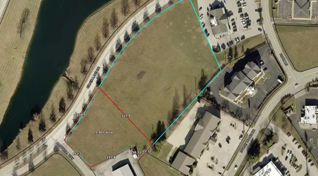
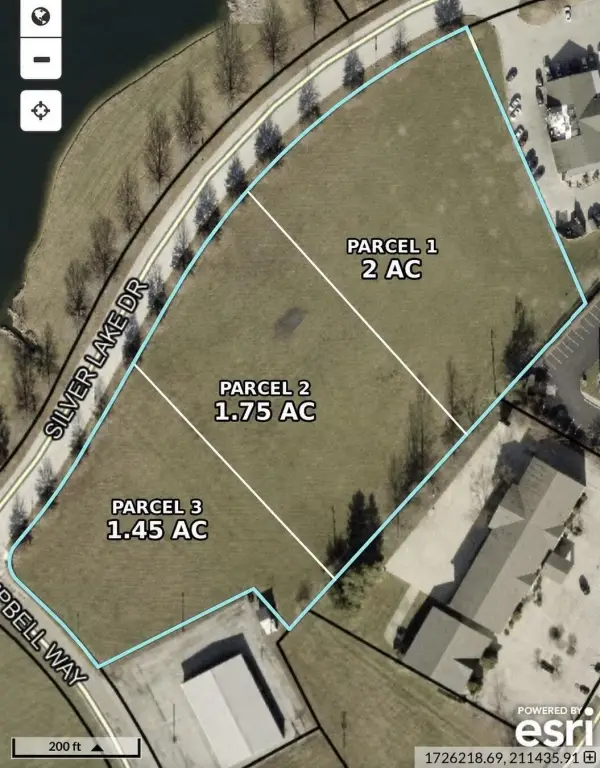
- Lot size
- 1.45 Acres
Utilities
- Utilities
- Cable Available
Listing agent Shannon Denniston License #266816 (859) 498-6309
Listing office Denniston Realty 1505 Old Silo View Ct, Mt. Sterling, KY (859) 498-6309
Listing date Jun 30, 2026
Copyright © 2026 ImagineMLS. All rights reserved. All information provided by the listing agent/broker is deemed reliable but is not guaranteed and should be independently verified.
HighLights
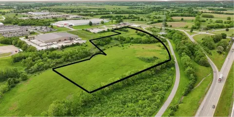
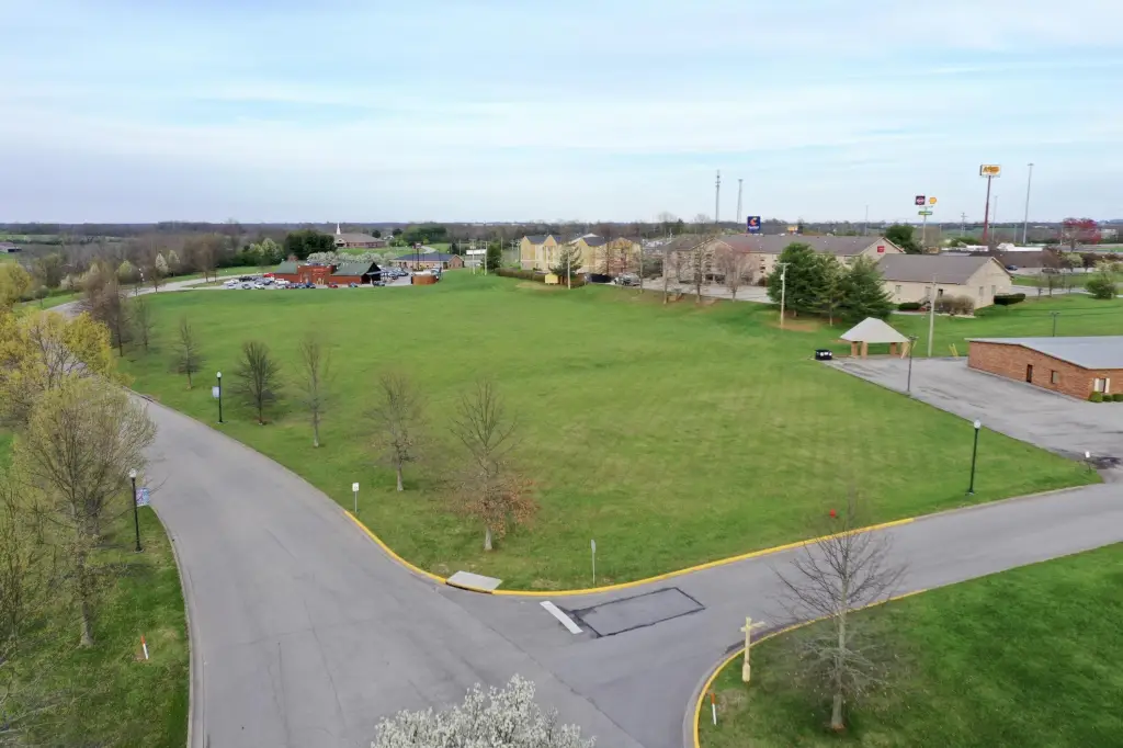
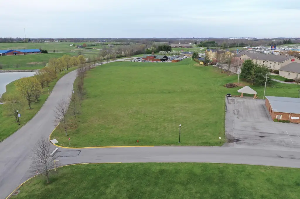
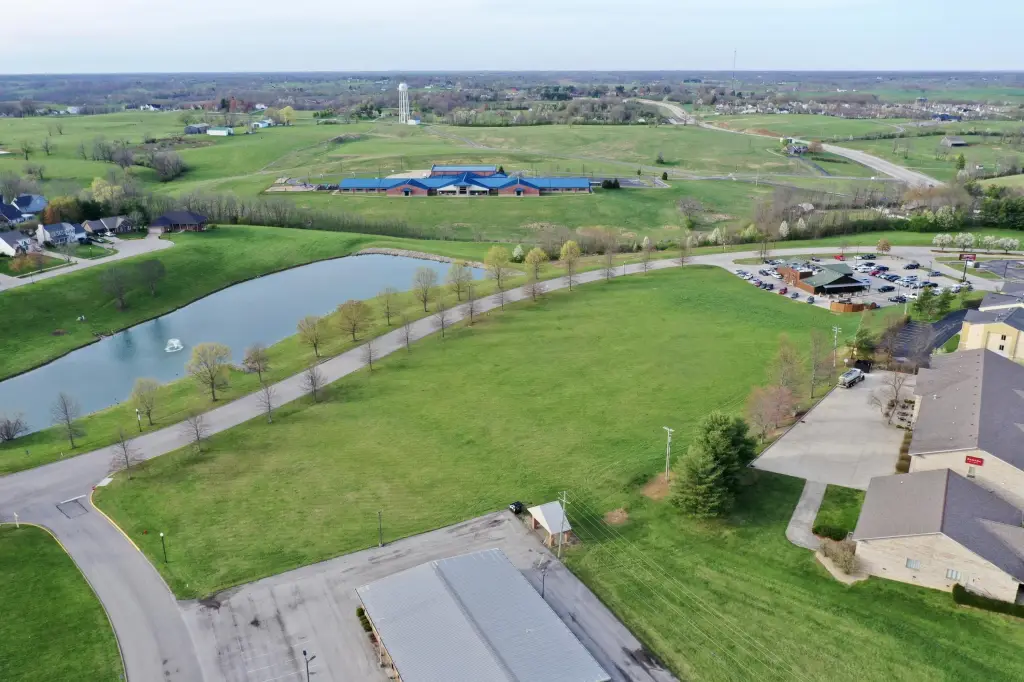
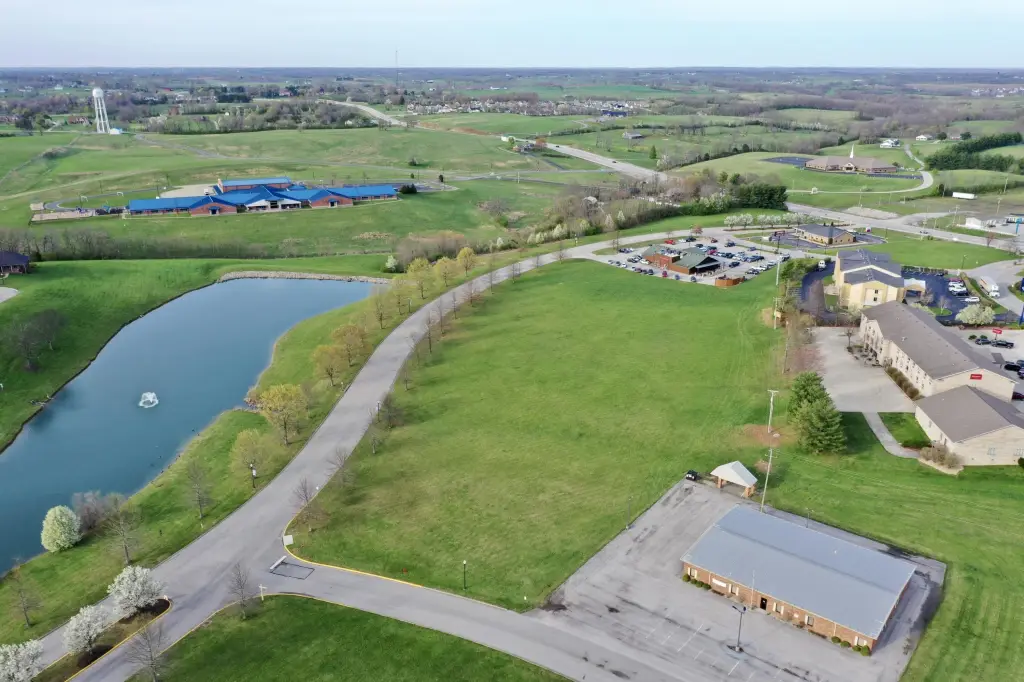
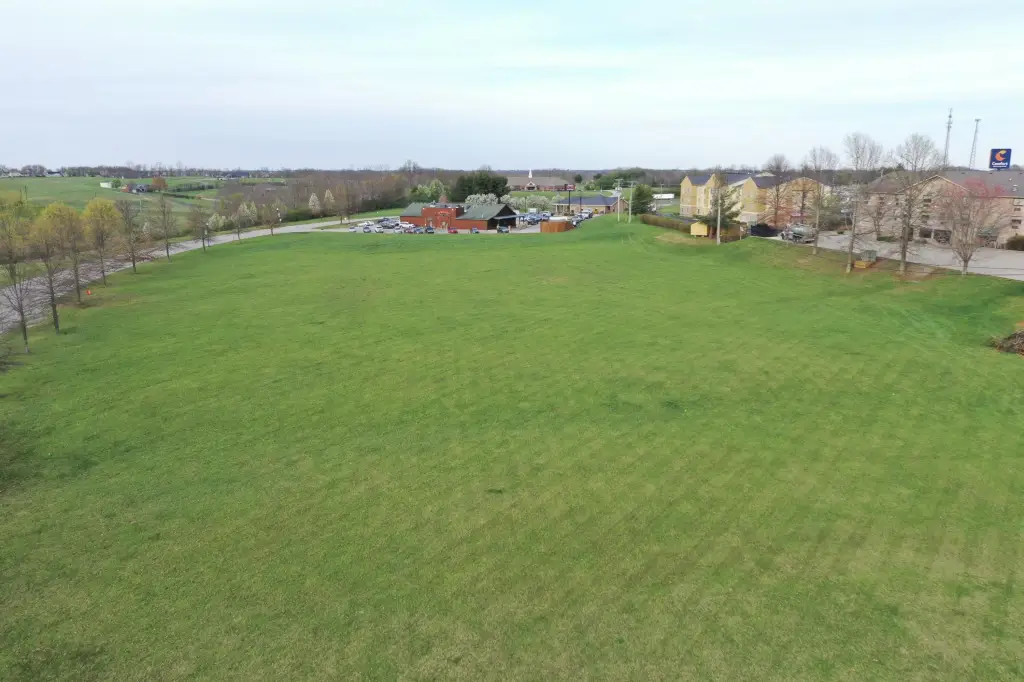
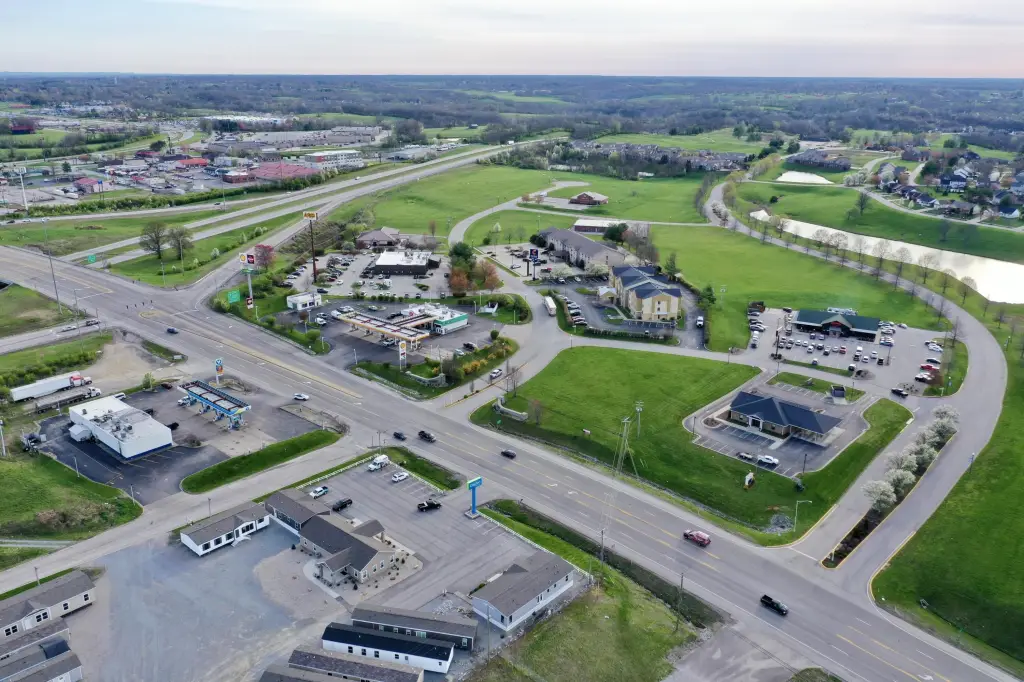
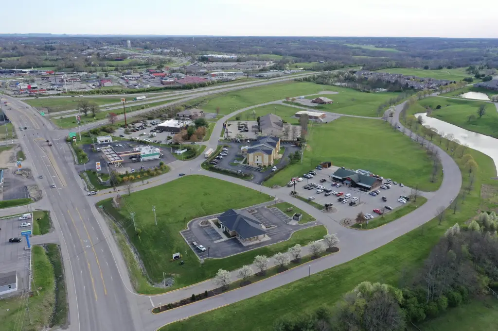
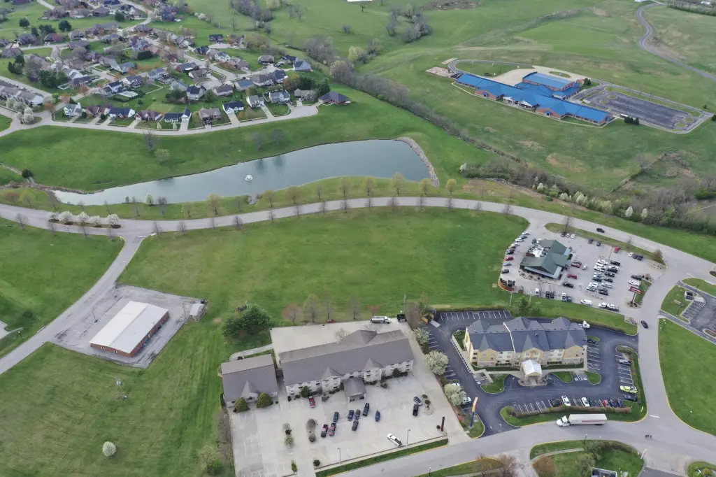
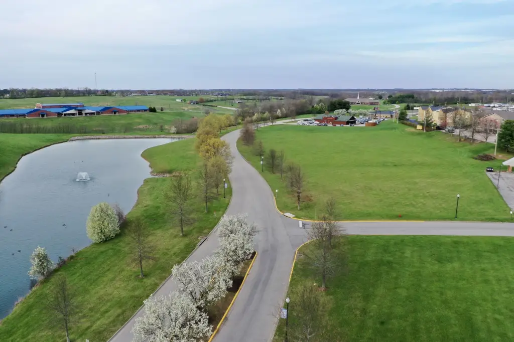
- 1.45‑acre Class A commercial lots just off Maysville Road and I‑64 (Exit 110) in Mount Sterling, KY
- Zoned Highway Business B‑2 and can be subdivided into larger or smaller acreage lots
- Up to 5.2 acres available for sale or ground lease at $425,000/acre
- Utilities available: electric, water, sewer, natural gas, broadband internet (cable available)
- Waterfront view with a seasonal water fountain; property adjoins Ramada Inn
- Wet territory designation allows the sale of beer, wine, and liquor by the drink; near CHI Saint Joseph Hospital (42 beds)
Overview
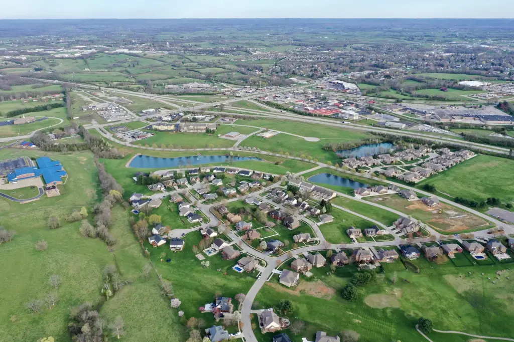
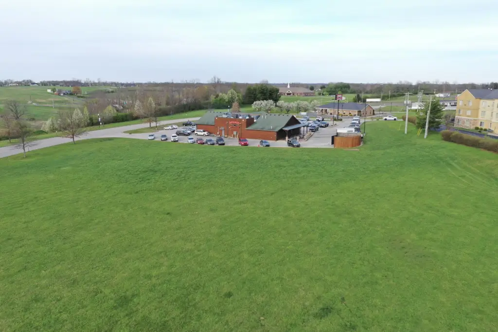
The parcel is positioned just off Maysville Road and I-64 at Exit 110 in Montgomery County, providing convenient regional access. The site adjoins Ramada Inn and is located within a wider commercial development that includes operations such as Cattleman's Roadhouse, Cracker Barrel, Comfort Inn & Suites, Shell, Krystal, and People's Bank.
Zoned Highway Business B-2, the property supports a range of commercial uses described by the listing, including restaurants, hotels, grocery stores, and retail or service-oriented businesses such as gas stations and car washes. The listing also notes a wet territory designation for the sale of beer, wine, and liquor by the drink. Utilities listed as available include electric, water, sewer, natural gas, and broadband internet, which can streamline early site planning for qualified development concepts.
Current Use by Public Records
Location Insight
- Map
- Local Demand
- City
- Mt Sterling
- County
- Montgomery
- State
- Kentucky
- Longitude
- -83.953524
- Latitude
- 38.079448