3905 Georgia Highway 138 Covington, GA 30014

LAND - Covington, GA
Property size:
960 SFLot size:
73.97 AcresPrice / SF:
$1,036/SF- Added:
- Feb 10, 2026
- Days on Market:
- 80
- Last Refresh:
- May 1 at 5:06 pm
Property Features for 3905 Georgia Highway 138
General Information
- Property type
- Land
- Property subtype
- Other
- Zoning
- A-1
- Security features
- Security
- Vegetation
- Heavily Wooded, Brush
- Standard status
- Active
- Size
- 960 SF
- Lot size
- 73.97 Acres
Taxes and HOA fees
- Tax Year
- 2025
- Tax Annual Amount
- 6891
Utilities
- Utilities
- Cable Available
Listing agent Kevin Witcher License #400273 770-267-7557 ext301
Listing office Jackson Realty 316 N Broad Street, Monroe, GA (770) 267-7557
Listing date Feb 10, 2026
MLS# 7717830
Listing URL
Copyright © 2026 First Multiple Listing Service, Inc. All rights reserved. All information provided by the listing agent/broker is deemed reliable but is not guaranteed and should be independently verified.
Overview
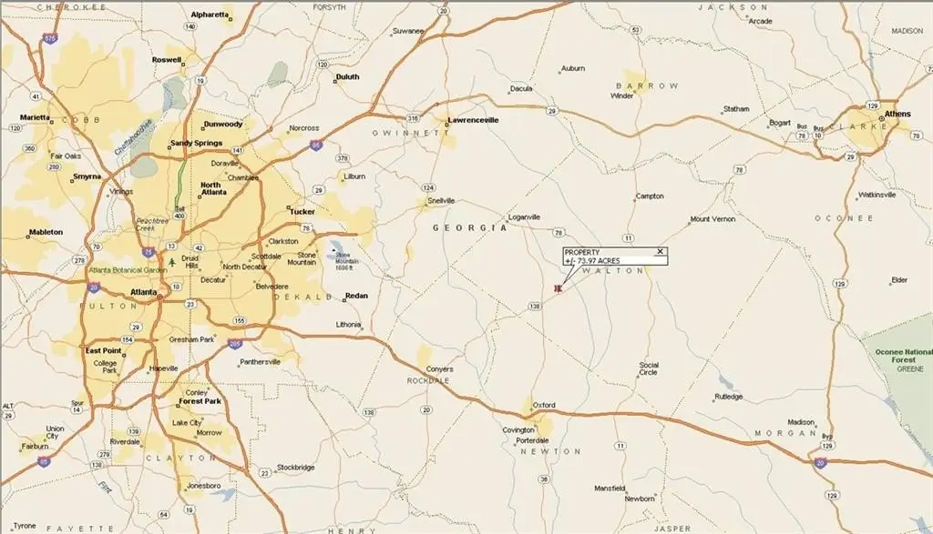
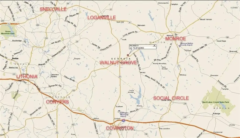
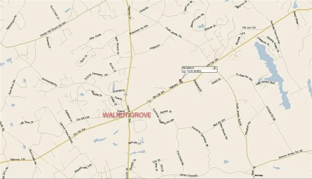
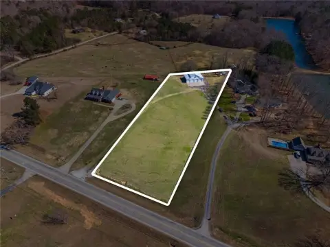
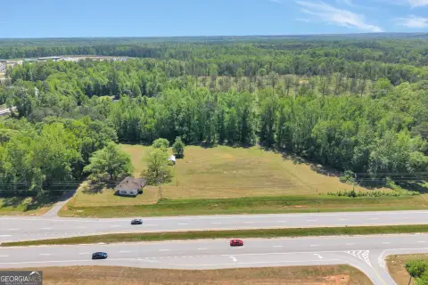
73.97 Acres on GA Highway
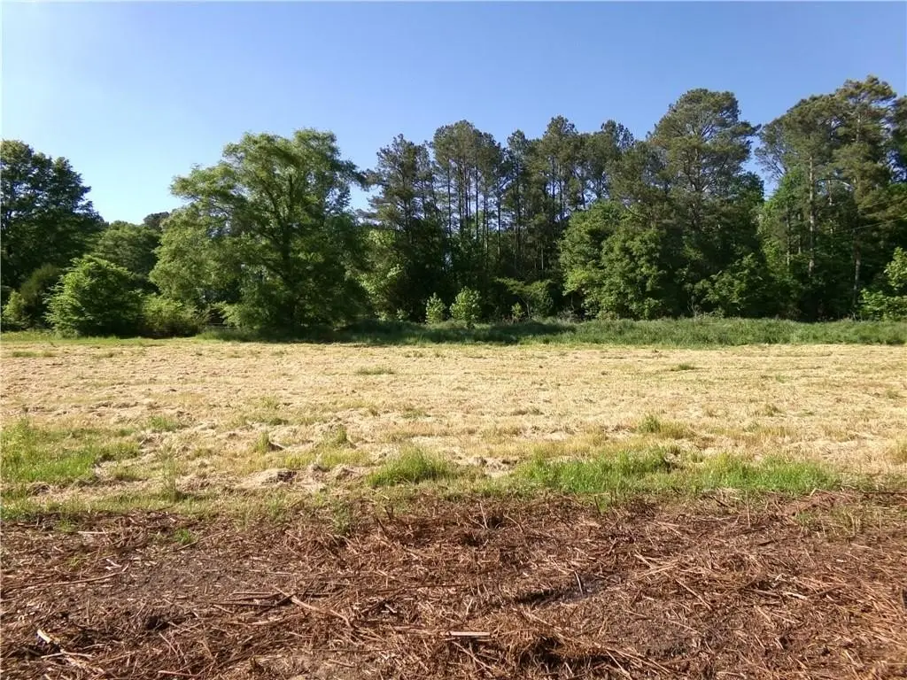
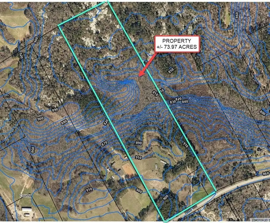
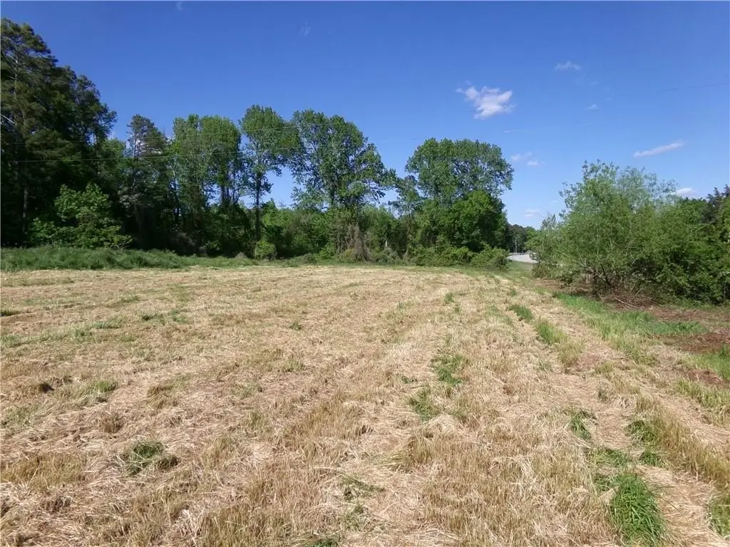
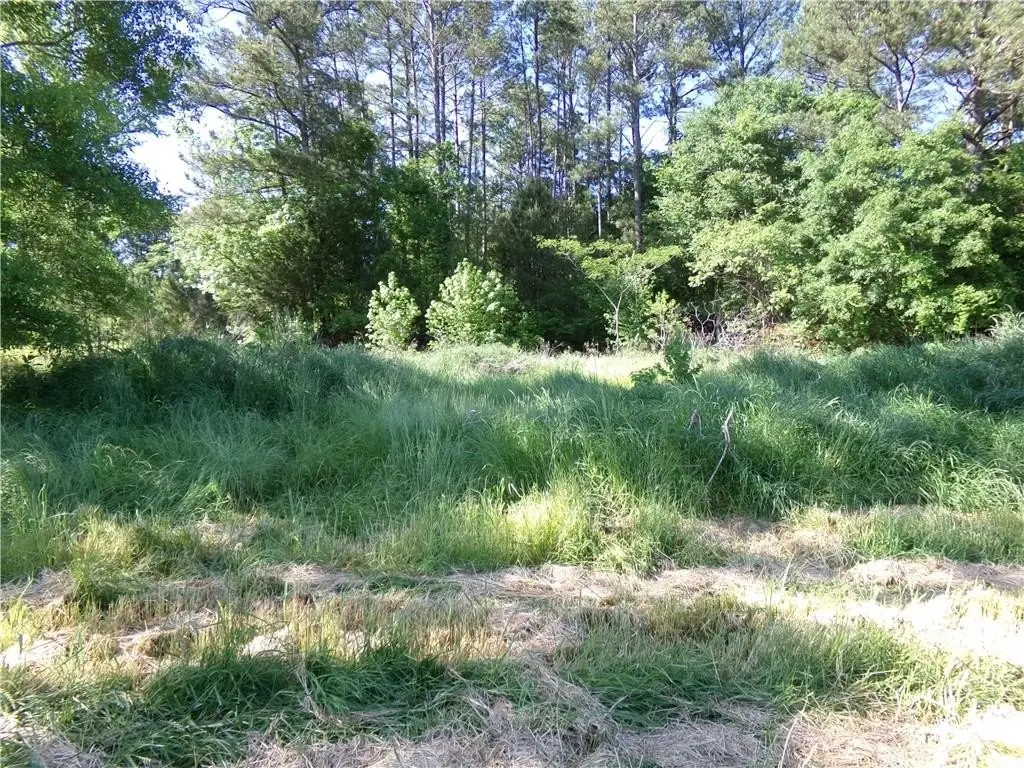
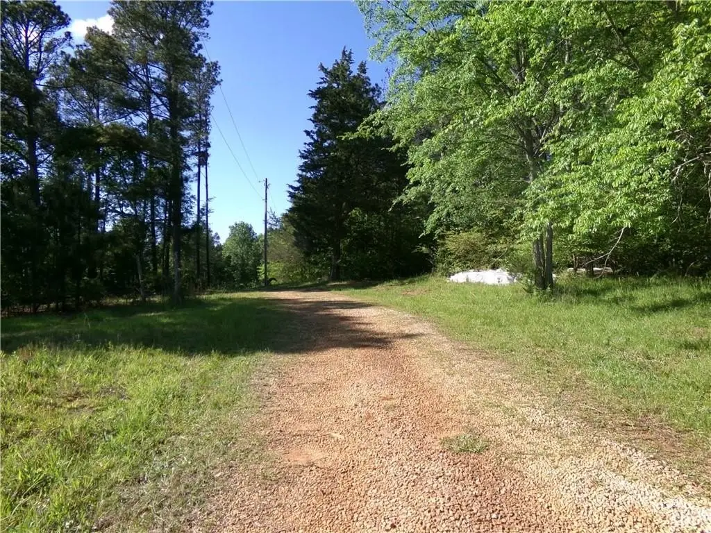
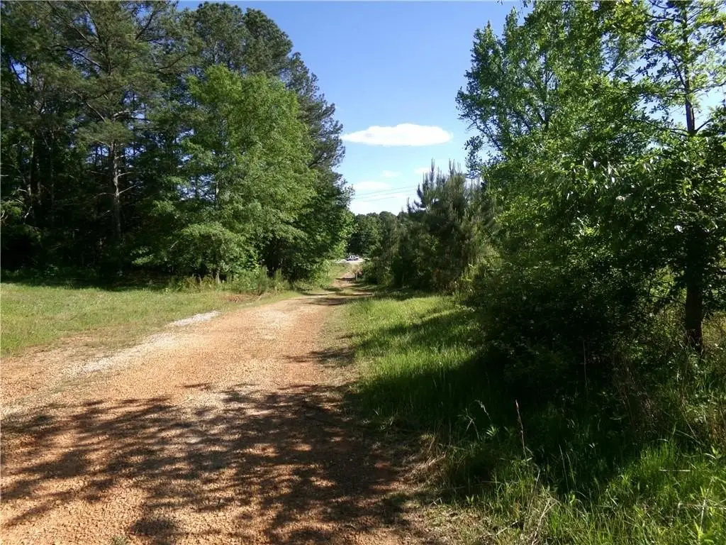
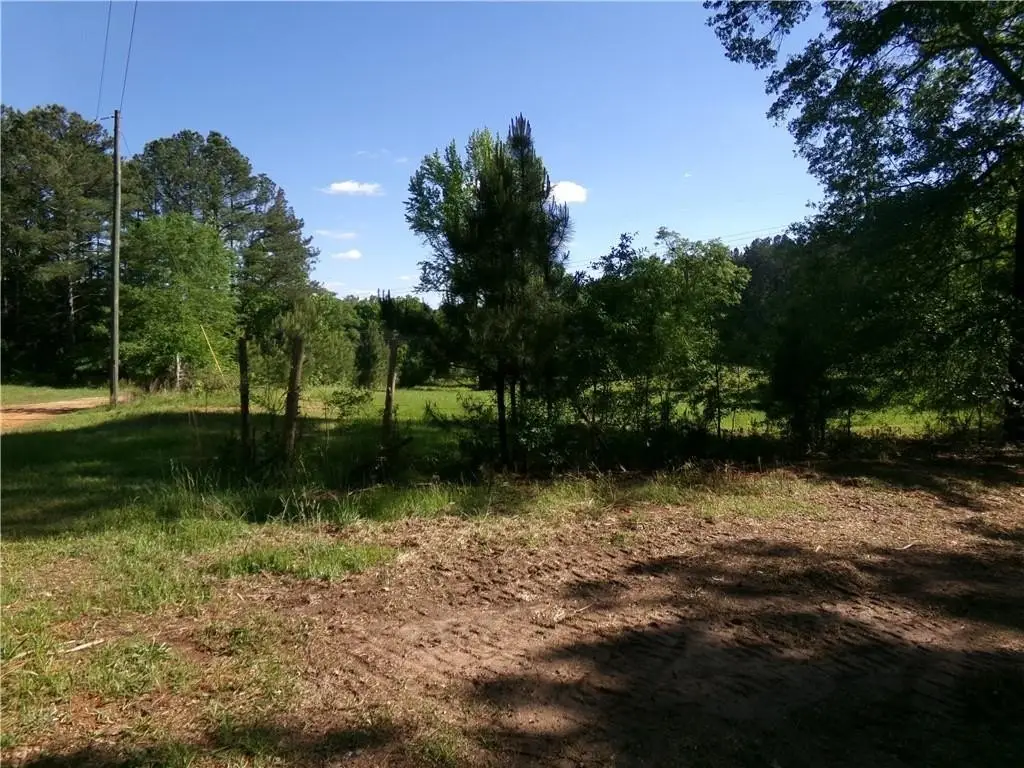
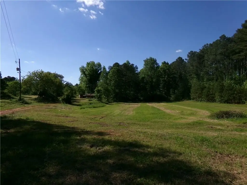
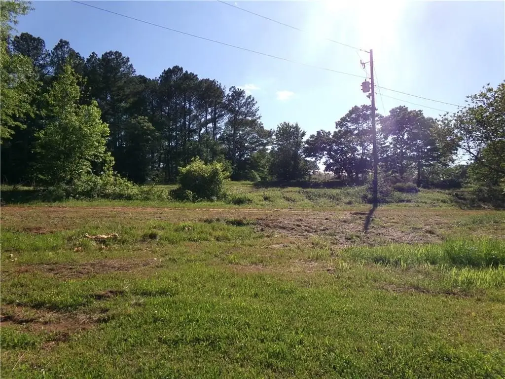
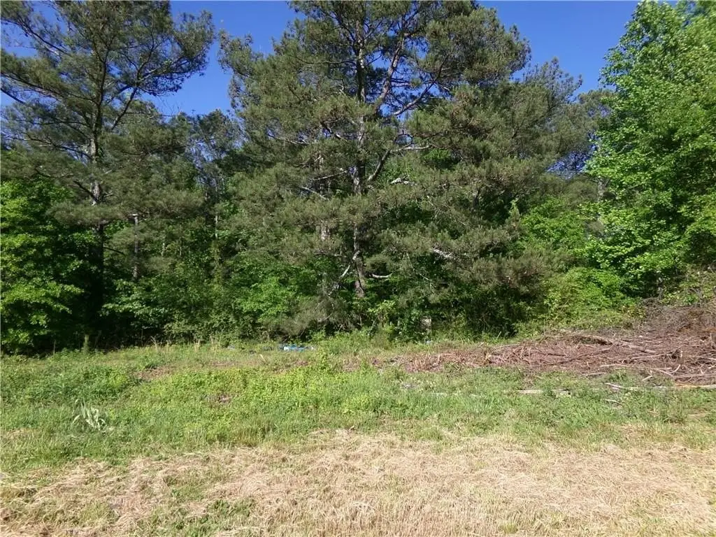
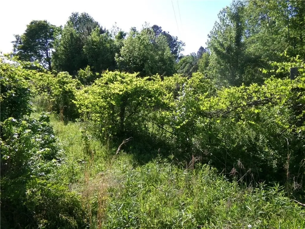
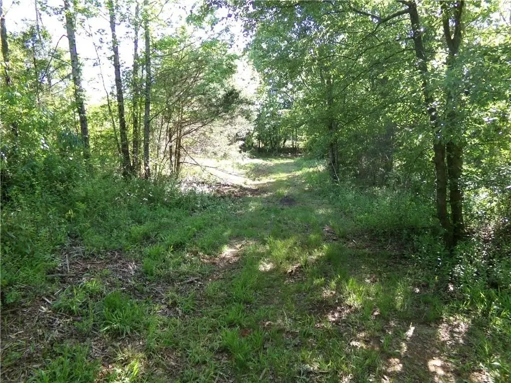
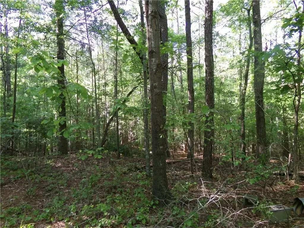
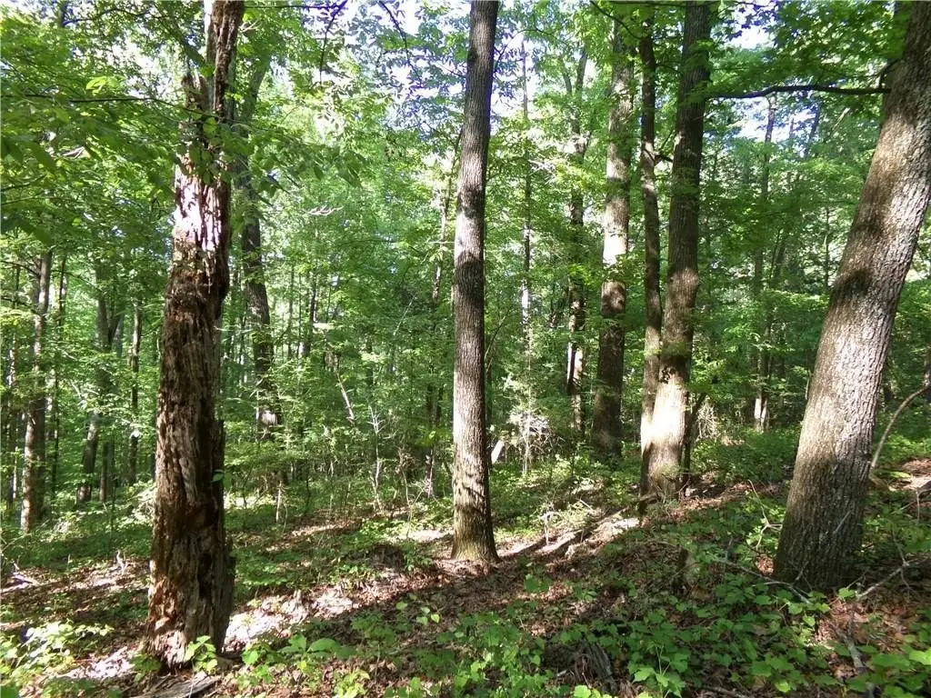
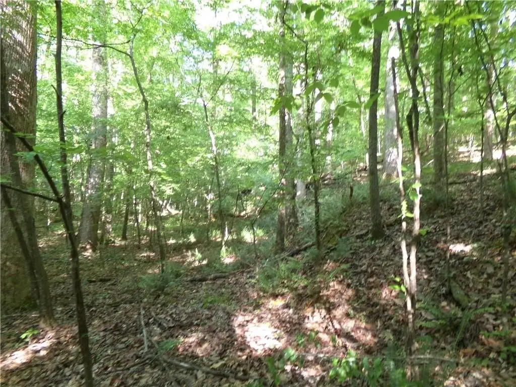
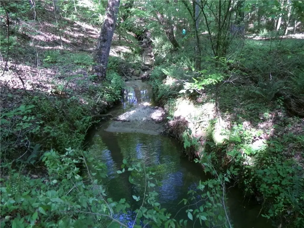
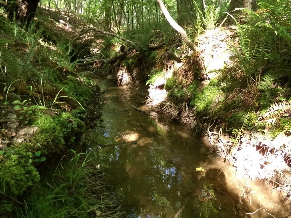
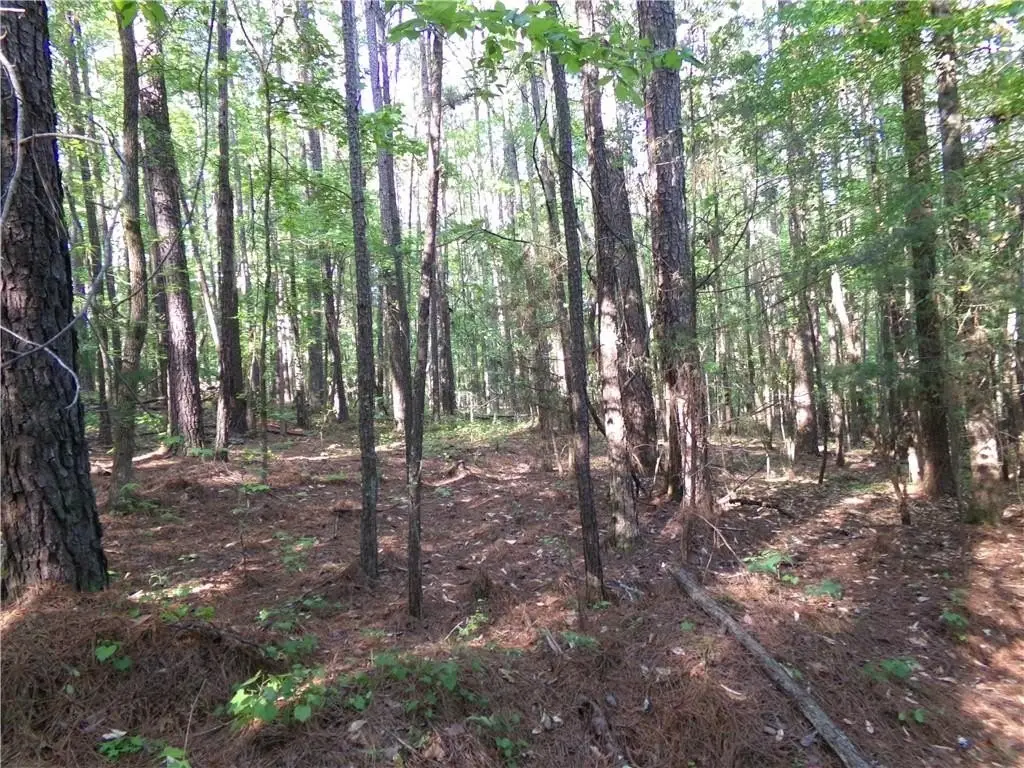
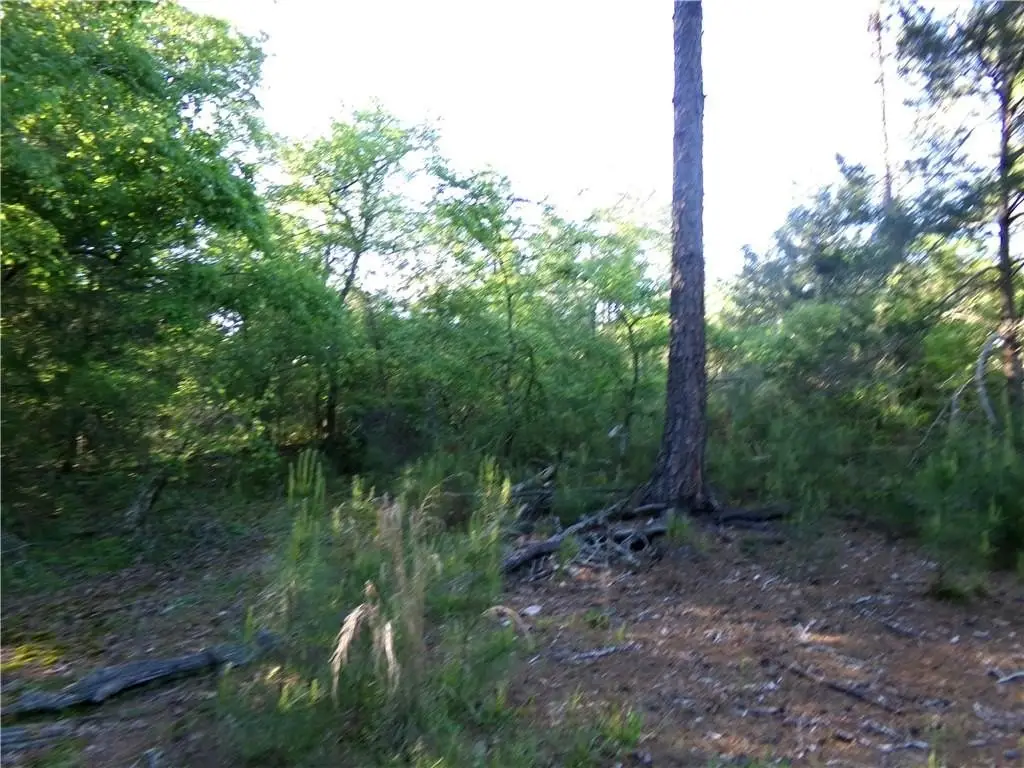
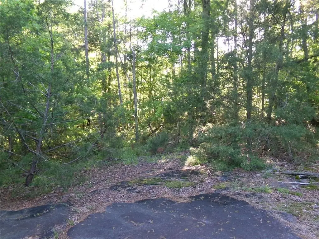
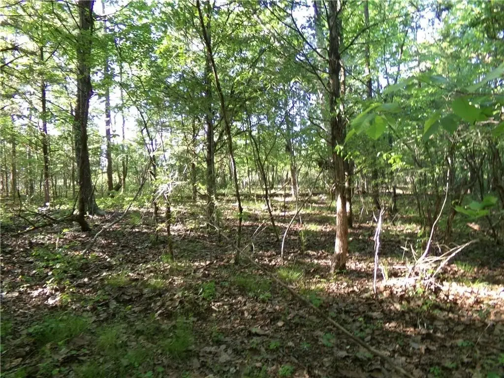
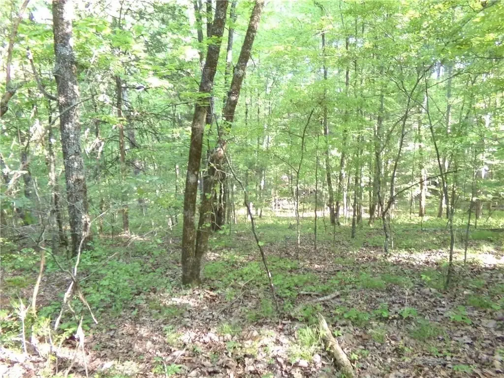
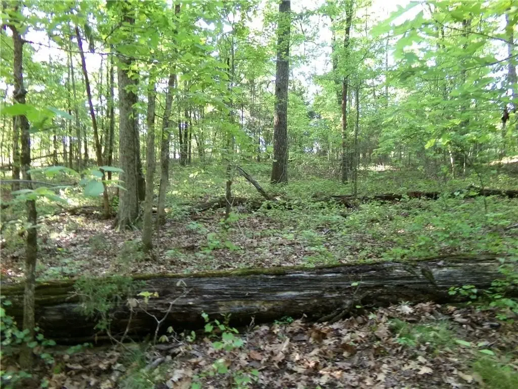
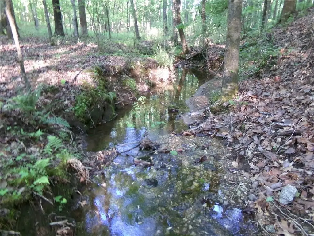
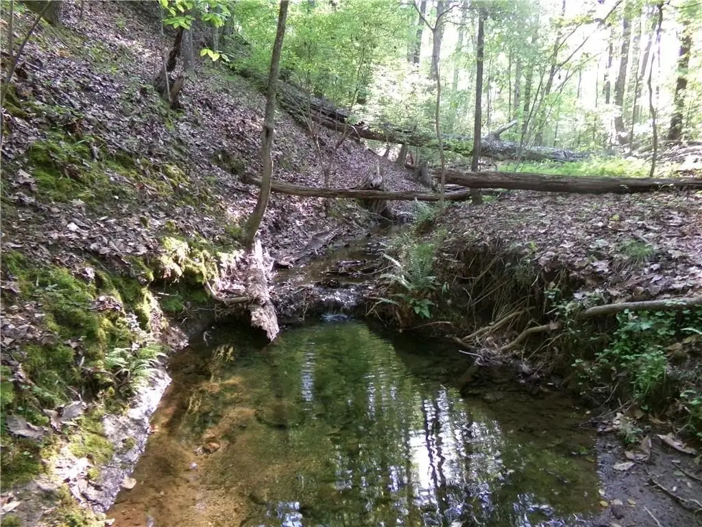
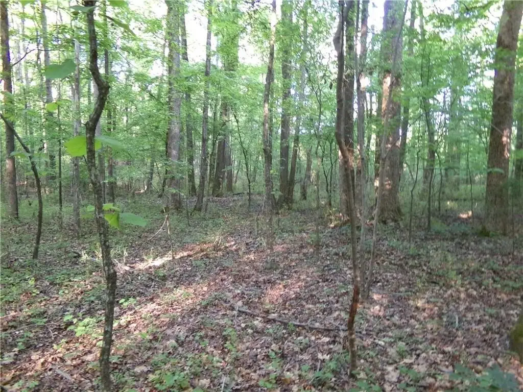
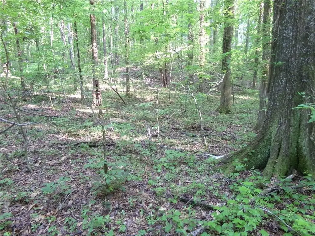
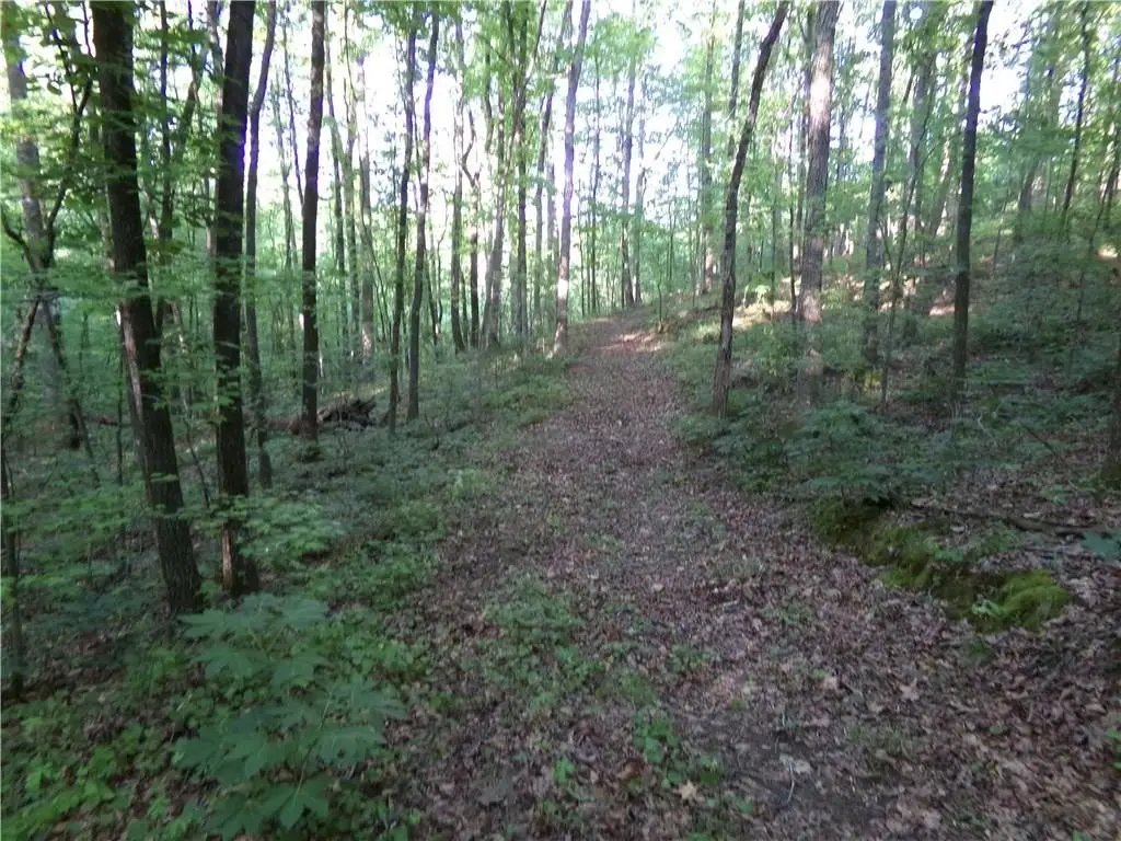
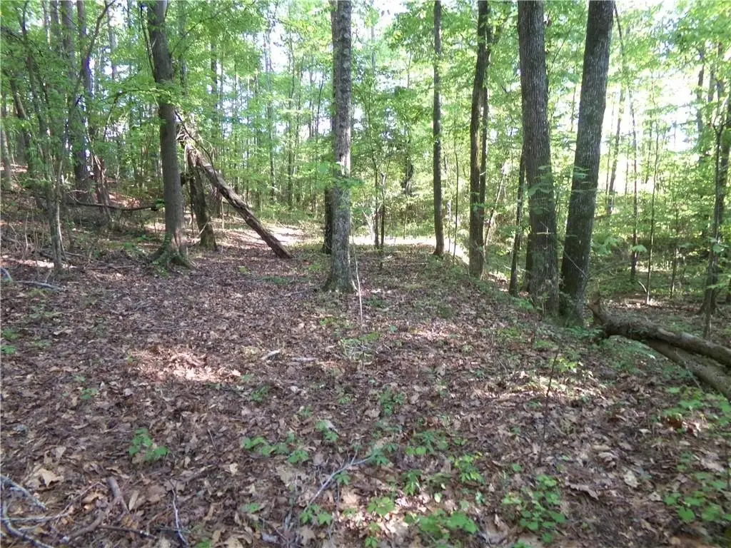
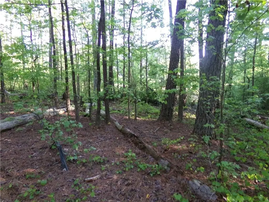
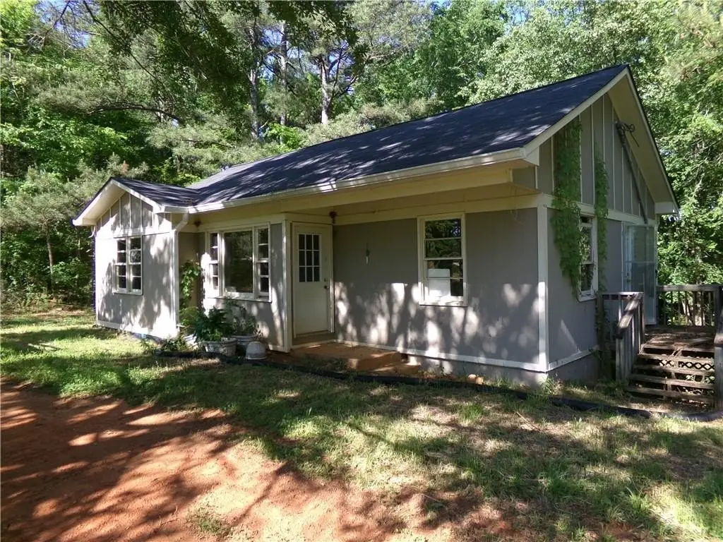
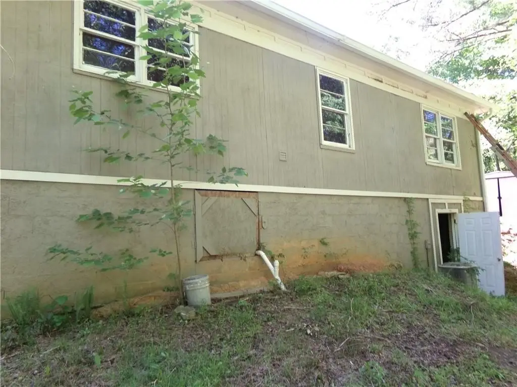
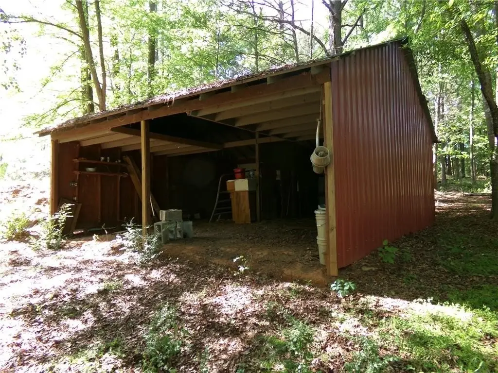
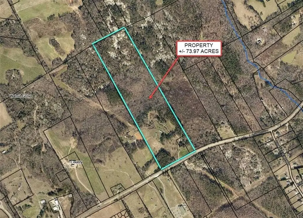
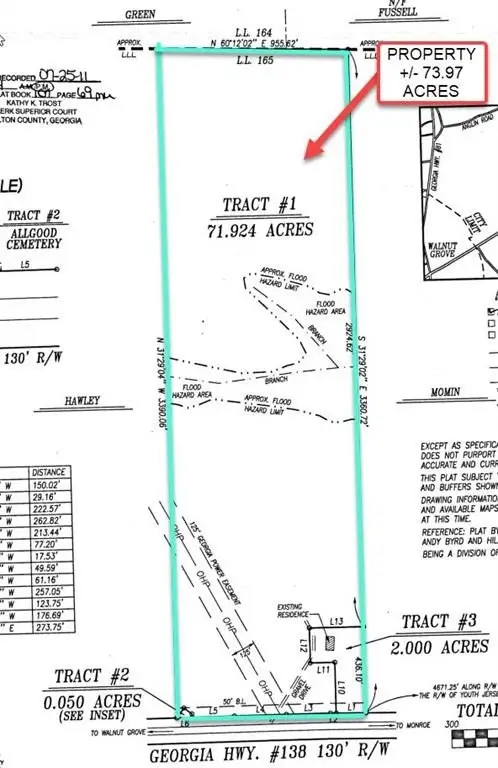
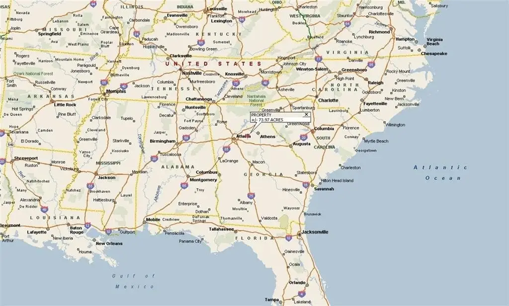
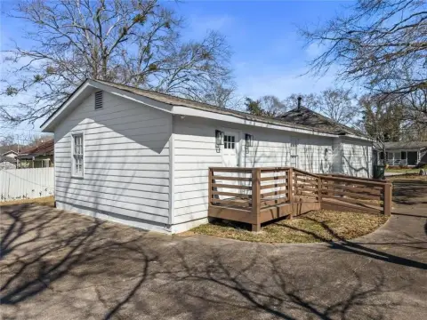
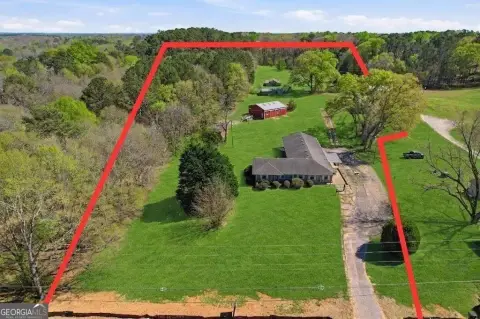
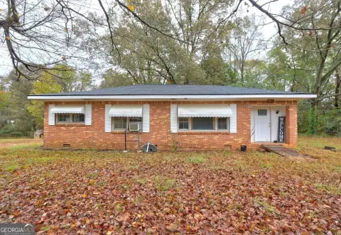
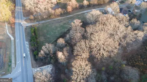
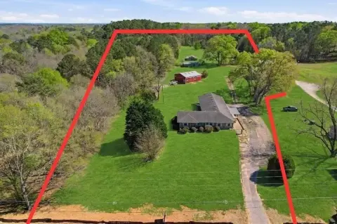
This listing features approximately 73.97 acres of land zoned A-1, rural estate, situated along the north side of Georgia Highway 138, east of Walnut Grove, and roughly 1.2 miles east of the intersection of Georgia Highway 138 and Georgia Highway 81 in Walton County, Georgia. The tract offers approximately 955 linear feet of road frontage along Georgia Highway 138. It is located about 7 miles southeast of Loganville, 7 miles southwest of Monroe, 11 miles northeast of Covington, and 32 miles east of downtown Atlanta. The diverse terrain is suitable for residential, agricultural, and recreational uses under the existing zoning. Approximately 15-20% of the land is open with a moderately rolling topography, while the remaining sections are heavily wooded with varying topography. The open areas, previously an organic farm, include water irrigation wells, framing for arch greenhouses, storage structures, a roughly 960-square foot wood frame structure (shell only) that was a previous single family dwelling unit, electric service lines, and dirt/gravel service roads. The wooded areas consist mostly of mature hardwood forests with some mature pine tree areas. A creek bisects the site, appearing perennial at 3-5 feet wide, a tributary to Cornish Creek. A system of interior dirt/gravel service roads, woods-roads, and trails provide access to most sections of the site. Access to the north section is provided over the creek by a culvert supporting an interior woods-road. The surrounding area east of the property is primarily single-family residential and limited agricultural, with custom-built homes and residential developments. The area west includes areas within Walnut Grove zoned for residential, agricultural, and commercial uses. Major traffic arteries include GA Highway 138, GA Highway 81, and U.S. Highway 78, providing access to shopping and employment districts. The property is located along the westbound lane of Georgia Highway 138, a 2-lane state highway connecting Monroe and Walnut Grove, intersecting U.S. Interstate 20 in Conyers, approximately 12 miles southwest. It is located within the Walnut Grove Elementary, Youth Middle School, and Walnut Grove High School districts. The tract has potential for low-density single-family residential development, acreage residential estate tracts, agricultural uses, and recreational uses. Subject to rezoning, the site's location and characteristics could support commercial uses. The property is identified as tax parcel numbers C0640060, C0640060A & C0640060B and is described in Deed Book 4927 - Page 319 and is identified as Tract #1, Tract #2 and Tract #3 in Plat Book 107 - Page 69.
Property Profile
Insight Report
Location Intelligence
Current Use by Public Records
Residential land & home ...
Map
- City
- Covington
- County
- Newton
- State
- Georgia
- Longitude
- -83.8085
- Latitude
- 33.5946
Nearby Similar for Sale


FAQs
What type of property is this?
Agricultural land / Farmland - 73.97 acres of land zoned A-1 in Covington, GA.
Where is this agricultural land / farmland located?
The property is located at 3905 Georgia Highway 138 Covington, GA.
What is the asking price?
The asking price for this property is $995,000.
What are key features of this property?
This property features: Large 73.97‑acre tract zoned A‑1, suitable for residential, agricultural, and recreational uses.; Located on GA Highway 138, offering convenient access to Loganville, Monroe, Covington, and Atlanta.; Features diverse terrain including open areas, mature hardwood forests, and a perennial creek.


