35XX ROCKCUT Rd, Kettle Falls, WA 99141
- Added:
- May 8, 2026
- Days on Market:
- 50
- Last Refresh:
- Jun 26 at 9:06 pm
Property Features for 35XX ROCKCUT Rd
General Information
- Property type
- Land
- Property subtype
- Other
- Zoning
- Forestry,Residential
- Standard status
- Active
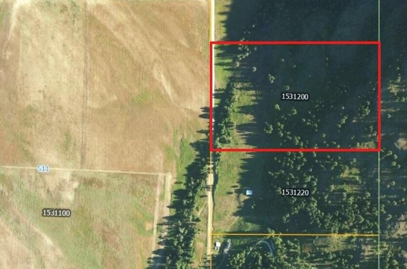
- APN
- 1531200
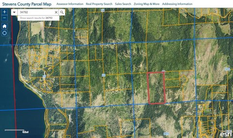
- Lot size
- 25.76 Acres
Taxes and HOA fees
- Tax Year
- 2025
- Tax Description
- S 3/4 SE4 NE4, LS S 140'
Listing agent DEBBIE BAKER License #106797 (509) 993-6357
Listing office WINDERMERE KETTLE FALLS PO BOX 437 - 250 E THIRD, KETTLE FALLS, WA (509) 738-6521
Listing date May 8, 2026
Copyright © 2026 Northeast Washington Association of Realtor MLS. All rights reserved. All information provided by the listing agent/broker is deemed reliable but is not guaranteed and should be independently verified.
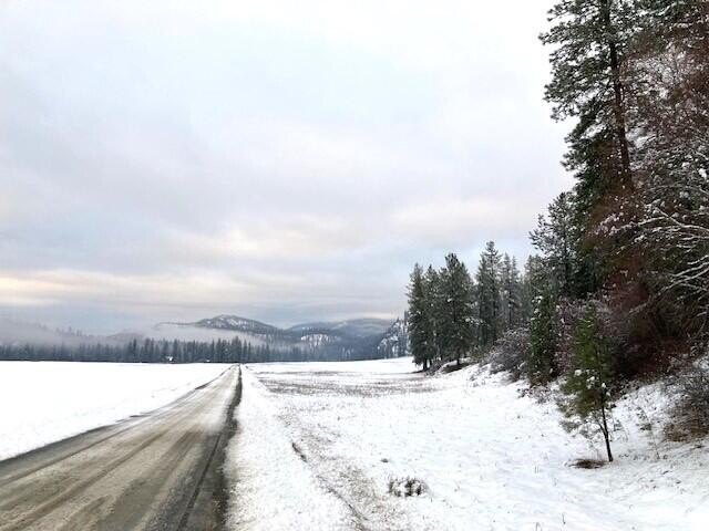
HighLights
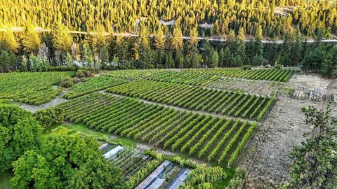
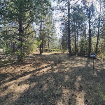
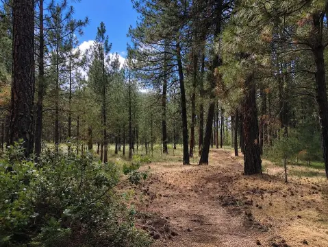
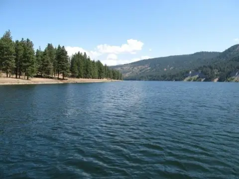
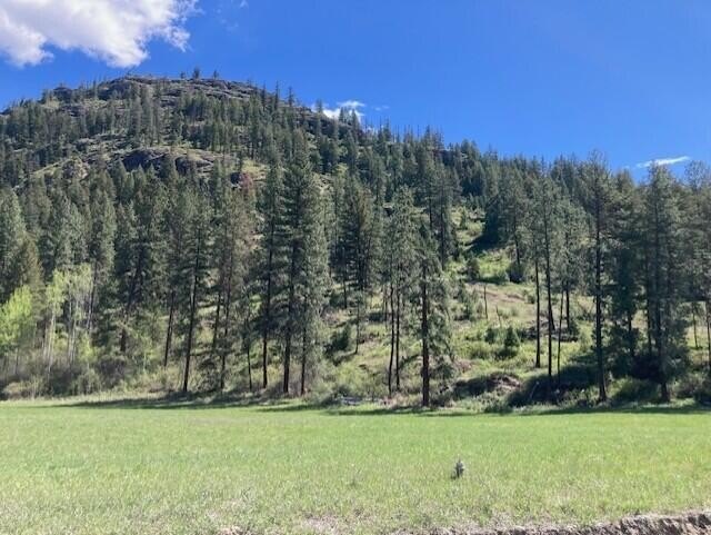
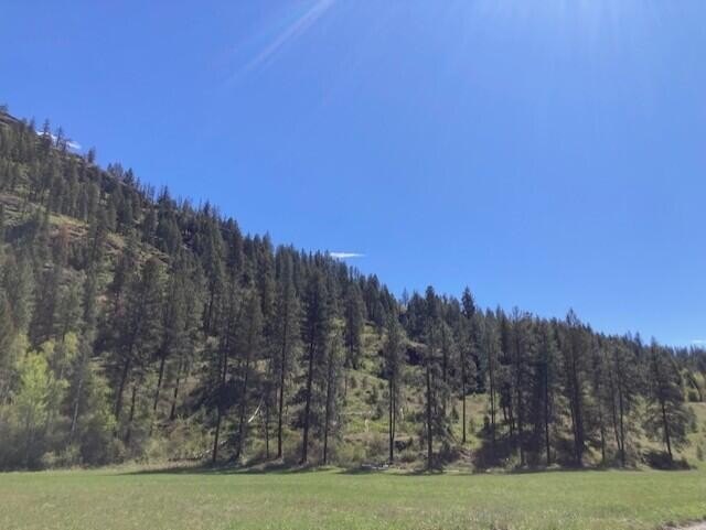
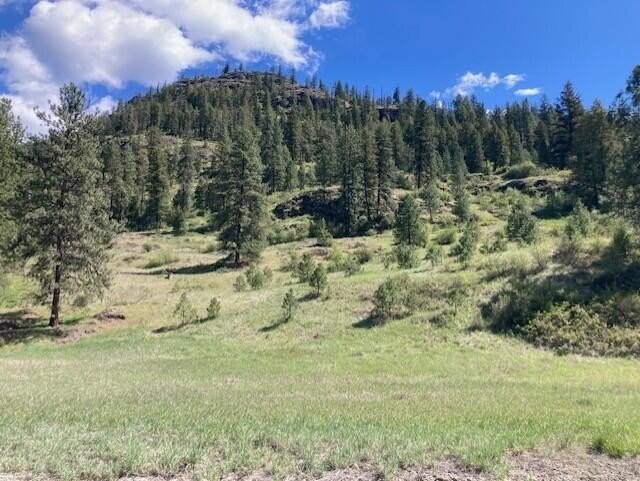
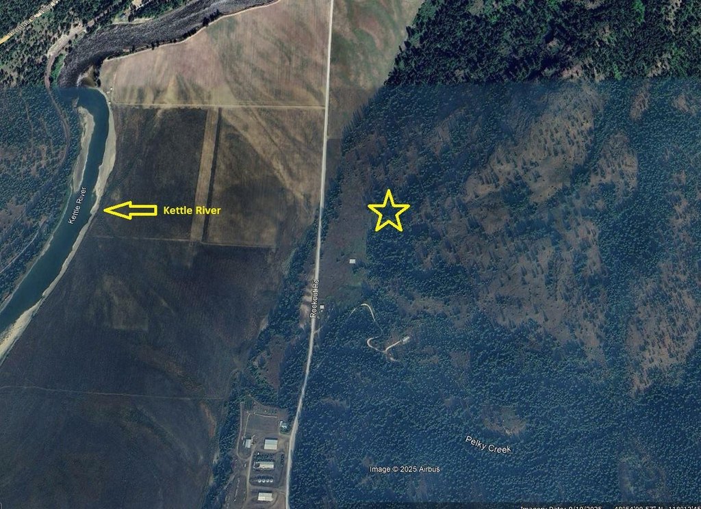
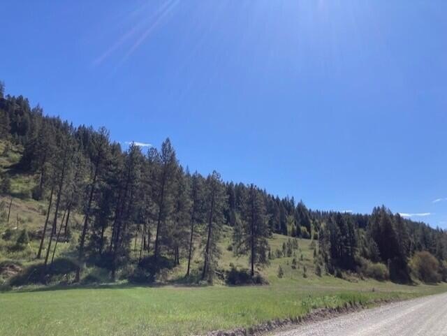
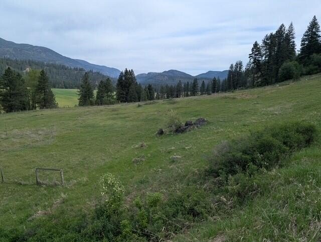
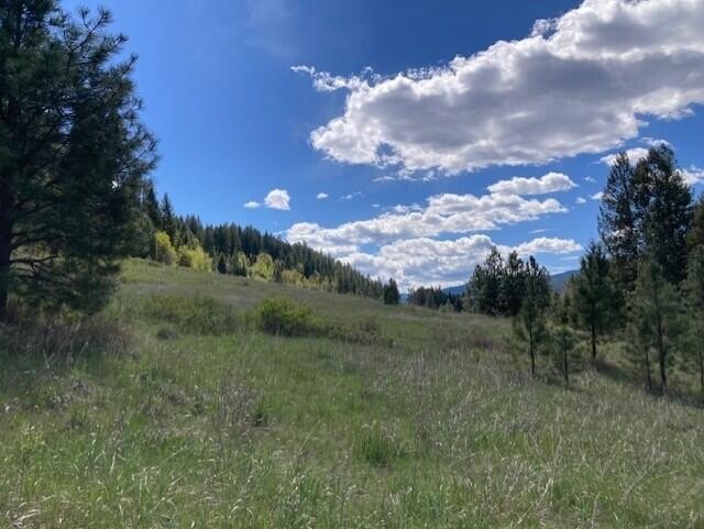
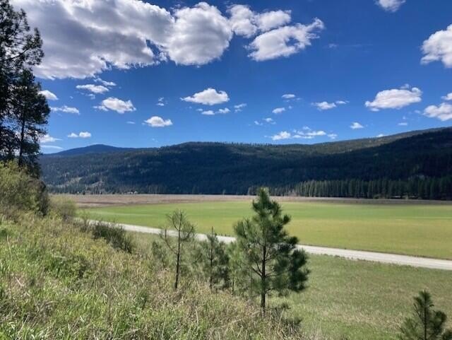
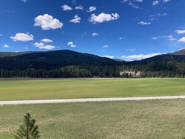
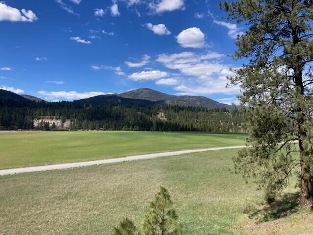
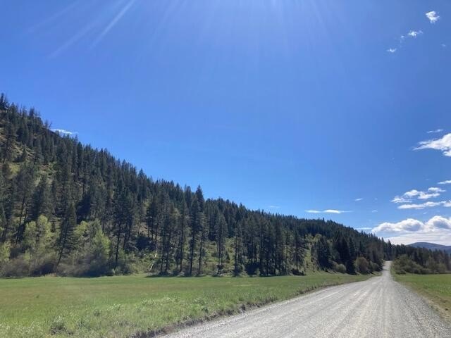
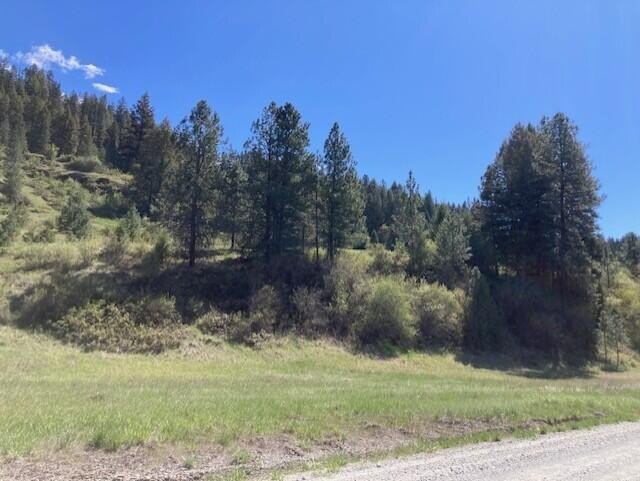
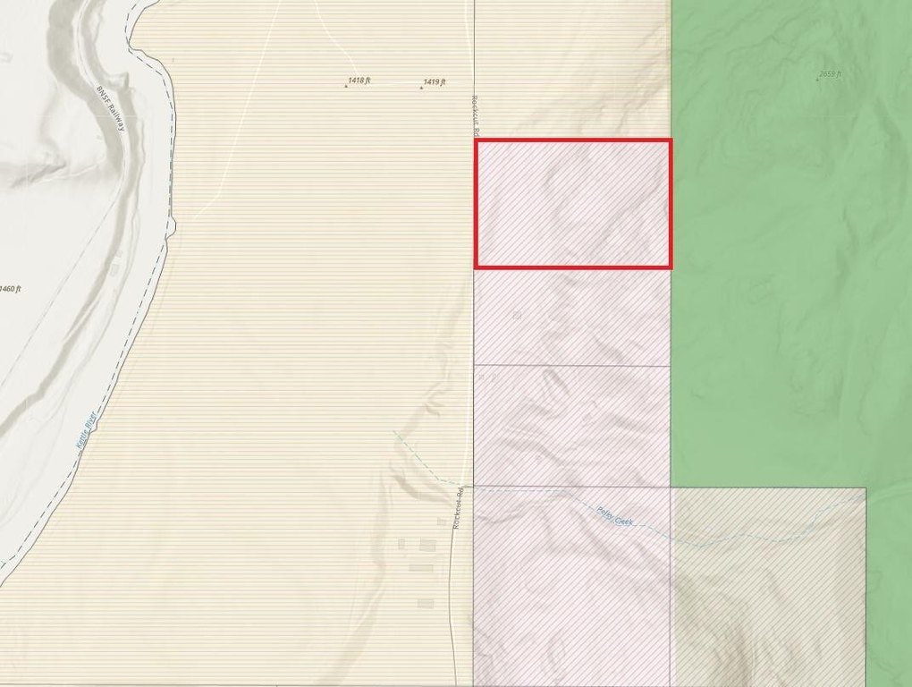
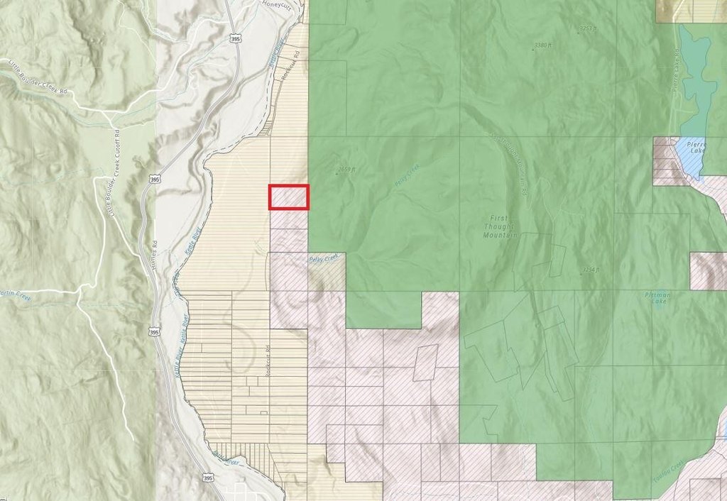
- 20 acres north of Kettle Falls near the Kettle River, with valley and distant mountain views
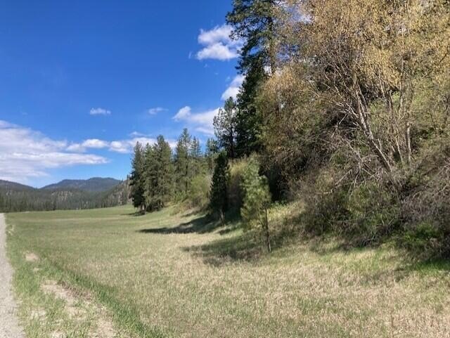
- Pasture land plus mature timber, with abundant wildlife reported
- Backs up to thousands of acres of National Forest for access to nearby recreation and exploration
- Natural hillside area identified as a potential building site with elevated views above the valley
- No CCRs; property is in DFL
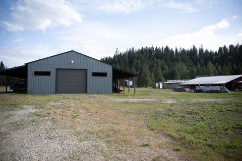
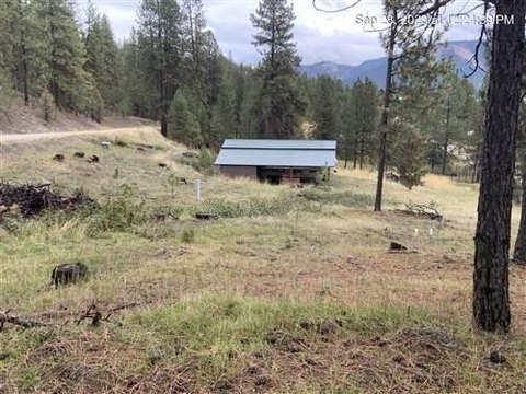
- Adjacent 20 acres also available, including an older shop, a spring, and a previous power setup
Overview
The property is located north of Kettle Falls and near the Kettle River, with views toward the valley and distant mountains. The land backs up to thousands of acres of National Forest, supporting continued exploration and recreation. The listing notes no CCRs. Zoning is identified as Forestry, Residential, and the property is described as being in DFL.
In practical terms, the mix of pasture, timber, and National Forest adjacency makes the property a workable fit for camping, RVing, hunting, or 4x4 use, while still aligning with a residential or farm-focused plan. An adjacent 20 acres is also available; that adjoining tract is described as including an older shop, a spring, and a previous power setup, which may appeal to buyers seeking additional acreage or existing site features.
Current Use by Public Records
Location Insight
- Map
- Local Demand
- City
- Kettle Falls
- County
- Ferry
- State
- Washington
- Longitude
- -118.199459
- Latitude
- 48.896799