TBD 14 Ac Lower Luther Road, Red Lodge, MT 59068
- Added:
- Jun 9, 2026
- Days on Market:
- 7
- Last Refresh:
- Jun 15 at 2:06 am
Property Features for TBD 14 Ac Lower Luther Road
General Information
- Property type
- Land
- Property subtype
- Other
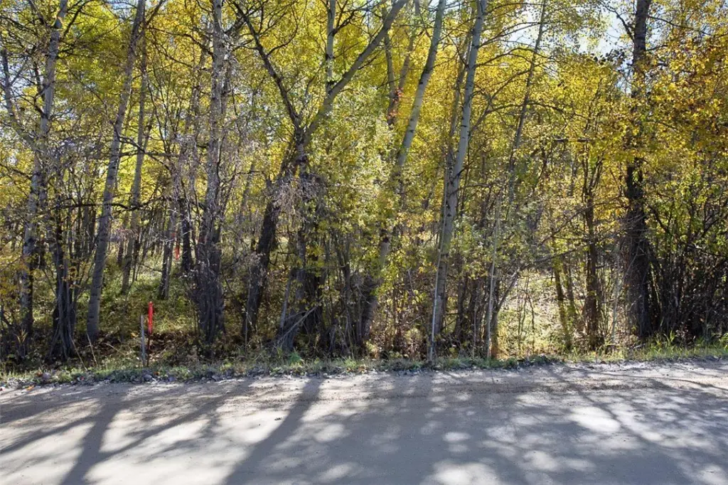
- Vegetation
- Brush, Wooded
- Standard status
- Active
- APN
- 9085022
- Lot size
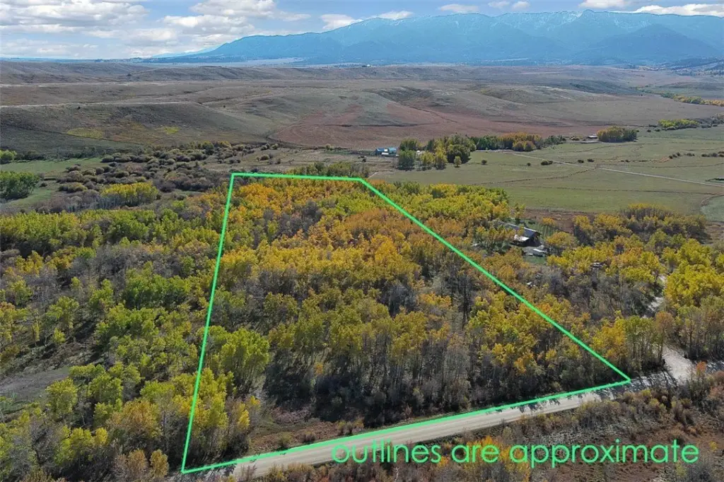
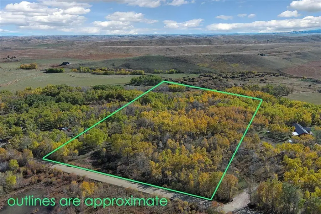
- 14.00 Acres
Taxes and HOA fees
- Tax Description
- S16, T06 S, R19 E, C.O.S. 2382 RB #2, PARCEL 4 AM, ACRES 14
- Tax Annual Amount
- 951

Listing agent Cynthia Dunham License #RRE-BRO-LIC-38598 (406) 425-0182
Listing office Berkshire Hathaway HS Floberg 1550 Poly Drive, BILLINGS, MT (406) 254-1550
Listing date Jun 9, 2026
Copyright © 2026 Billings Association of Realtors. All rights reserved. All information provided by the listing agent/broker is deemed reliable but is not guaranteed and should be independently verified.
HighLights
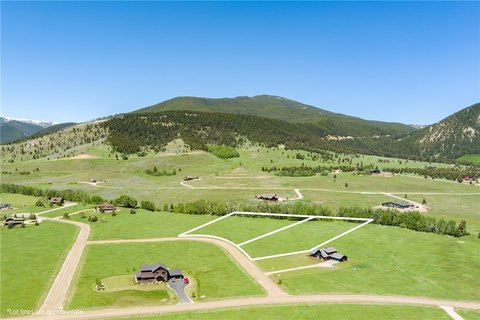
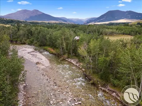
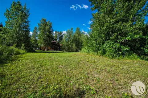
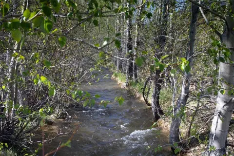
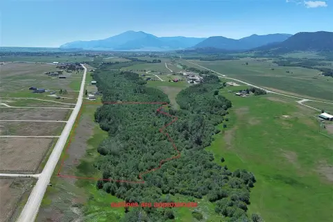
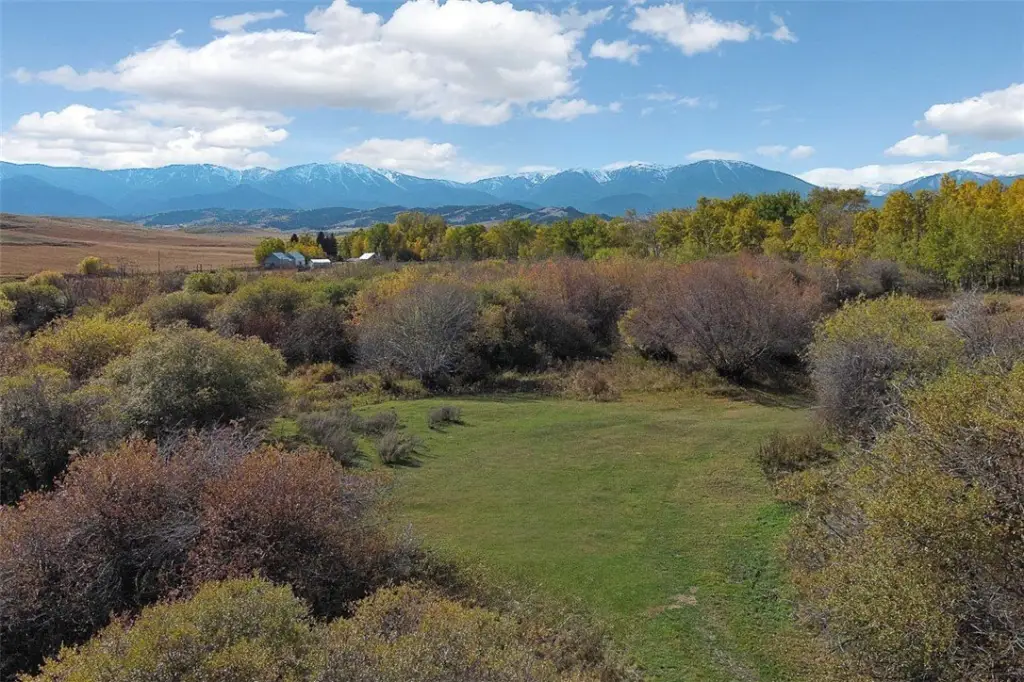
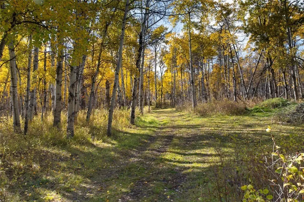
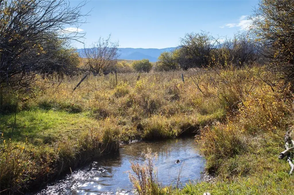
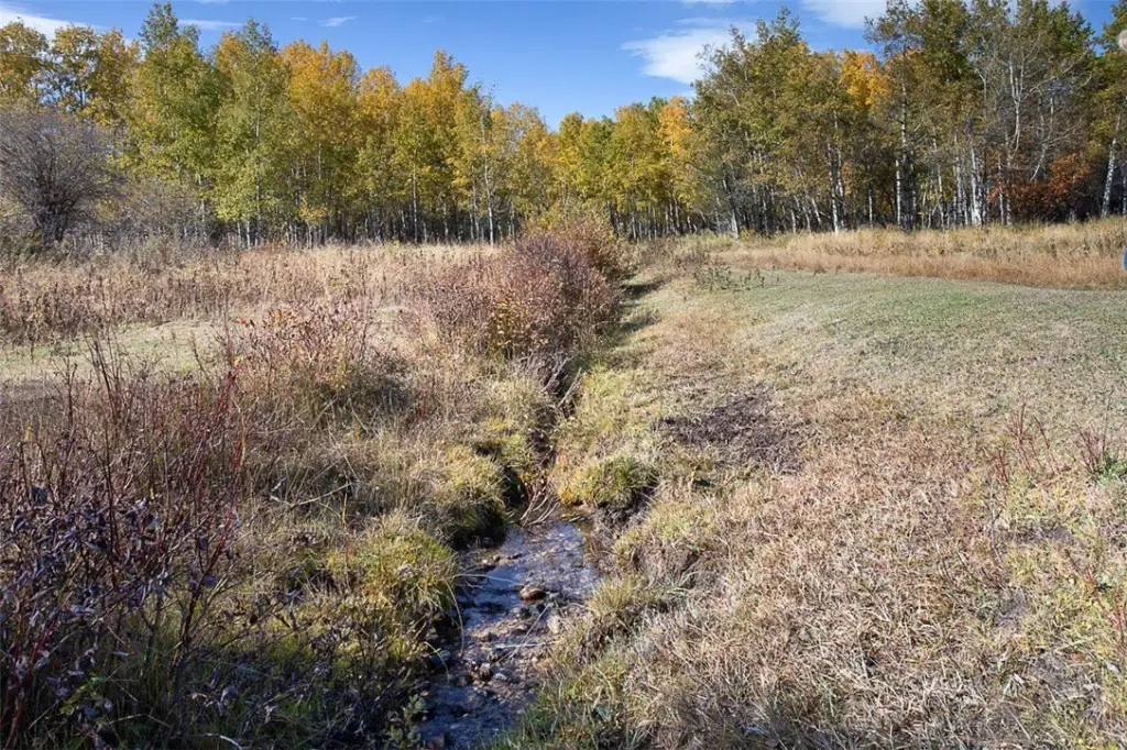
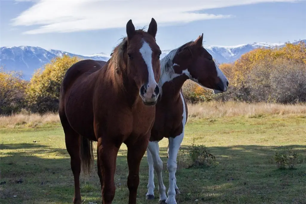
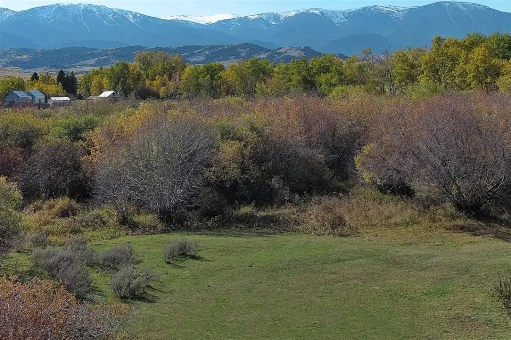
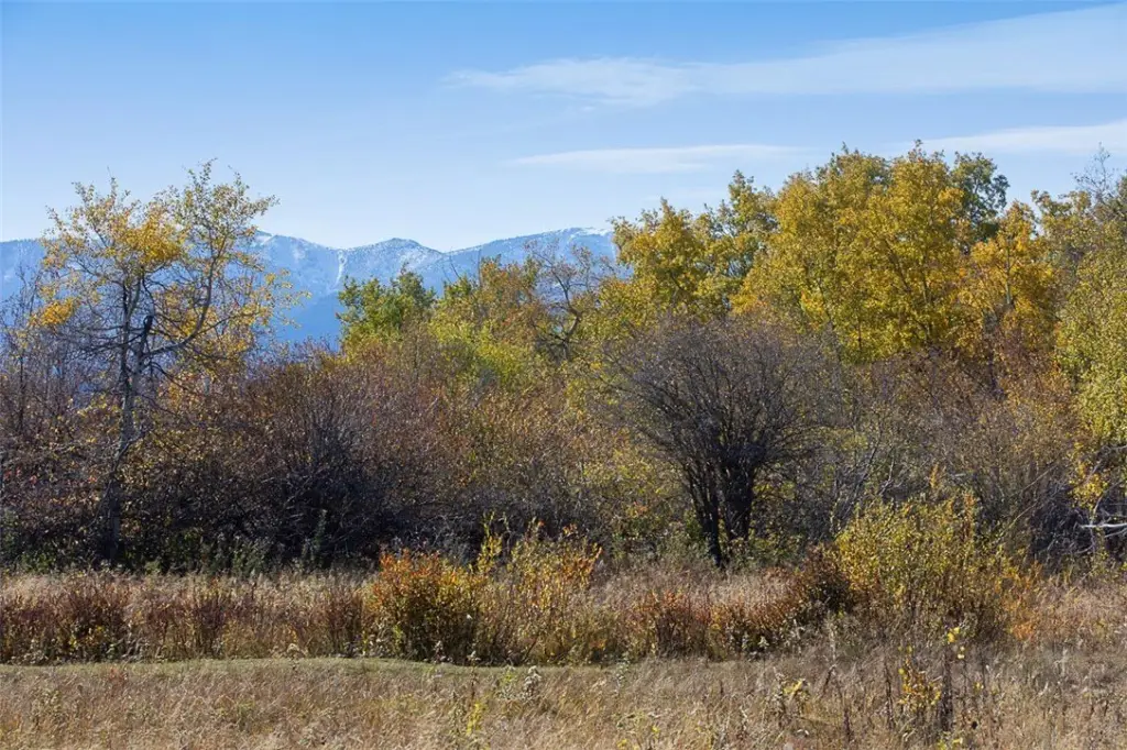
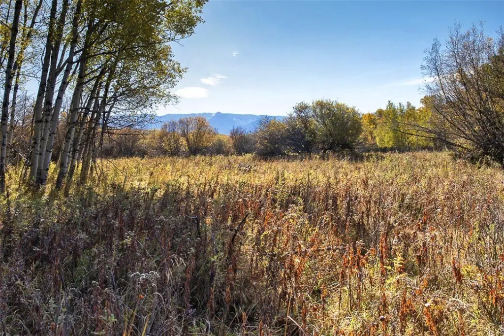
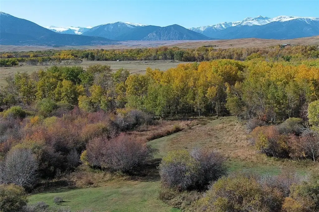
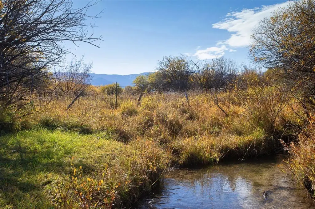
- 14 acres with live water, including Barlow Creek, a warm spring, and an irrigation stream - ideal for livestock.
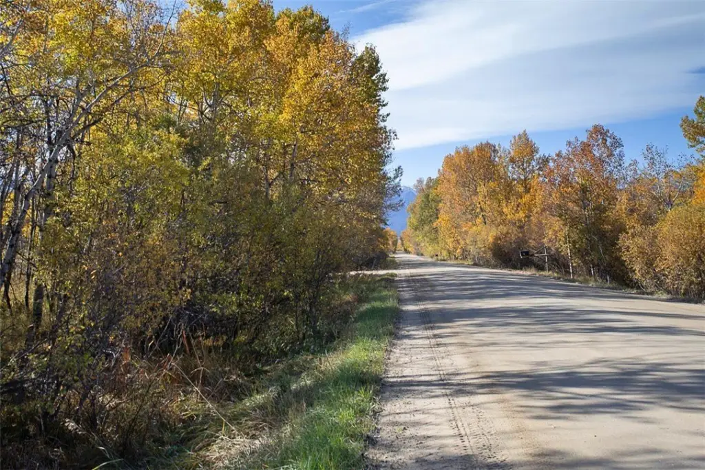
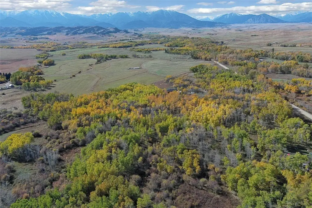
- Located in the desirable Luther area, just 20 minutes from Red Lodge, at the base of the Beartooth Mountains.
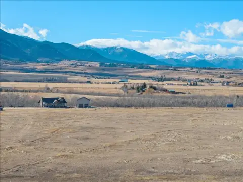
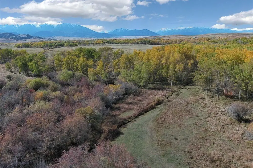
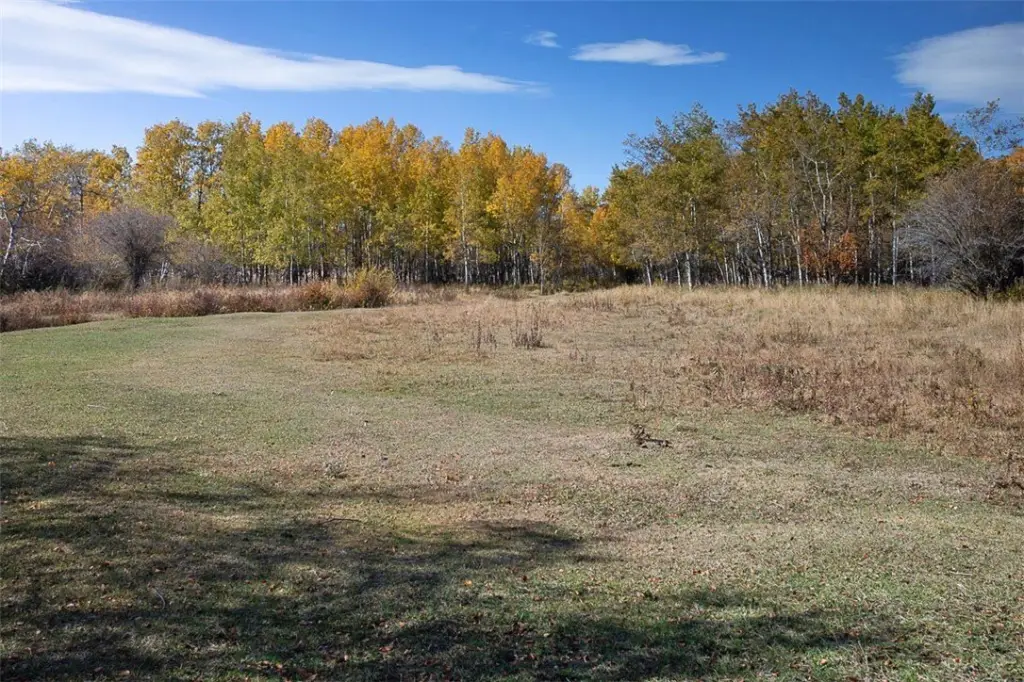
- Stunning mountain views and diverse landscape featuring wooded areas and open meadows.
- Multiple great building sites with power nearby.
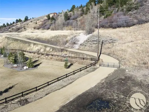
- Easy access and excellent grass for horses.
- Close proximity to Custer National Forest and Yellowstone National Park via the Beartooth Highway.
Overview
The property is located about 20 minutes west of Red Lodge, at the base of the Beartooth Mountains. It is surrounded by long-term generational ranches, and the nearby Custer National Forest provides additional opportunities for riding and hiking. Yellowstone Park is referenced as being approximately 125 miles away via the Beartooth Highway.
For buyers seeking rural acreage to support livestock or equestrian use, the combination of creek water, spring water, and an irrigation stream can be especially practical. With multiple building sites and utilities available nearby, the parcel may also fit buyers who want flexibility in where to site a home or ranch improvements while preserving a mix of wooded cover and open pasture.
Current Use by Public Records
Map
- City
- Red Lodge
- County
- Carbon
- State
- Montana
- Longitude
- -109.39072
- Latitude
- 45.305