
11th RD, Archer, NE 68816

- Added:
- Nov 7, 2025
- Days on Market:
- 239
- Last Refresh:
- Jul 4 at 10:06 pm
Property Features for 11th RD
General Information
- Property type
- Land
- Property subtype
- Other
- Standard status
- Active
- Lot size
- 375.00 Acres
Taxes and HOA fees
- Tax Annual Amount
- 14069

Listing agent Jeff Moon License #20171092 (308) 995-8067
Listing office AgWest Land Brokers 415 West 4th Ave, Holdrege, NE (308) 995-8067
Listing date Nov 7, 2025
Copyright © 2026 My State MLS. All rights reserved. All information provided by the listing agent/broker is deemed reliable but is not guaranteed and should be independently verified.
HighLights
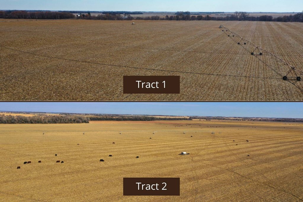
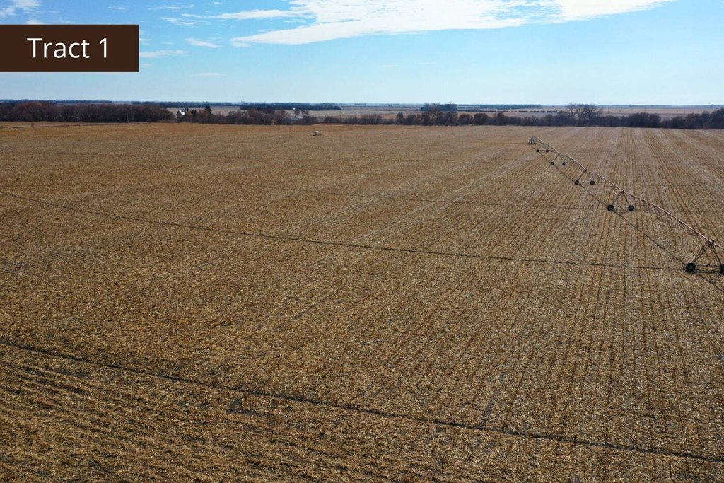
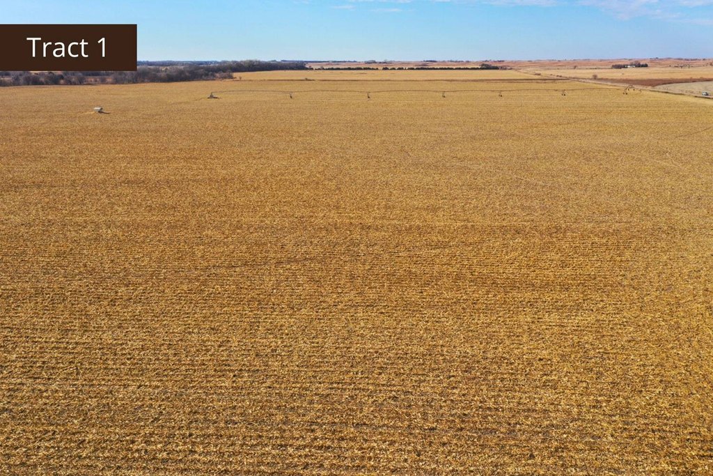
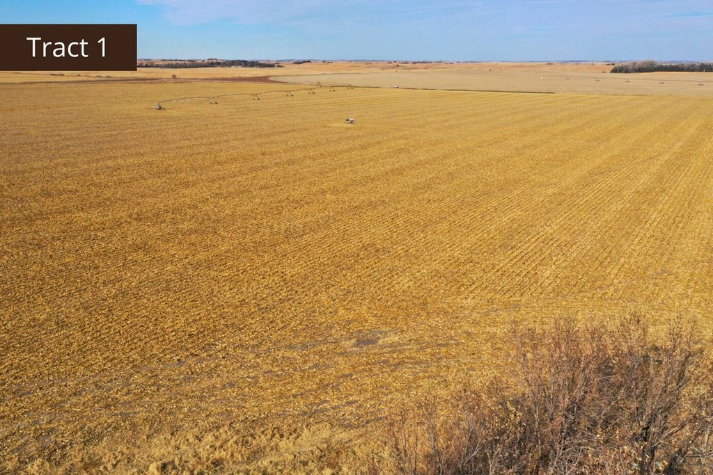
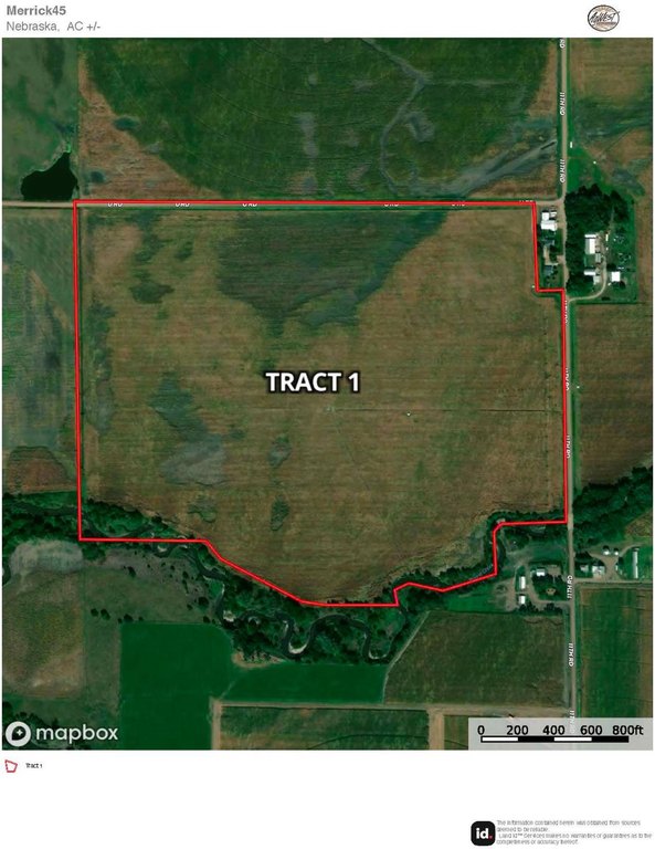
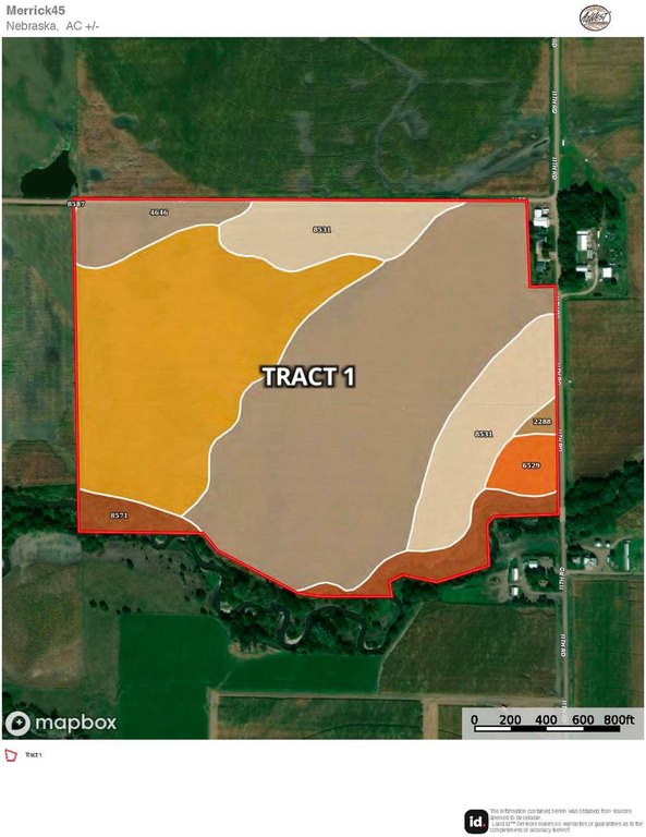
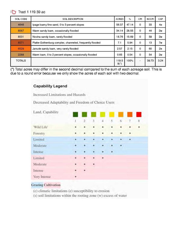
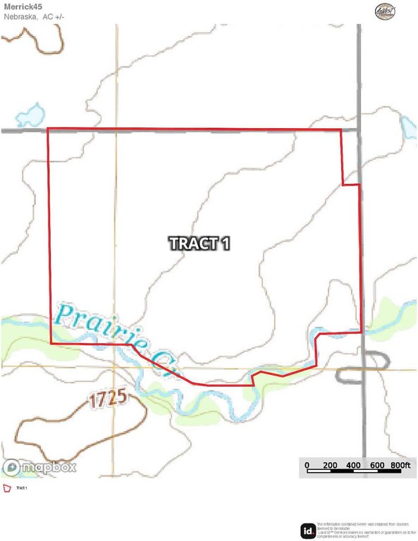
- Tract 1: 119.75+/- acres with 110.48+/- irrigated acres and 5 irrigation wells, including a 2017 6‑tower Valley center pivot with corner arm.
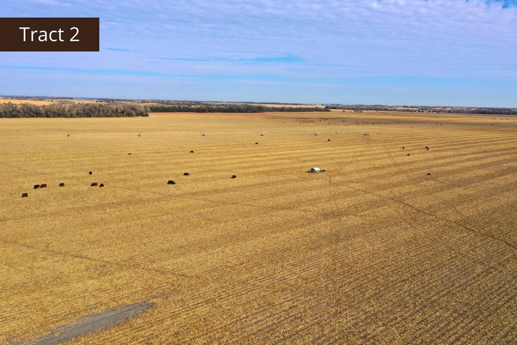
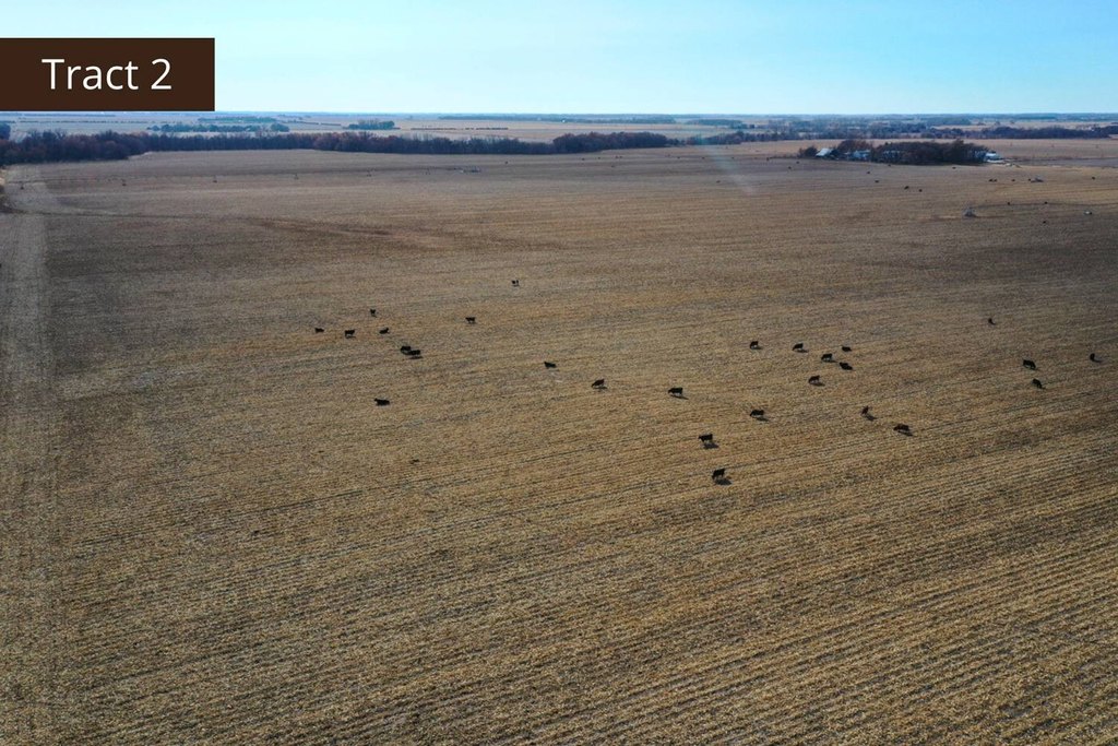
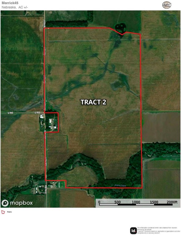
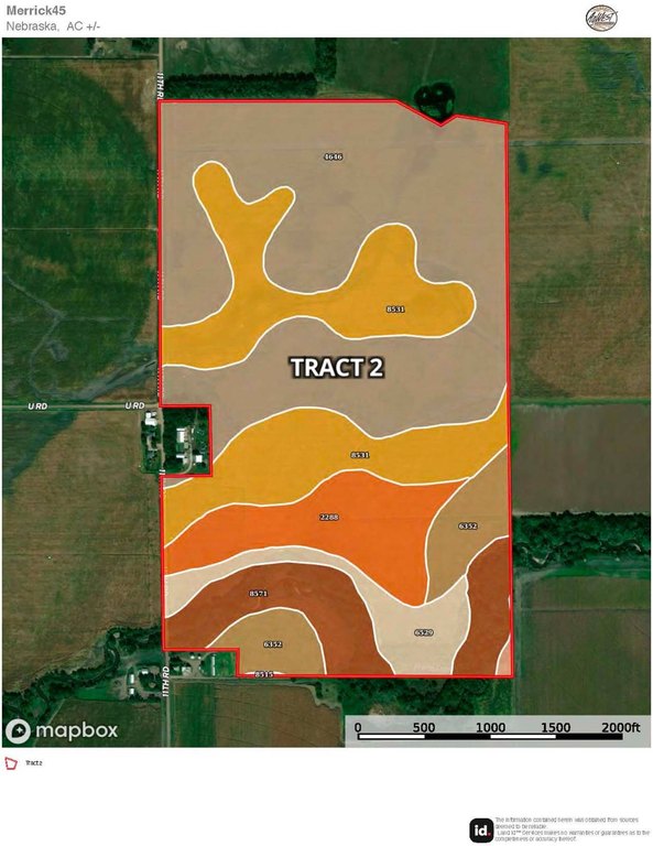
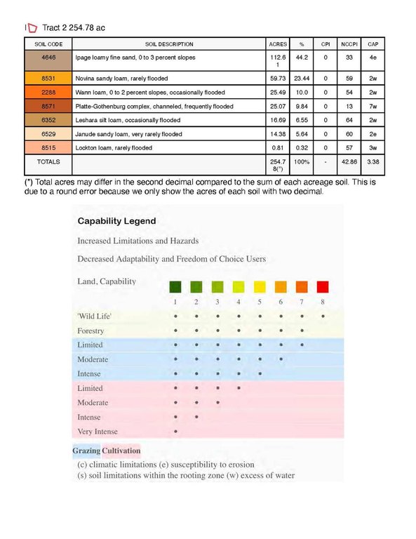
- Tract 2: 255.14+/- acres with 206.04+/- irrigated acres plus 10.08+/- dryland acres, served by 7 irrigation wells and a 7‑tower Valley center pivot.
- Both tracts have updated irrigation equipment, including serviced wells (pull and repair) and added underground piping to support efficient irrigation operations.
- Tract 1 certified irrigated acres: 111.32 (Central Platte NRD). Tract 2 certified irrigated acres: 218.50 (Central Platte NRD).
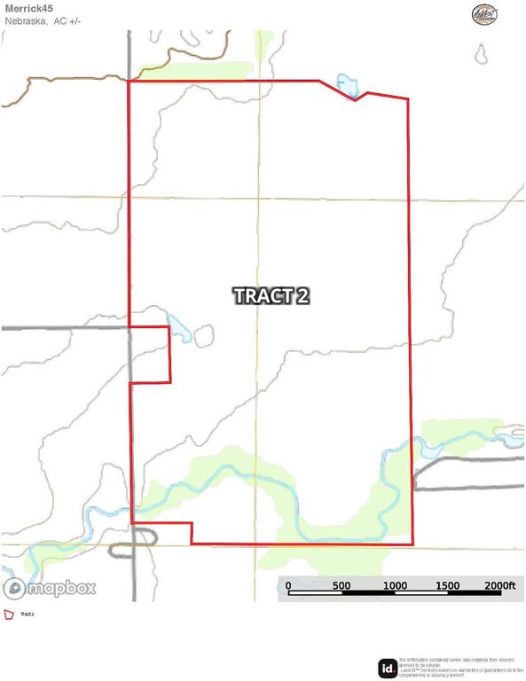
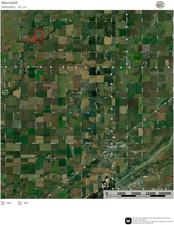
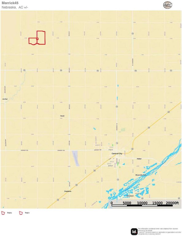
- Tract 1 and Tract 2 are adjacent and can be paired for a combined, larger operation.
- Prairie Creek borders the south end of Tract 2.
Overview
Tract 2 consists of primarily center-pivot irrigated cropland with a smaller portion of gravity-irrigated ground, supported by seven irrigation wells and additional irrigation infrastructure updates. The property includes 7- and 6-tower Valley center pivot configurations, with system setups described in the irrigation information, and is identified as part of SW1/4 of Section 35, Township 15 North, Range 7 West, along with additional portions in neighboring sections. Prairie Creek borders the south end of Tract 2.
Because the tracts are adjacent and can be paired, this combination supports expansion for an operator seeking a larger, consolidated farm unit, or provides separate ownership options for those targeting different production blocks. The seller also conveys all mineral rights owned, if any, with the sale.
Current Use by Public Records
Map
- City
- Archer
- County
- Merrick
- State
- Nebraska
- Longitude
- -98.092555
- Latitude
- 41.22147


