119 kings highway N Road, Westport, CT 06880
- Added:
- May 8, 2026
- Days on Market:
- 48
- Last Refresh:
- Jun 24 at 6:06 am
Property Features for 119 kings highway N Road
General Information
- Property type
- Land
- Property subtype
- Other
- Zoning
- AA residential
- Standard status
- Active
- Lot size
- 0.87 Acres
Taxes and HOA fees
- Tax Year
- 2026
- Tax Annual Amount
- 7872
Utilities
- Sewer type
- Public Sewer
- Water source
- Public
Listing agent Helen Cusa (203) 221-0666
Listing office Brown Harris Stevens 56 Post Road E, Westport, CT (203) 221-0666
Listing date May 8, 2026
Copyright © 2026 SmartMLS, Inc. All rights reserved. All information provided by the listing agent/broker is deemed reliable but is not guaranteed and should be independently verified.
HighLights
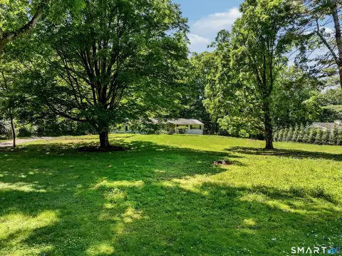
- .87‑acre lot in an AA Res zone in the desirable Old Hill area
- Elevated, rolling land positioned off Kings Highway with distance views of the river and town through the trees
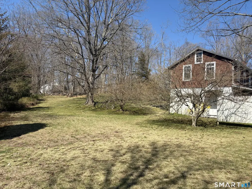
- Older 1,400 SF single‑family home currently used as a rental for many years
- Home layout includes two levels with separate entrances; each level has a living room, 1 bedroom, kitchen, and full bath
- Utilities include public water and public sewer
- Sewer hookup for a new single‑family home on Kings Highway is paid in full (see Town Hall for building regulations)
Overview
The lot is described as being ideally positioned off Kings Highway, with distance views of the river and town through the trees. The property also includes a sewer hookup for a new single-family home on Kings Highway that has been paid in full. Prospective development would need to follow applicable building regulations reviewed with town hall.
From a tenant or owner-operator standpoint, the existing configuration may support flexible use as an accessory unit or as separate office space in connection with a future home plan, subject to local requirements. For buyers, this parcel offers a combined approach: purchase the land with an existing income-producing structure and sewer service already paid for, while planning for redevelopment in accordance with town regulations.
Current Use by Public Records
Map
- City
- Westport
- County
- Fairfield
- State
- Connecticut
- Longitude
- -73.367364
- Latitude
- 41.146056