1000 BLK Hwy 97, Molino, FL 32577
- Added:
- Jun 14, 2026
- Days on Market:
- 4
- Last Refresh:
- Jun 17 at 6:06 am
Property Features for 1000 BLK Hwy 97
General Information
- Property type
- Land
- Property subtype
- Other
- Standard status
- Active
- APN
- 344N323401000001
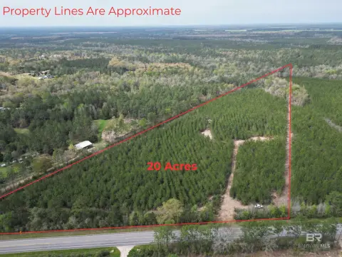
- Lot size
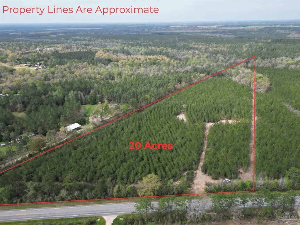
- 20.00 Acres
Taxes and HOA fees
- Tax Description
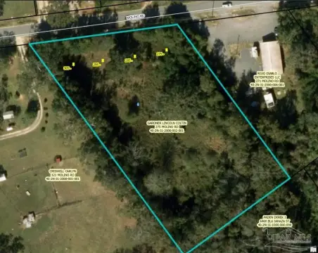
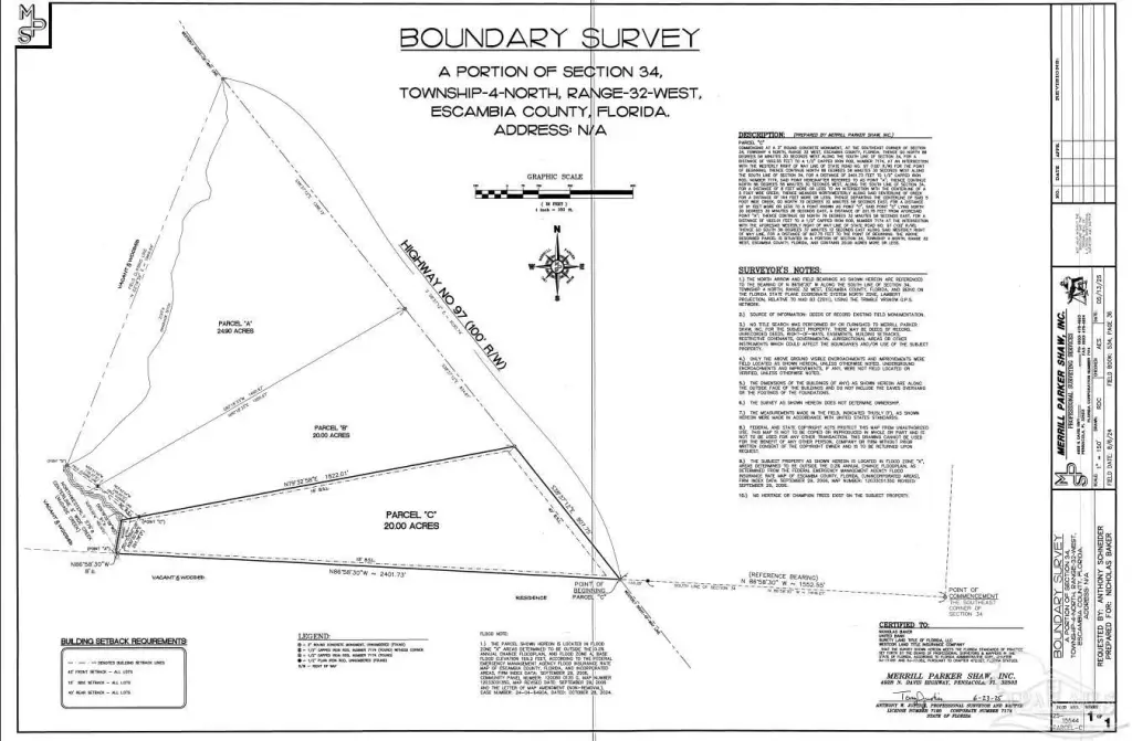
- COMMENCING AT A 3 INCH ROUND CONCRETE MONUMENT, AT THE SOUTHEAST CORNER OF SECTION 34, TOWNSHP 4 NORTH, RANGE 32 WEST, ESCAMBIA COUNTY, FLORDA; THENCE GO NORTH 86 DEGREES 58 MINUTES 30 SECONDS WEST ALONG THE SOUTH LINE OF SECTION 34. FOR A DISTANCE OF 1552.55 FEET TO A CAPPED IRON ROD, 7174. AT AN INTERSECTION WITH THE WESTERLY RIGHT OF WAY LINE OF STATE ROAD NO: 97 (100 FT R/W). FOR THE POINT OF BEGINNING THENCE CONTINUE NORTH 86 DEGREES 58 MINUTES 30 SECONDS WEST ALONG THE SOUTH LINE OF SECTON 34, FOR A DISTANCE OF 2401.73 FEET TO 1/2 INCH CAPPED IRON ROD, NUMBER 7174, SAID PONT HEREINAFTER REFERRED TO AS POINT -A- THENCE CONTINUE NORTH 86 DEGREES 58 MINUTES 30 SECONDS WEST ALONG THE SOUTH LINE OF SECTION 34. FOR A DISTANCE OF 8 FEET MORE OR LESS TO AN INTERSECTION THE CENTERLINE A 5 FOOT WIDE CREEK: THENCE MEANDER NORTHWESTERLY ALONG CENTERLINE OF CREEK FOR A DISTANCE OF 576 FEET MORE OR LESS TO AN INTERSECTION WITH A DRAINAGE DITCH; THENCE MEANDER NORTHEASTERLY ALONG SAID DRAINAGE DITCH, FOR A DISTANCE OF 3 FEET MORE OR LESS TO A POINT LYING NORTH 29 DEGREES 54 MINUTES 05 SECONDS WEST FOR A DISTANCE OF 483.39 FEET THE AFORESAID POINT -A SAID PONT HEREINAFTER REFERRED TO AS POINT -B- THENCE MEANDER NORTHEASTERLY ALONG SAID DRAINAGE DITCH FOR A DISTANCE OF 2120 FEET MORE OR LESS TO A 1/2 INCH CAPPED IRON ROD, NUMBER 7174, AT AN INTERSECTION THE AFORESAID WESTERLY RIGHT OF WAY LINE OF STATE ROAD NO: 97 (100 R/W, SAID POINT LYING NORTH 22 DEGREES 18 MINUTES 39 SECONDS EAST FOR A DISTANCE OF 1969.59 FEET THE AFORESAID POINT -B- THENCE GO SOUTH 38 DEGREES 37 MINUTES 12 SECONDS EAST ALONG SAID WESTERLY RIGHT OF WAY LINE. DISTANCE OF 3030.74 FEET TO THE PONT OF BEGINNING. THE DESCRIBED PARCEL S SITUATED IN A PORTION OF SECTION 34. TOWNSHIP 4 NORTH, RANGE 32 WEST ESCAMBIA COUNTY, FLORIDA, AND CONTAINS 64.90 ACRES. OR 9143 P 1333
Utilities
- Water front features
- Creek, Waterfront
- Water front
- 1

Listing agent Brett Helton License #151144-1 (251) 294-2060
Listing office PHD Real Estate, LLC 1812 S Main Street, Atmore, FL (251) 368-1063
Listing date Jun 14, 2026
Copyright © 2026 Pensacola Association of REALTORS. All rights reserved. All information provided by the listing agent/broker is deemed reliable but is not guaranteed and should be independently verified.
HighLights
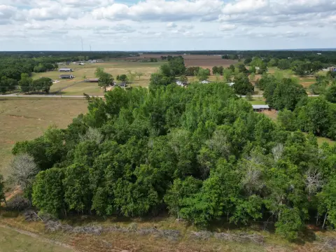
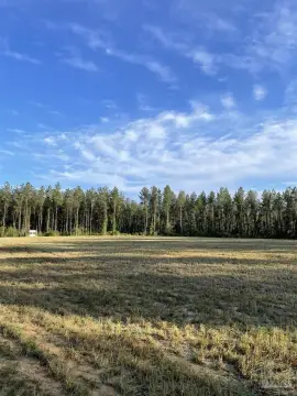
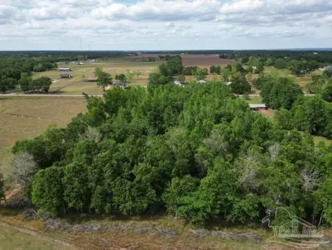
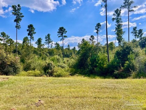
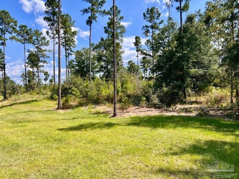
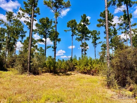
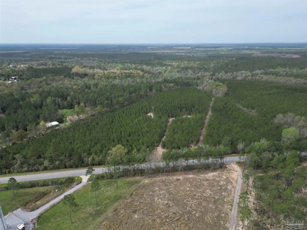
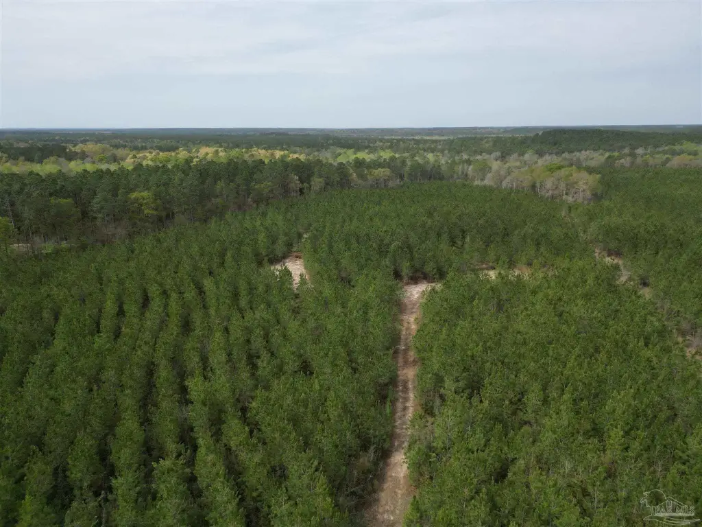
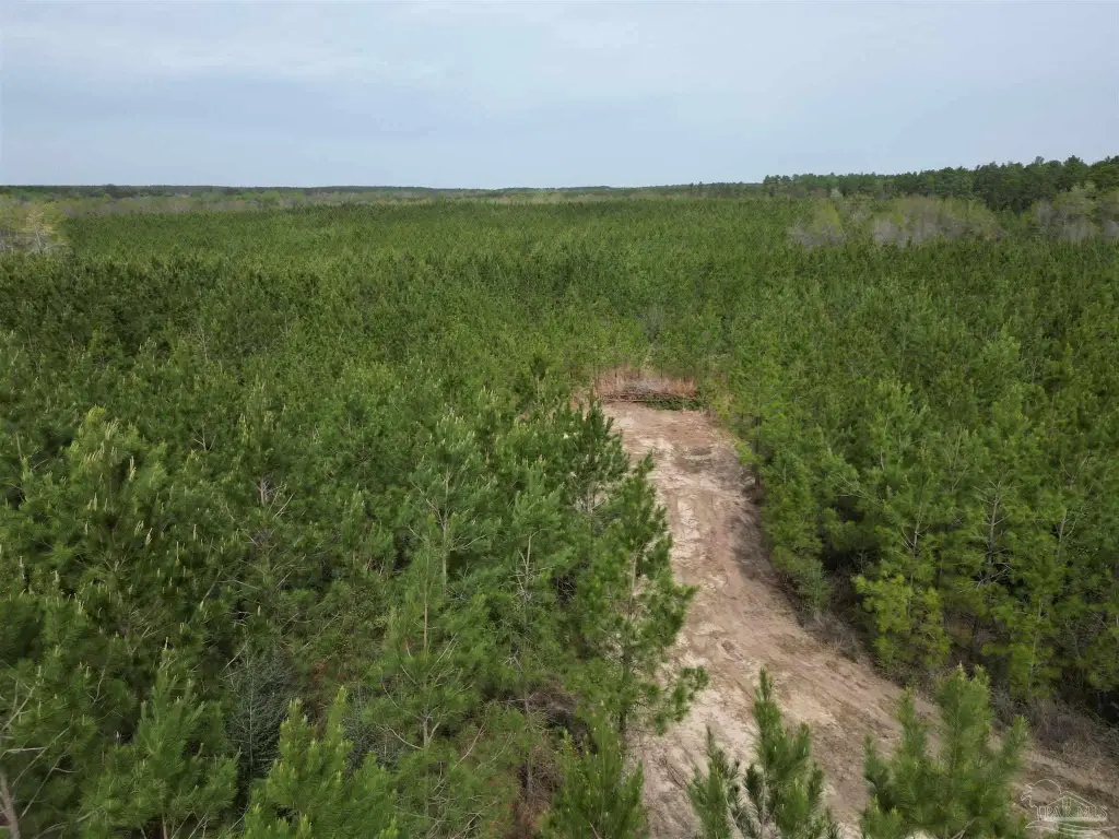
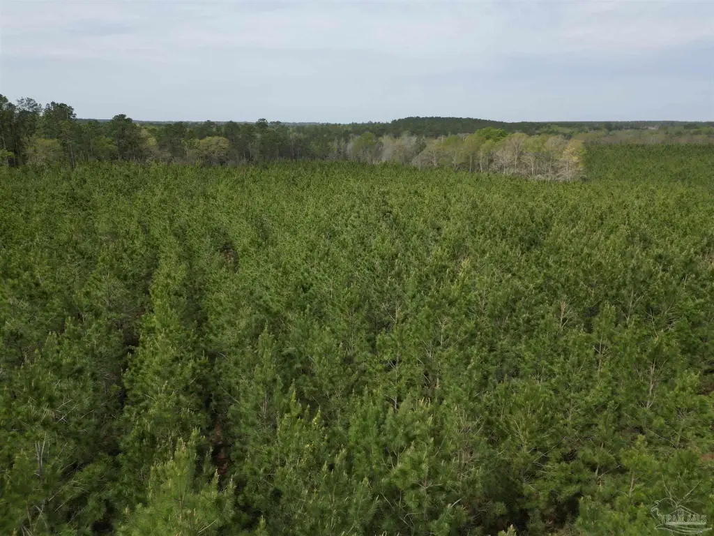
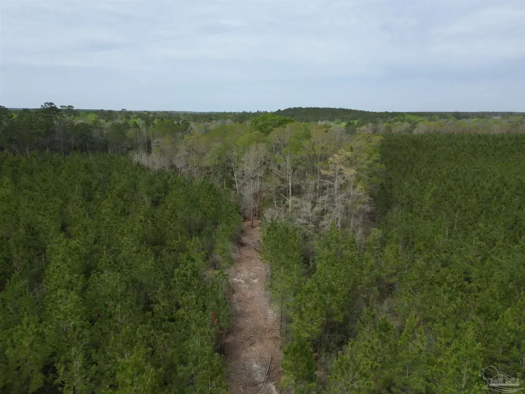
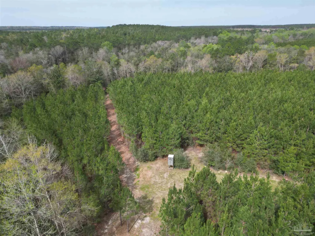
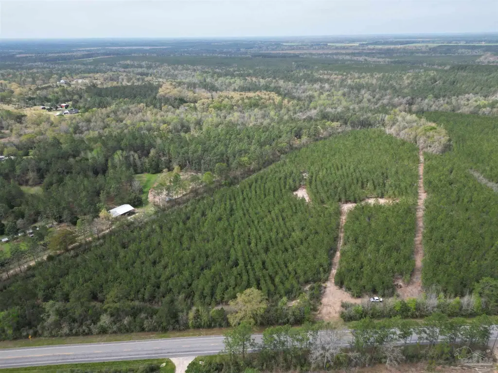
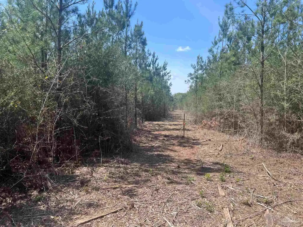
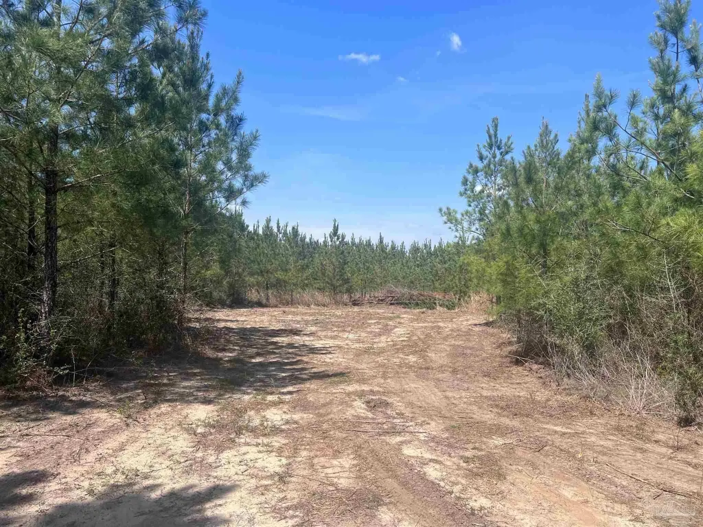
- 20‑acre waterfront property in Molino, FL backing up to McDade Creek
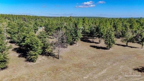
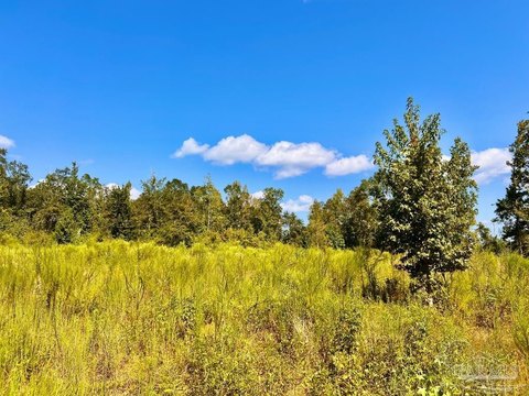
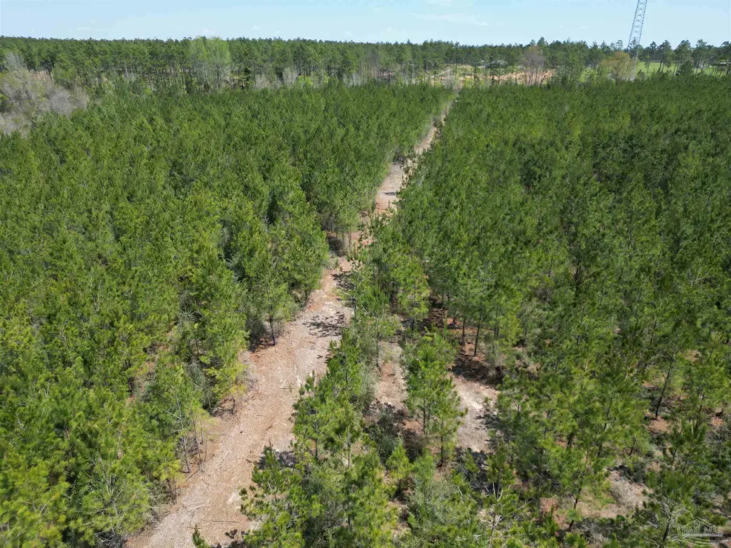
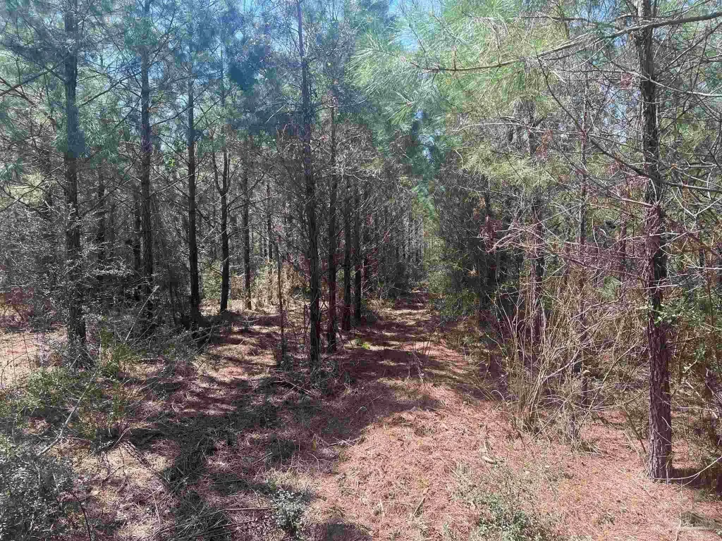
- Features scenic forest views with young to middle‑aged Loblolly pine trees
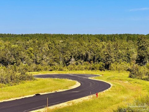
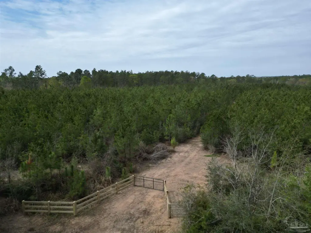
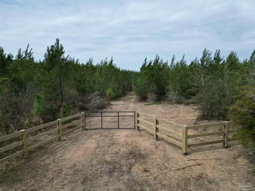
- Newly installed entrance gate provides added privacy and security
- Multiple cleared areas for ready‑to‑use building or other uses
- Property line brush cut all the way to the back for clear boundaries and access
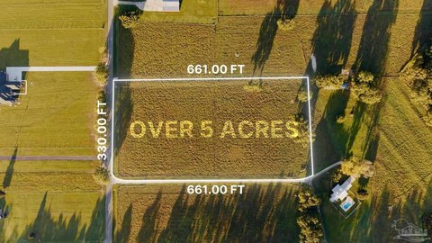
- Already surveyed and properly split through Planning and Zoning for development
Overview
Located in Molino, Florida, the property is described as offering convenient access to the amenities of Pensacola, approximately 30 minutes away. The listing also notes the parcel has been surveyed and properly split through Planning and Zoning, indicating readiness for development planning.
For buyers looking for land with a mix of timber cover and cleared space, this tract provides options for a homestead, recreational retreat, or other development plans. The creek-backed configuration and gated entry may appeal to users prioritizing a quieter, country-style setting while still remaining within a reasonable drive to nearby services. The combination of cleared areas, maintained boundaries, and the completed survey split are practical factors for anyone evaluating a development-ready ownership in Escambia County.
Current Use by Public Records
Map
- City
- Molino
- County
- Escambia
- State
- Florida
- Longitude
- -87.3786
- Latitude
- 30.7355