Way Up Lode Survey No. 7310 Virginia City, MT 59729
- Added:
- Aug 20, 2024
- Days on Market:
- 590
- Last Refresh:
- Apr 1 at 1:06 pm
Property Features for Way Up Lode Survey No. 7310
General Information
- Property type
- Land
- Property subtype
- Other
- Standard status
- Active
- APN
- 0002302300
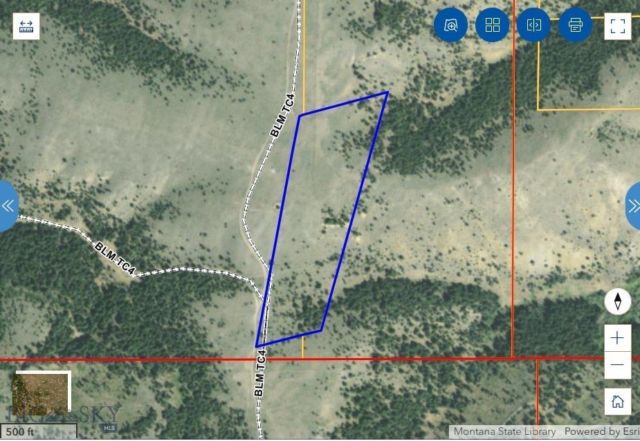
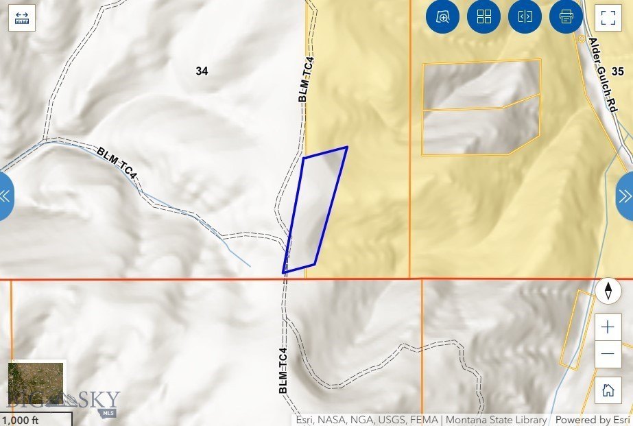
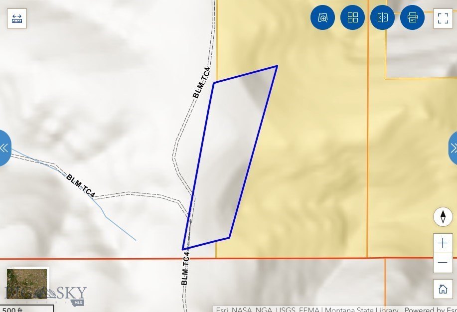
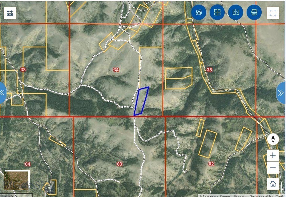
- Lot size
- 15.71 Acres
Taxes and HOA fees
- TaxYear
- 2021
- TaxDescription
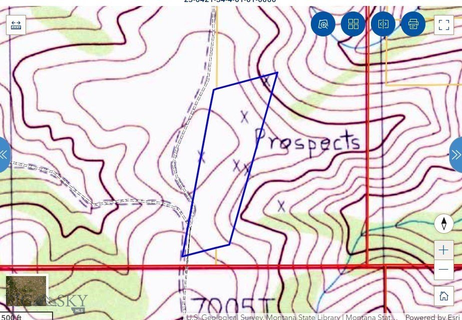
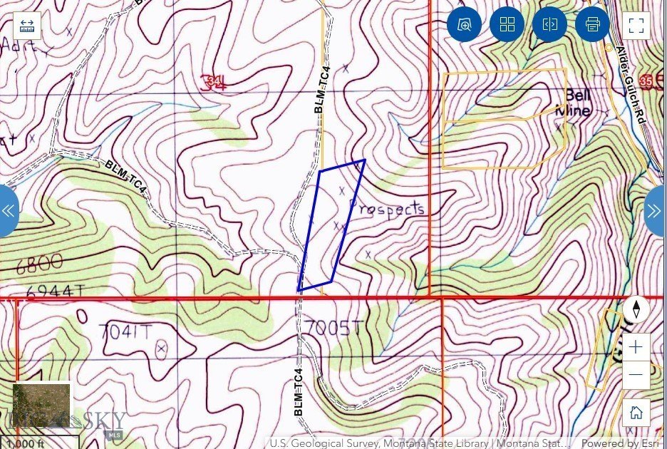
- S34, T06 S, R03 W, ACRES 15.71, WAYUP SUR 7310 ME 4482 Full: undivided 7.5% interest in the Way Up Lode, Survey No 7310, M.E. No. 4482, Located in the southeast quarter of Section 34, Township 6 South, Range 3 West, M.P.M., and more particularly described in the Patent recorded in Book 64, page 614
- TaxAnnualAmount
- 5
Listing agent DeHart Home Hunters License #RBS-79003 (406) 560-8288
Listing office Venture West Realty 135 Mill Town Loop #B, Bozeman, MT (406) 522-9378
Listing date Aug 20, 2024
MLS# 395056
Copyright © 2025 Big Sky Country MLS. All rights reserved. All information provided by the listing agent/broker is deemed reliable but is not guaranteed and should be independently verified.
Overview
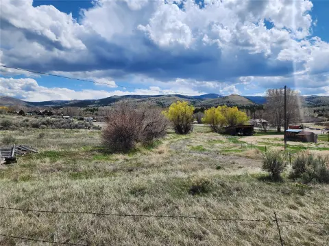
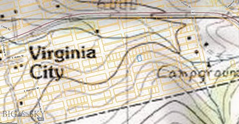
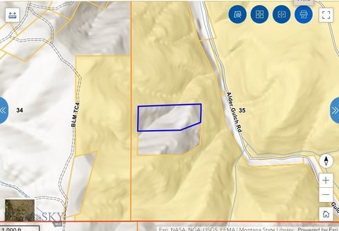
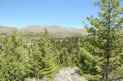
Montana Land Near Virginia City
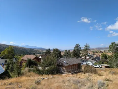
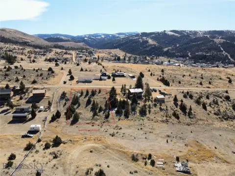
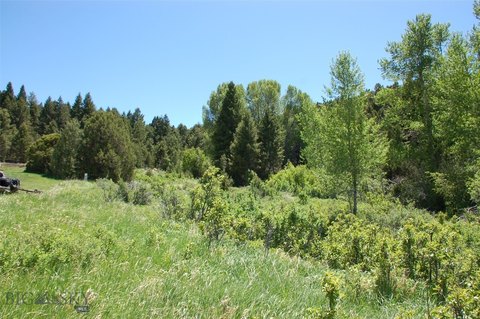
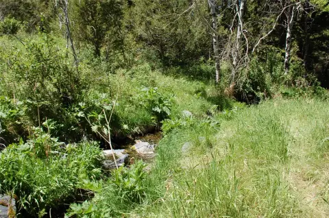
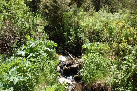
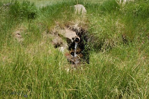
This 15.71-acre property, identified as Way Up Lode Survey #7310, offers a blend of Montana heritage, wildlife, and remoteness near Virginia City. The site provides scenic views and proximity to Virginia City's tourism circuit, suitable for prospecting or recreation. The land is an off-grid sanctuary with rugged charm and investment potential. This property represents a 7.5% undivided interest in the 15.71 acres, shared with approximately six additional owners. Bordered by BLM land on one side and private land on the other, it is located near Virginia City and Alder Gulch, part of the gold-mining corridor with documented placer and lode activity. The area is suitable for hunting, hiking, and heritage tourism. The land presents opportunities for panning for gold, silver, base metal minerals, and garnets. Buyers are advised to perform their own due diligence.
Property Profile
Insight Report
Location Intelligence
Current Use by Public Records
Recreation land
Map
- City
- Virginia City
- County
- Madison
- State
- Montana
- Longitude
- -111.582
- Latitude
- 45.4126
Nearby Similar for Sale


FAQs
What type of property is this?
Land - 15.71-acre recreational land near Virginia City, Montana.
Where is this land located?
The property is located at Way Up Lode Survey No. 7310 Virginia City, MT.
What is the asking price?
The asking price for this property is Off market.
What are key features of this property?
This property features: Fractional ownership (7.5% interest) of 15.71 acres near Virginia City.; Proximity to Virginia City and Alder Gulch, offering heritage tourism opportunities.; Surrounded by BLM land on one side, providing access to public lands.


