M42L37 2 Kendall Farm Trail, Rangeley, ME 04970
- Added:
- Jun 12, 2026
- Days on Market:
- 3
- Last Refresh:
- Jun 14 at 7:06 am
Property Features for M42L37 2 Kendall Farm Trail
General Information
- Property type
- Land
- Property subtype
- Other
- Zoning
- Residential
- Parking features
- Driveway
- Standard status
- Active
- Lot size
- 1.12 Acres
Taxes and HOA fees
- Tax Year
- 2025
- Tax Annual Amount
- 1448
Utilities
- Sewer type
- Septic Needed
- Water source
- Public
- Water front
- 1
Listing agent Shawn Russell (207) 778-1060
Listing office Morton & Furbish Agency 2478 Main Street, Rangeley, ME (207) 864-5777
Listing date Jun 12, 2026
Copyright © 2026 Maine Listings. All rights reserved. All information provided by the listing agent/broker is deemed reliable but is not guaranteed and should be independently verified.
HighLights
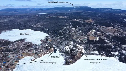
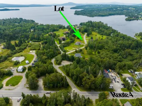
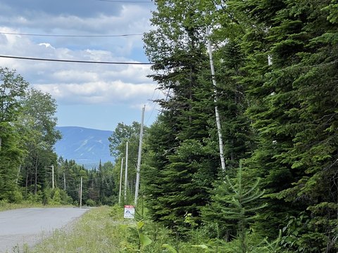
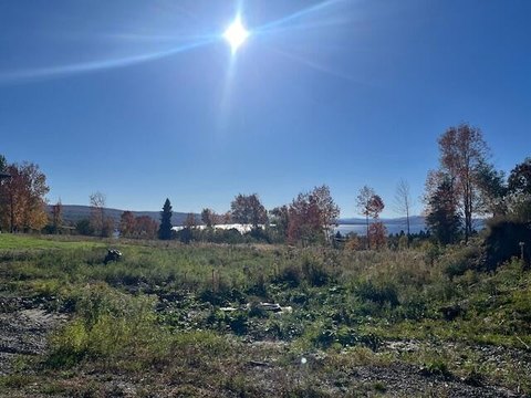
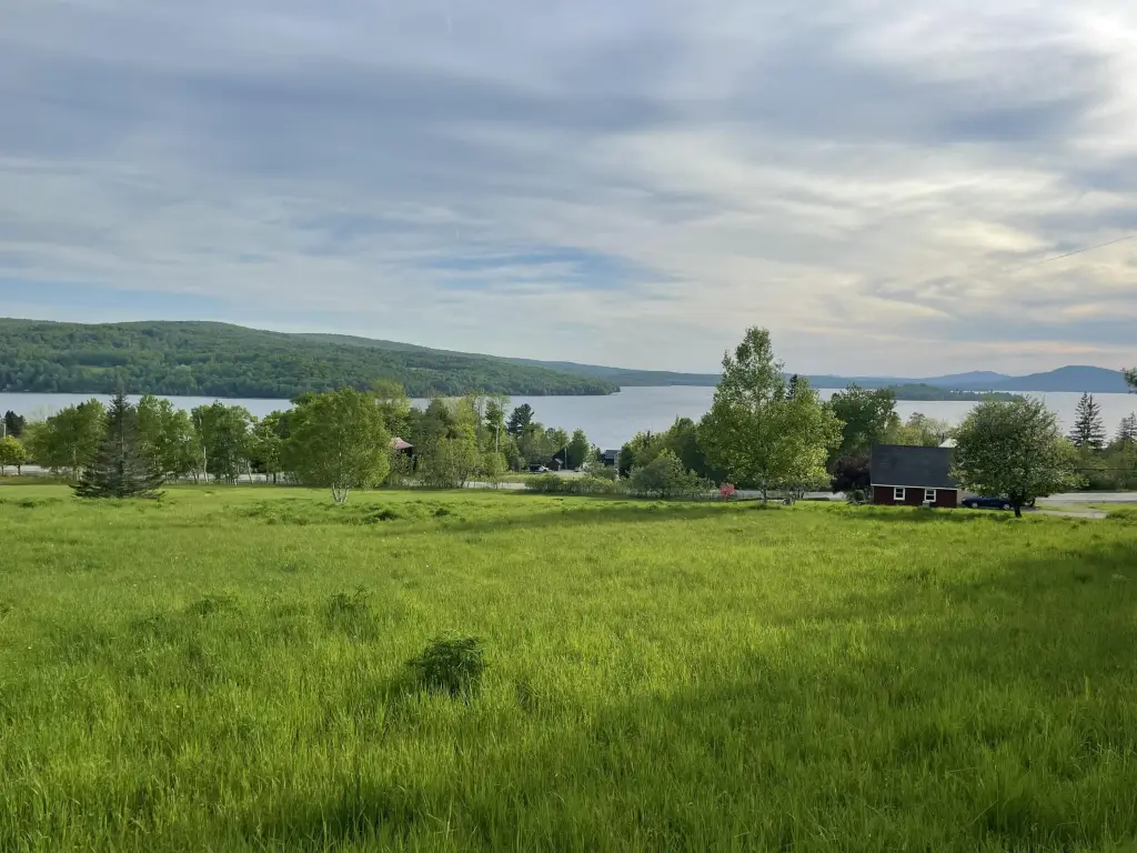
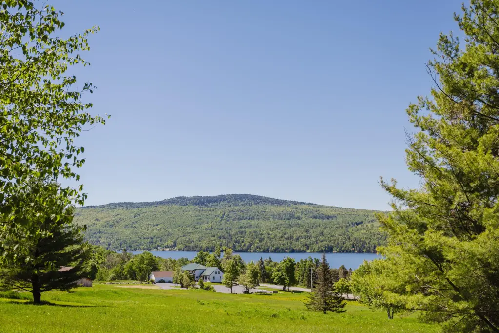
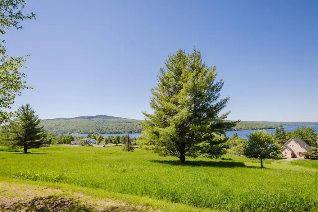
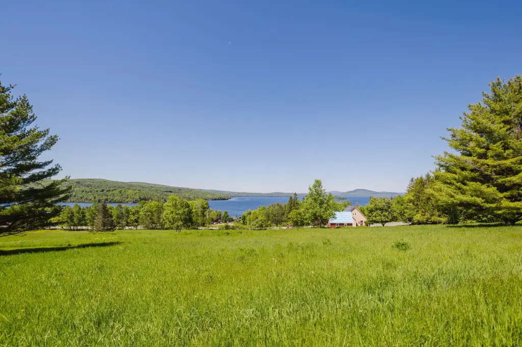
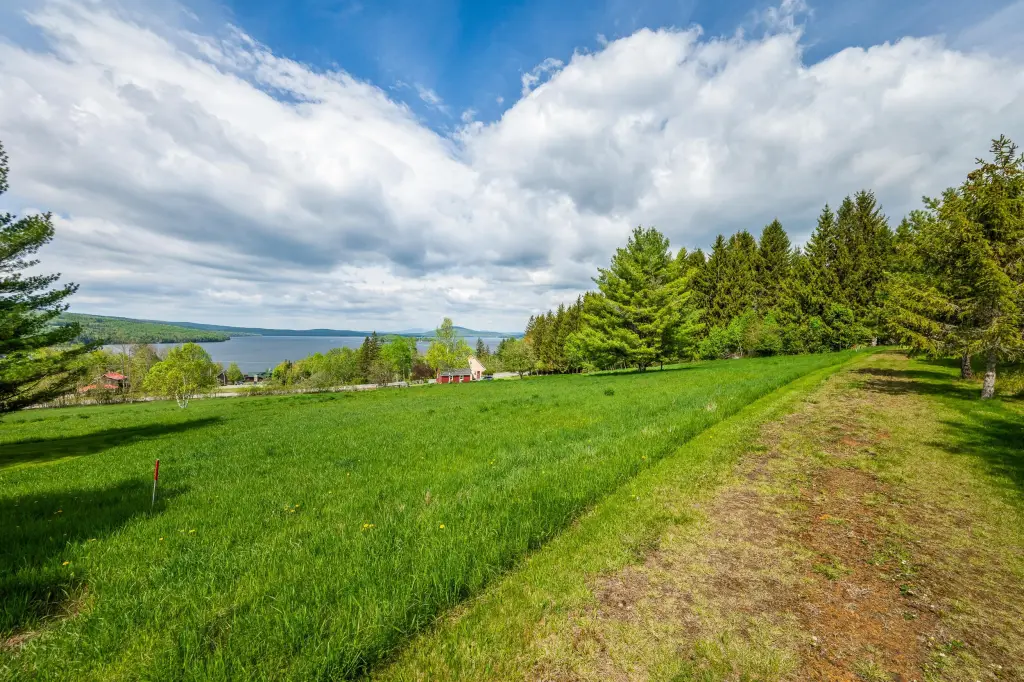
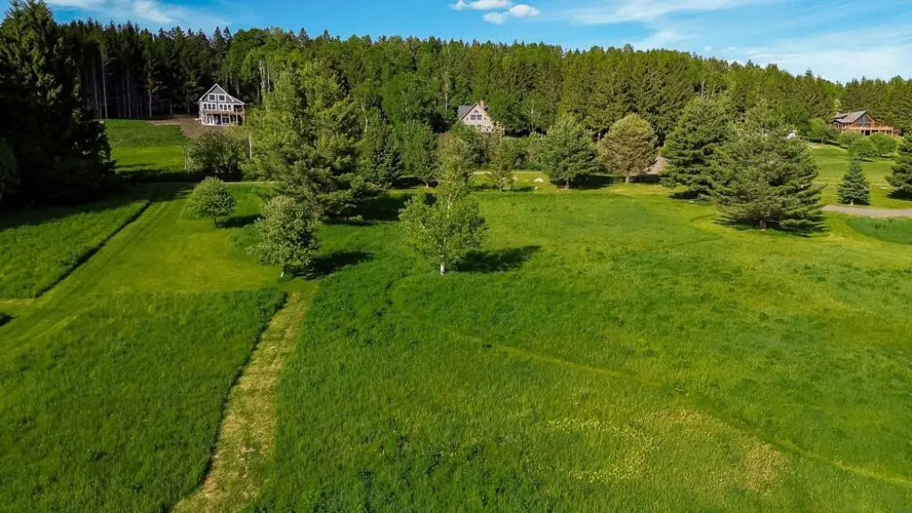
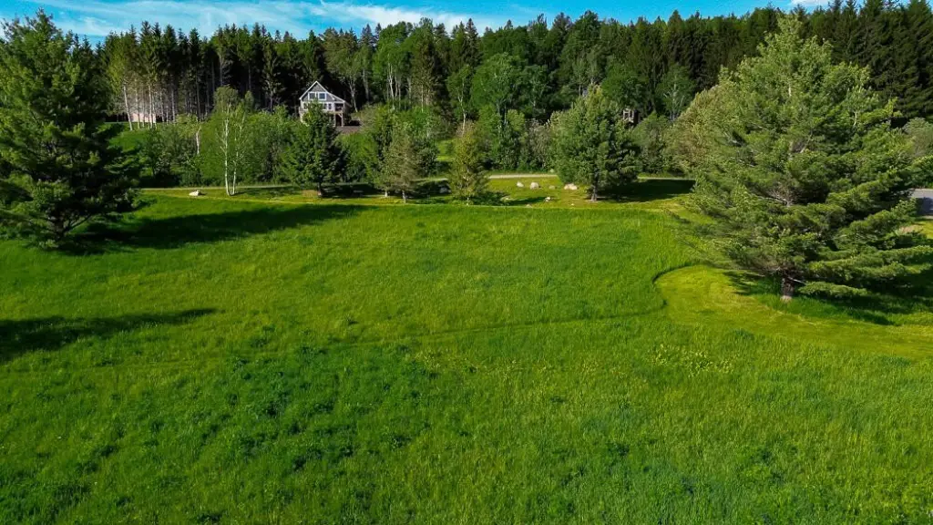
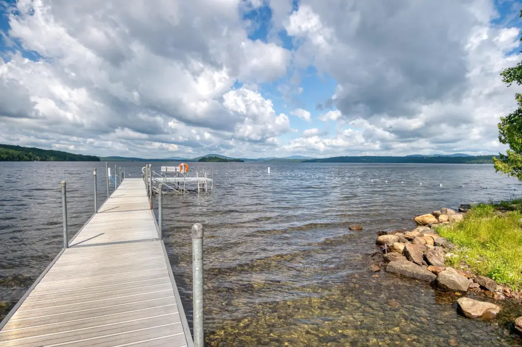
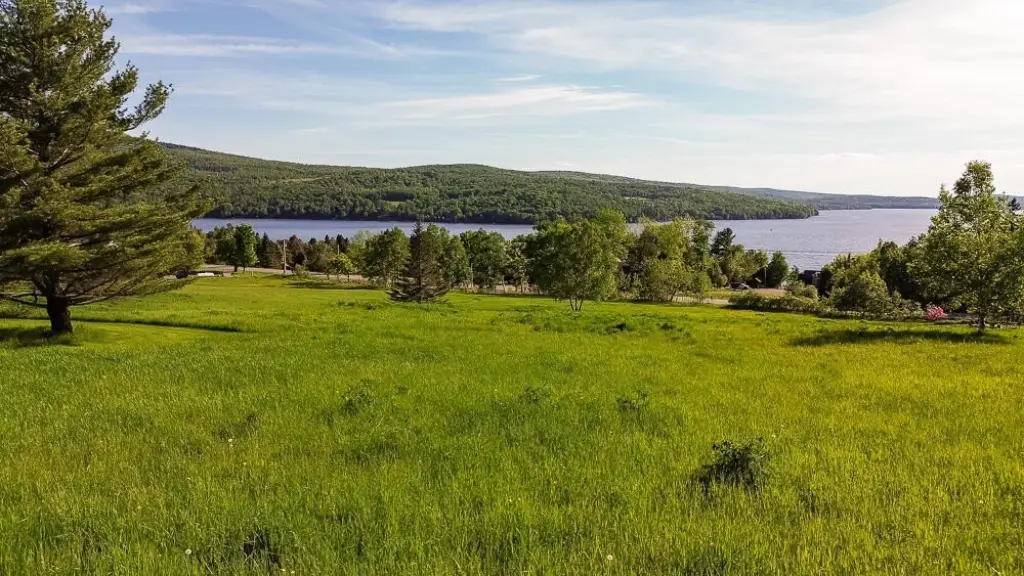
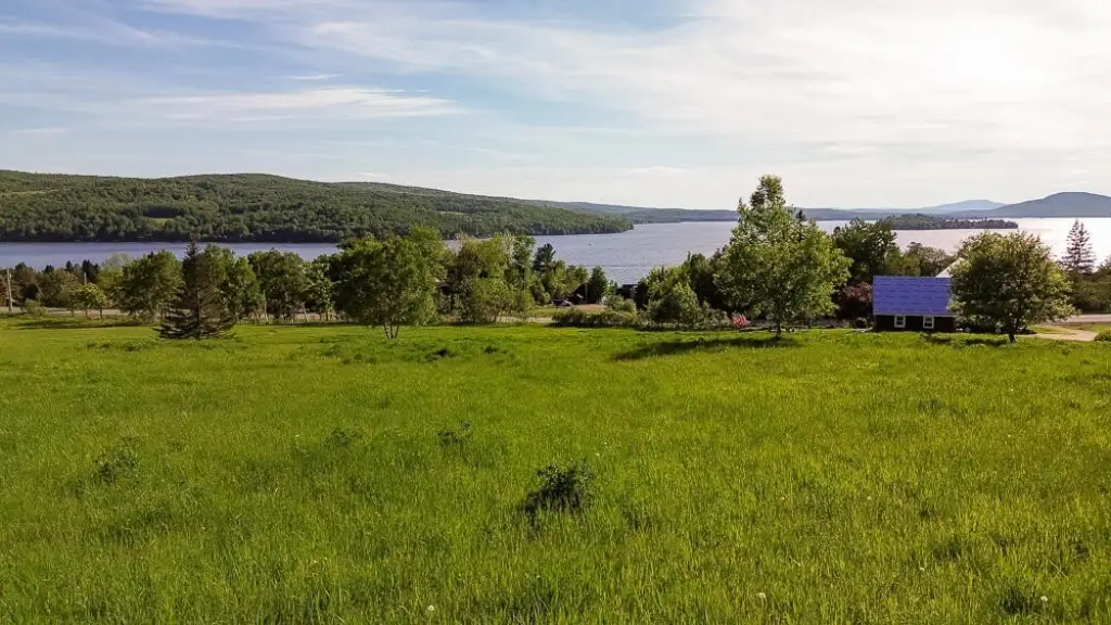
- 1.12‑acre lot in Lakeview Highlands, Rangeley, with sweeping westerly views of Rangeley Lake and western mountains (protected by deed)
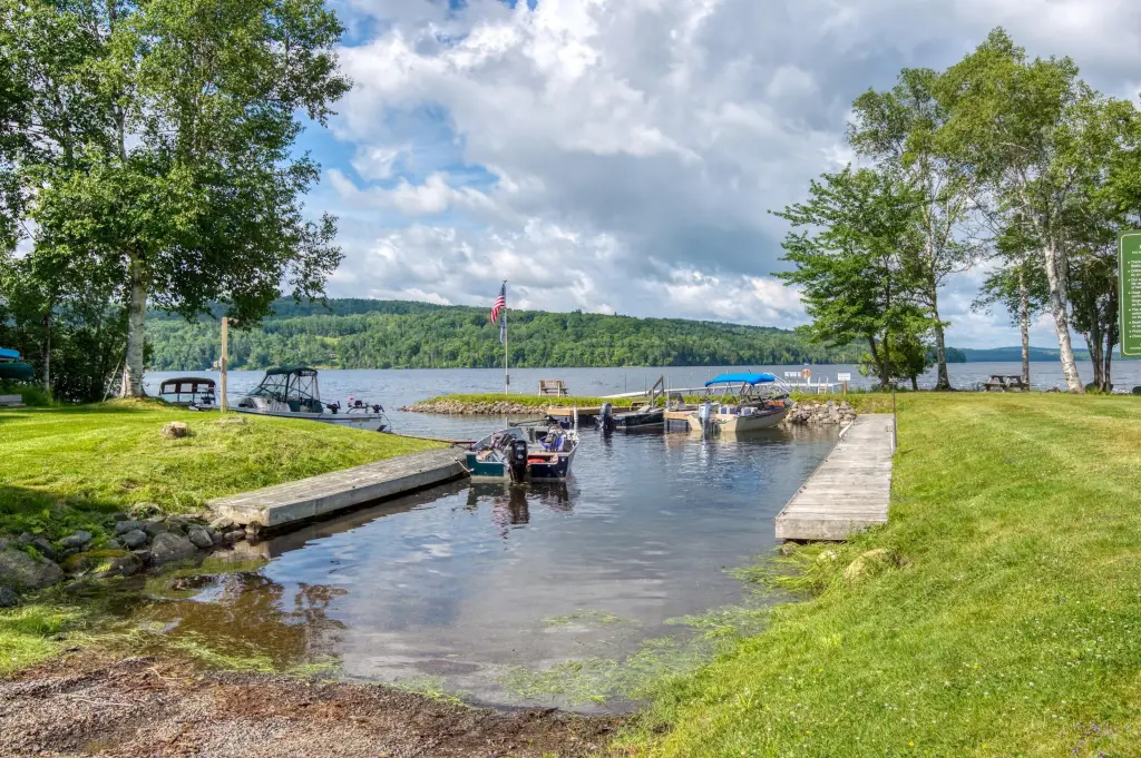
- 212 feet of shared deeded waterfront on Rangeley Lake, located a short distance away
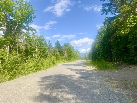
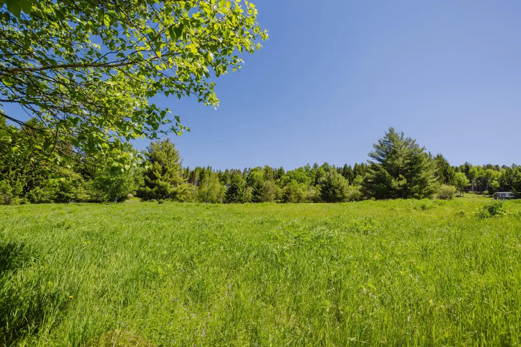
- Cleared, well maintained, and gently sloping property suited for building
- Public water and underground power available
- Septic needed; sewer not currently available
- Access via well‑maintained road and driveway; located along Kendall Farm Trail near Lynn Way
Overview
The land is positioned along Kendall Farm Trail near Lynn Way in Rangeley, Maine. A short distance away, the parcel includes 212 feet of shared deeded waterfront on Rangeley Lake, and the waterfront access is protected by deed. The listing also notes snowmobile access from the property, connecting to area recreation.
For buyers seeking a residential build site with ready-to-connect utilities, this lot provides a practical foundation in a maintained subdivision setting. The combination of cleared land, deed-protected views, and shared deeded waterfront can support a range of outdoor-oriented home plans while keeping day-to-day logistics manageable with public water and underground power already available. Lot 2 is referenced in the amended subdivision plan #3692.
Current Use by Public Records
Location Insight
- Map
- Local Demand
- City
- Rangeley
- County
- Franklin
- State
- Maine
- Longitude
- -70.632973
- Latitude
- 44.94743