Overview
Topock AZ Land on Route 66
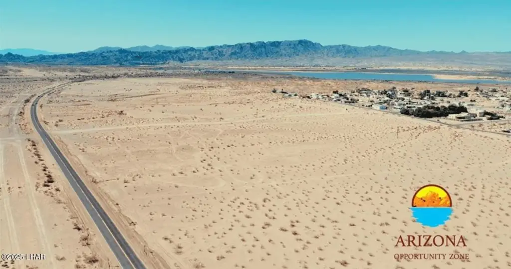
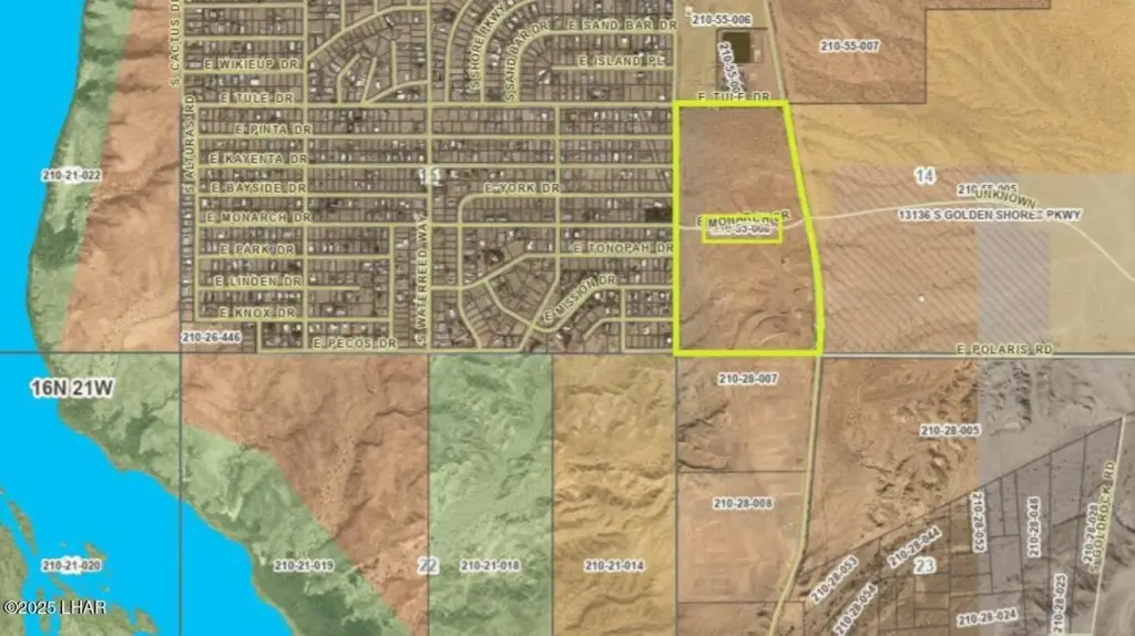
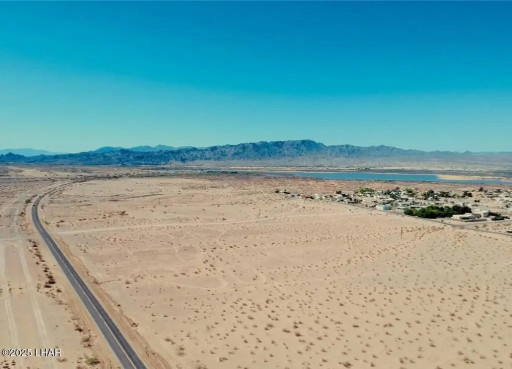
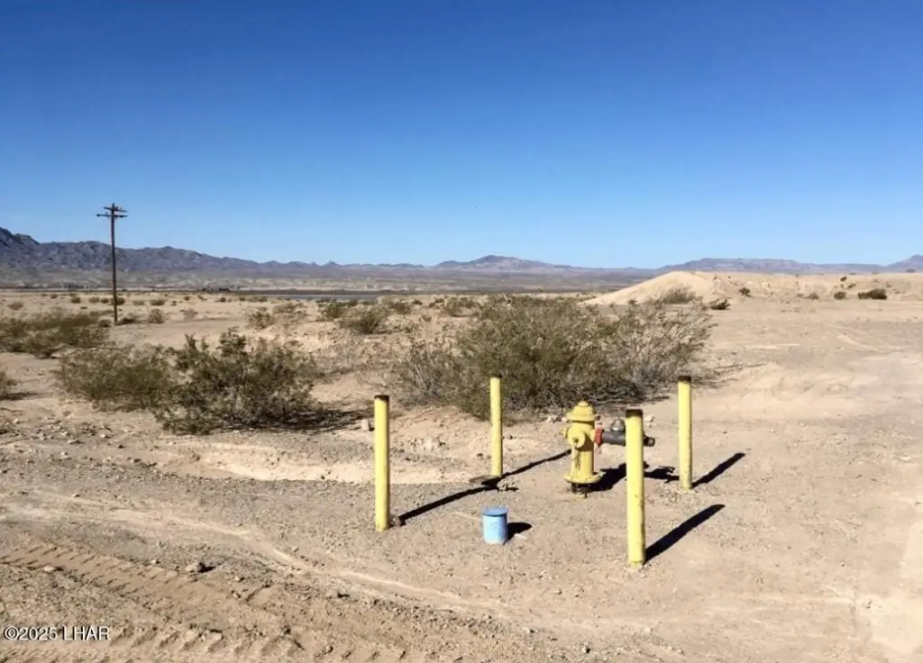
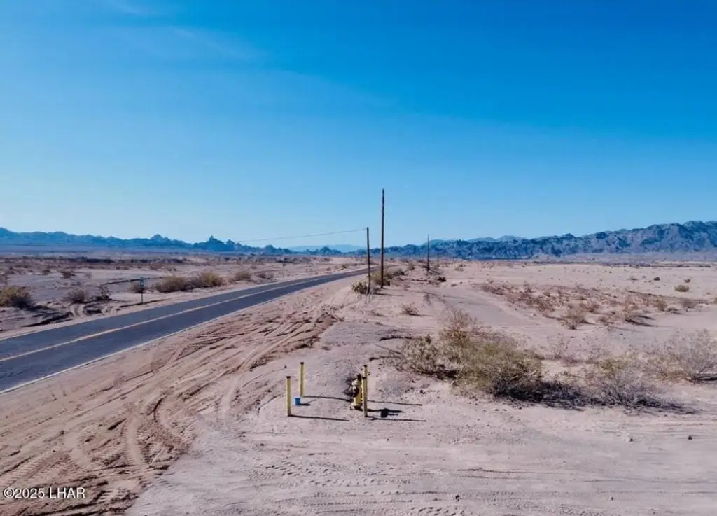
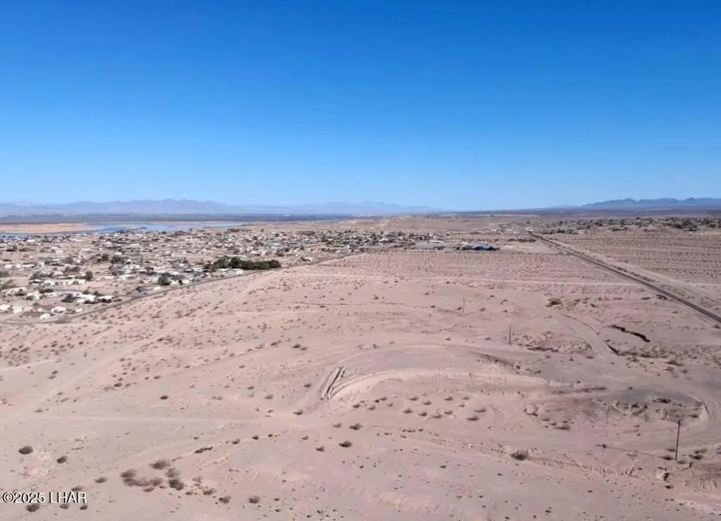
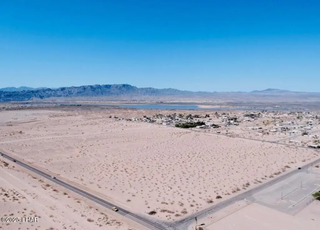
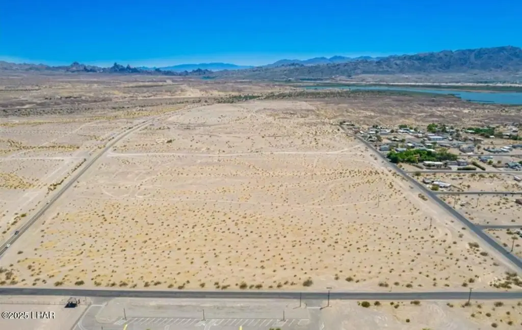
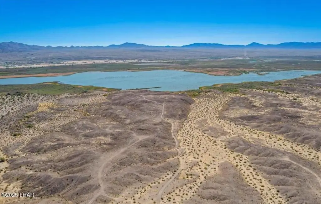
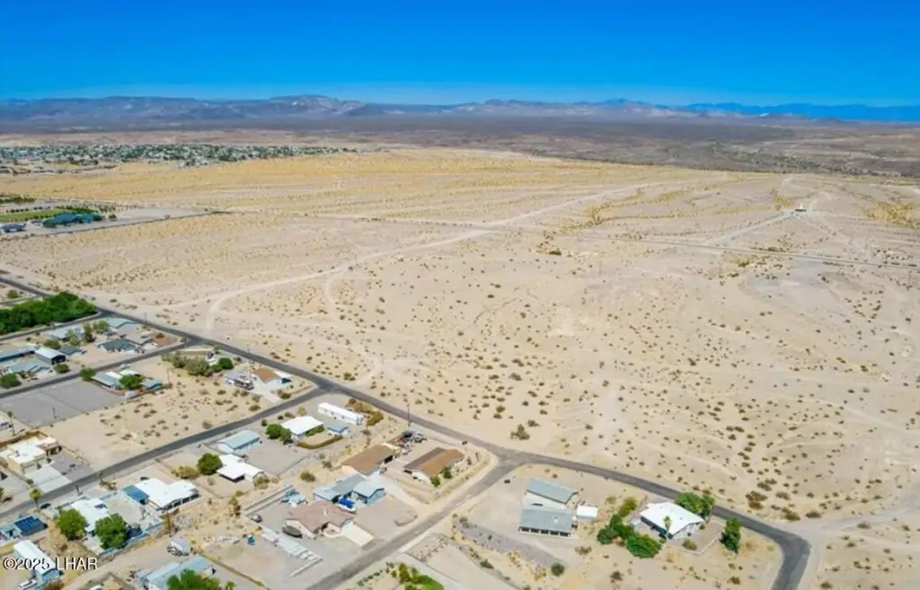
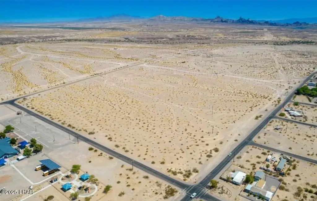
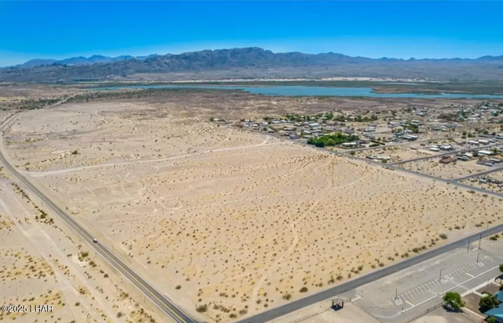
This 83.20-acre parcel is located directly on Historic Route 66 in Topock, Arizona, overlooking the Colorado River and Havasu National Wildlife Refuge. The property is situated in a federal Opportunity Zone, offering investment potential for housing, an RV resort, campground, storage, retail, or mixed-use development. Zoned A-R (Agricultural Residential) under the Mohave County General Plan with Urban Development and Light Industrial designations, it features nearly half a mile of frontage along Route 66 with paved access on two sides. Utilities are available on site, including power, high-speed internet, natural gas, and water service. Golden Shores Water Company has issued a "will serve" letter, and the state previously approved a 100-year Colorado River water supply. The land is entirely outside the floodplain in FEMA Zone X and sits at approximately 600 feet elevation, offering unobstructed panoramic views. It is ideally situated near Golden Shores and Topock, minutes from Topock66 Marina & Restaurant, and centrally located between Lake Havasu City, Bullhead City, Laughlin, and Needles. With over 145,000 residents within a 35-mile radius, this parcel presents a large-scale development opportunity. Quick access to I-40, nearby schools, fire department, post office, and local businesses is available. Outdoor recreation surrounds the area with boating, fishing, off-roading, and wildlife exploration all within minutes. This property provides the land, location, and infrastructure to bring a residential community, destination RV resort, or mixed-use investment blending homes, storage, and retail to life.