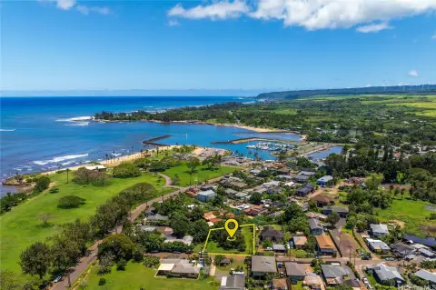
64-486 Kamehameha Highway, Haleiwa, HI 96712

- Added:
- Oct 20, 2025
- Days on Market:
- 236
- Last Refresh:
- Jun 12 at 10:06 am
Property Features for 64-486 Kamehameha Highway
General Information
- Property type
- Land
- Property subtype
- Other
- Standard status
- Active
- APN
- 1-6-4-001-014-0109
- Lot size
- 18.00 Acres

Listing agent Ralph S Gray License #RS-57803 (808) 295-0704
Listing office Hawaii Homes International 1920 Ala Moana Blvd. Suite 102, Honolulu, HI (808) 949-0020
Listing date Oct 20, 2025
Copyright © 2026 HiCentral MLS. All rights reserved. All information provided by the listing agent/broker is deemed reliable but is not guaranteed and should be independently verified.
HighLights
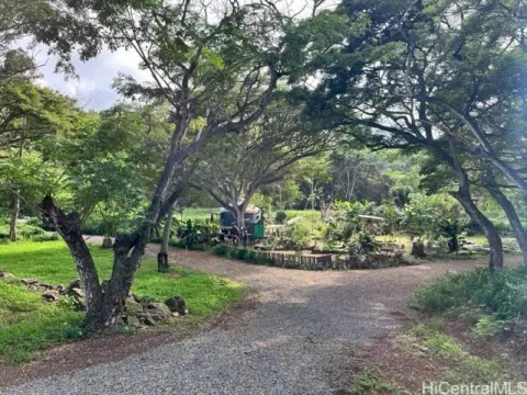
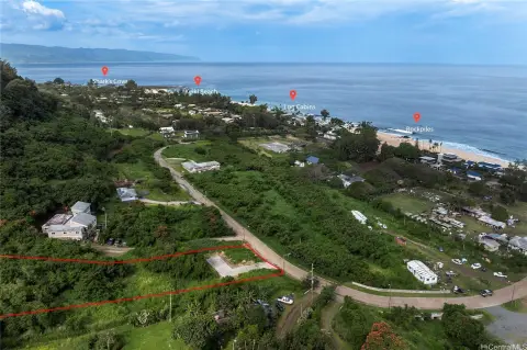
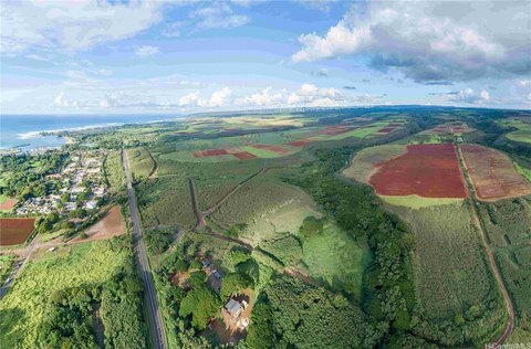
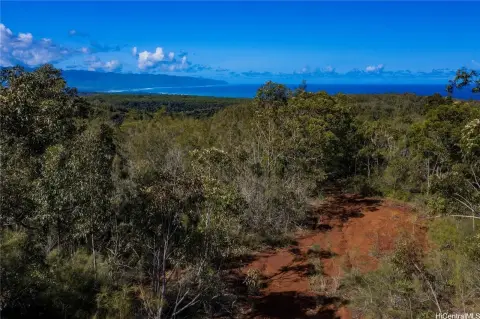
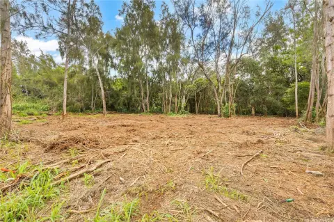
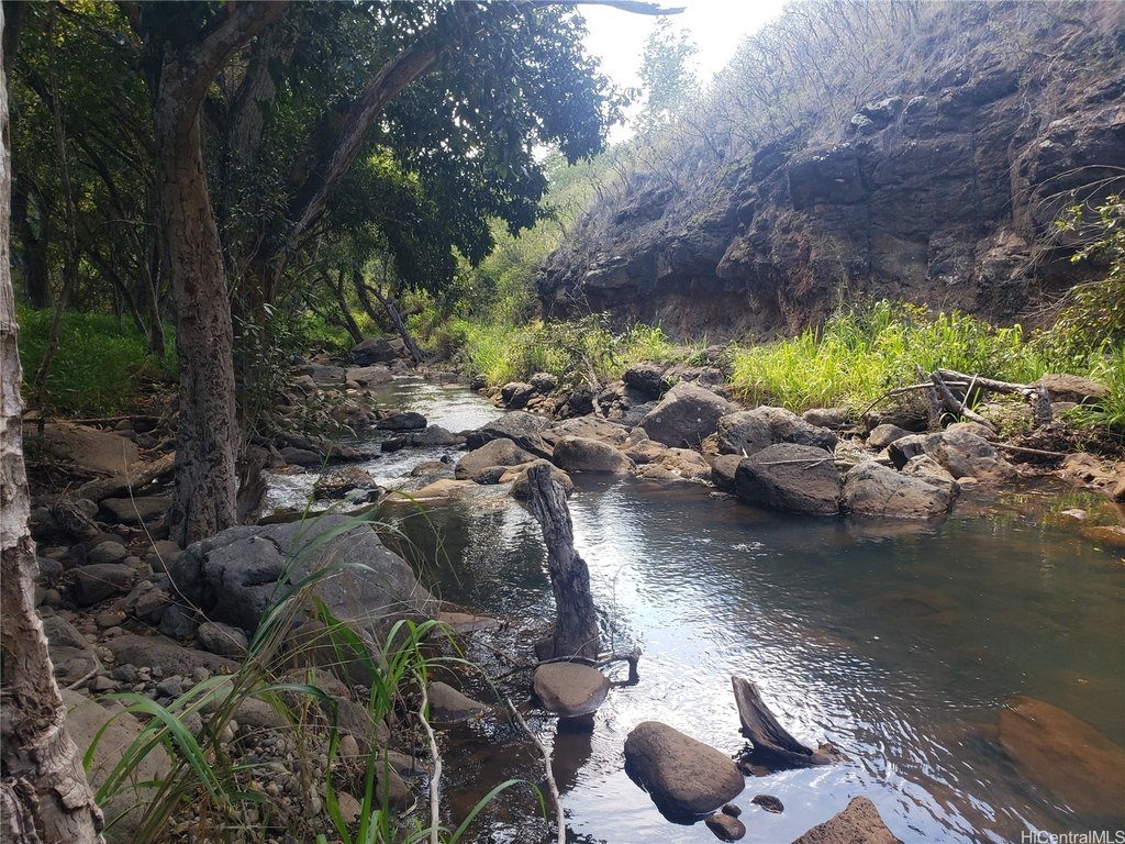
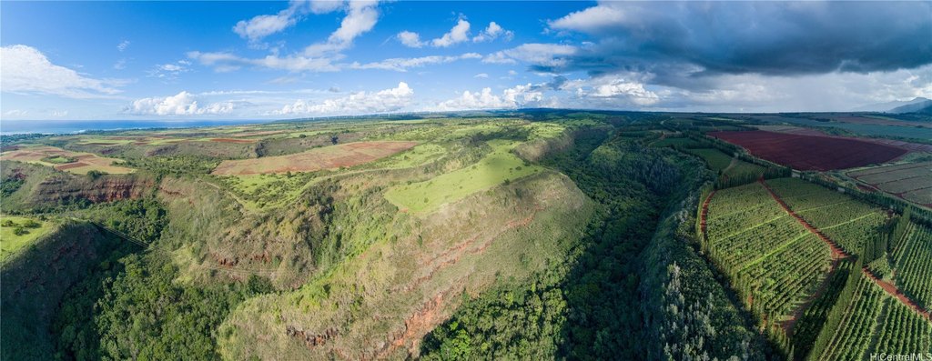
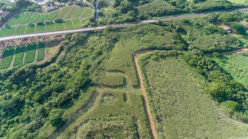
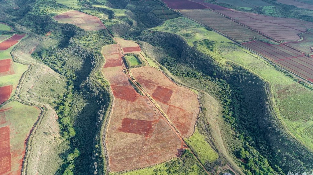
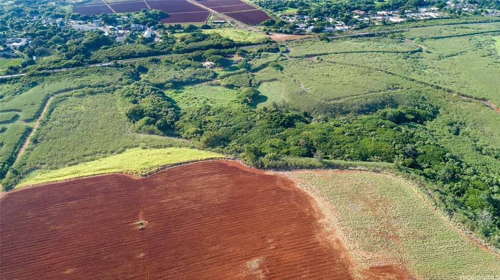
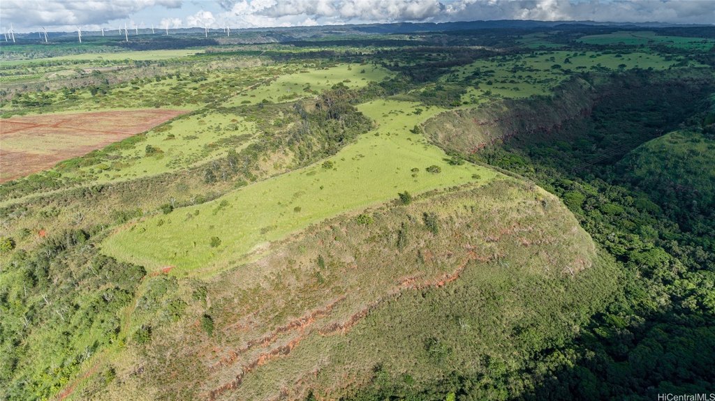
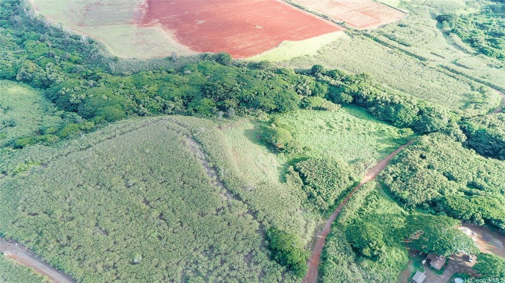
- Approximately 18 acres suitable for creating a farm, ranch, or agro‑tourism business within the Laukiha'a Farms Community.
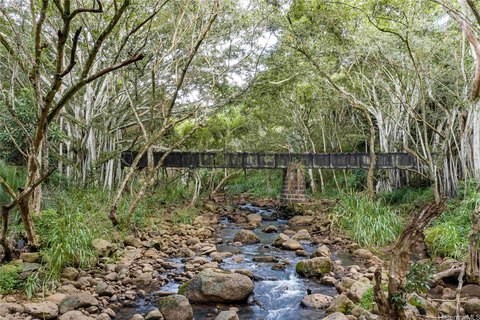
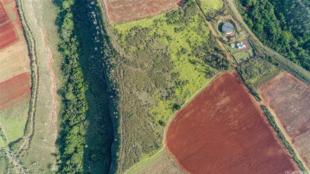
- Includes approximately 10 farmable acres with Opae'ula stream frontage, ideal for cacao and shade plants.
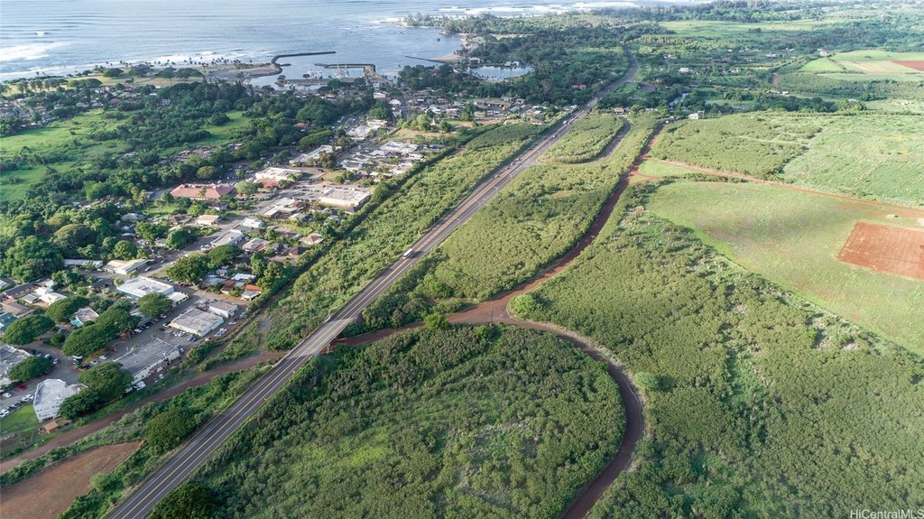
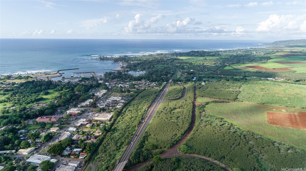
- Additional 2.5 acres of farmable land located next to the access road for easy access.
- Opportunity to obtain a special‑use permit for a walking tour showcasing a tropical farm.
- Allows for accessory agricultural structures necessary for an AG business.
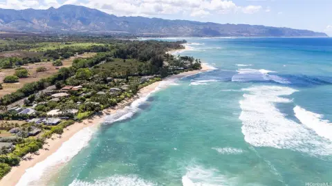
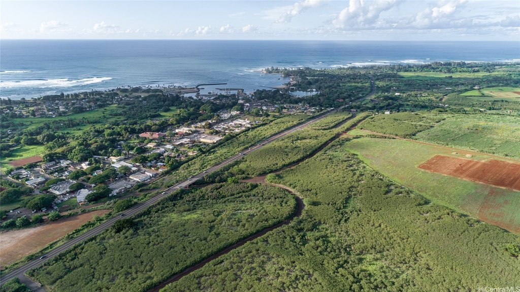
- Conveniently located near Haleiwa Town, North Shore Marketplace, beaches, and freeway access to Honolulu.
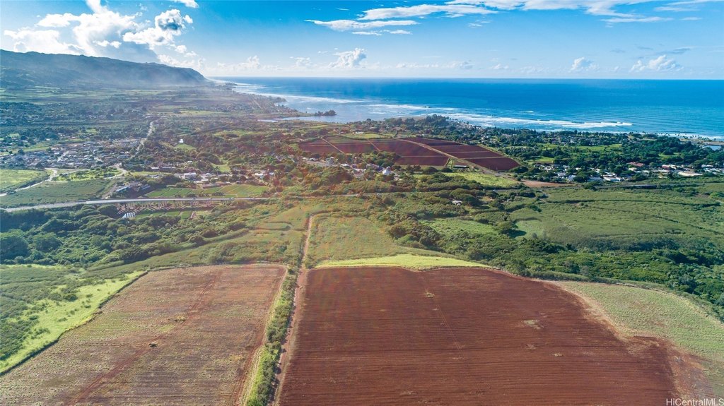
Overview
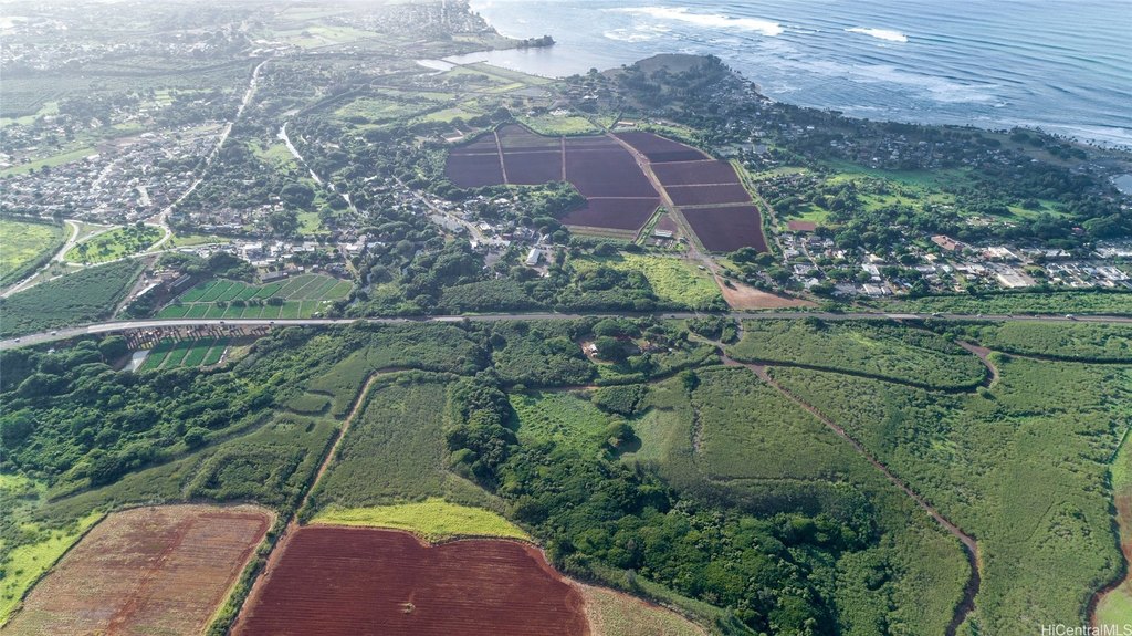
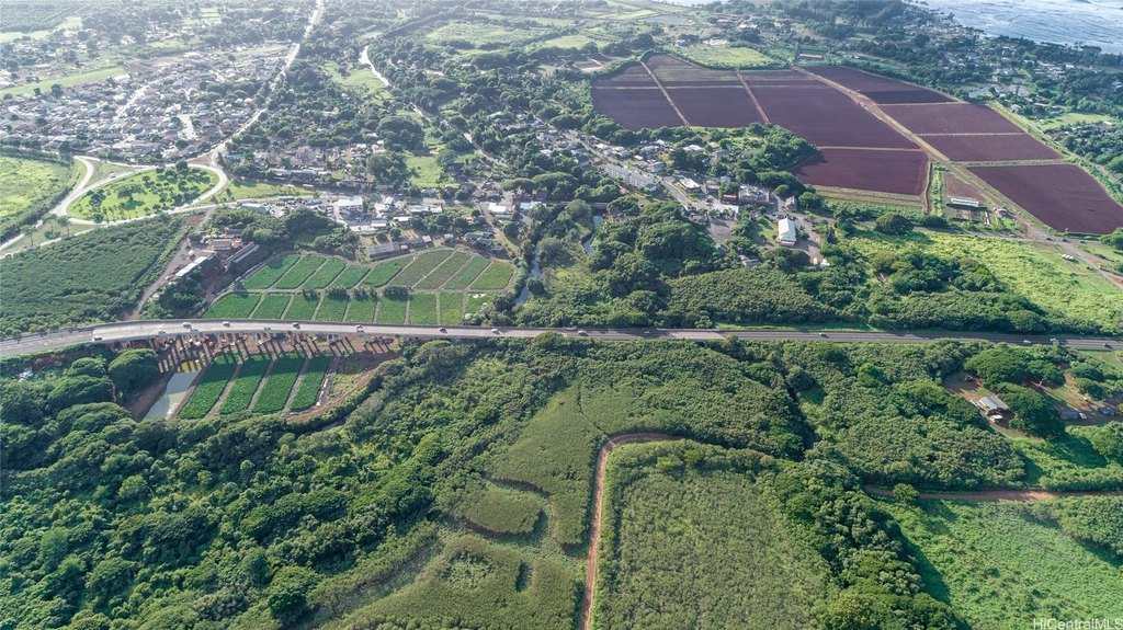
The site is located at 64-486 Kamehameha Highway in Haleiwa, on the hillside of cultural Haleiwa Town near the North Shore Marketplace. The upland area is described as being adjacent to the access road for easier reach, while the lower valley portion sits along the stream. The property is positioned within the Laukiha'a Farms Community, an agricultural community intended to foster agriculture and eco-friendly uses.
For an owner-operator, this configuration may support a working farm or a shade-plant focused concept given the stated stream environment. It also may align with special-use permitting for a walking tour experience that showcases the tropical farm and plants along the stream in the valley. With no dwellings permitted, the focus is on agricultural operations and accessory structures rather than residential use.
Current Use by Public Records
Map
- City
- Haleiwa
- County
- Honolulu
- State
- Hawaii
- Longitude
- -158.080159
- Latitude
- 21.570531