5700 Block Pine Forest Rd Walnut Hill, FL 32568

- Added:
- Sep 27, 2024
- Days on Market:
- 554
- Last Refresh:
- Apr 3 at 7:06 pm
Property Features for 5700 Block Pine Forest Rd
General Information
- Property type
- Land
- Property subtype
- Other
- Standard status
- Active
- APN
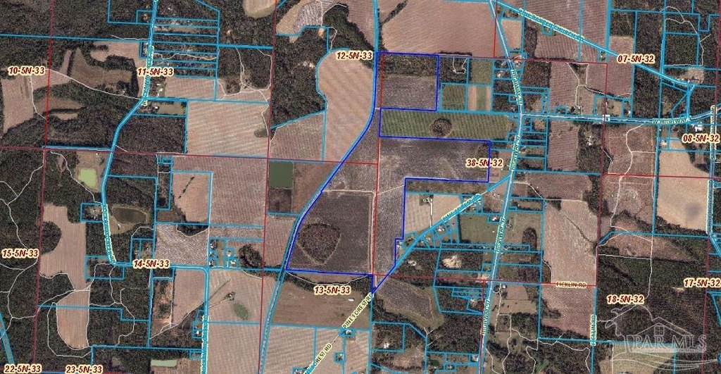
- 385N333301000000
- Lot size
- 248.00 Acres
Taxes and HOA fees
- Tax Description
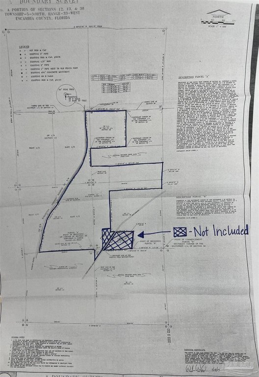
- BEGINNING AT THE SOUTHWEST CORNER OF SECTION 38, TOWNSHIP 5 NORTH, RANGE 33 WEST, ESCAMBIA COUNTY, FLORIDA; THENCE SOUTH 89 DEGREES 52 MINUTES 46 SECONDS WEST ALONG THE SOUTH LINE OF THE NORTHWEST 1/4 OF SECTION 13, TOWNSHIP 5 NORTH, RANGE 33 WEST A DISTANCE OF 2117.40 FEET TO THE EASTERLY R/W LINE OF BURLINGTON NORTHERN RAILROAD (R/ W VARIES); THENCE GO ALONG SAID EASTERLY R/W LINE THE FOLLOWING 7 COURSES: NORTH 14 DEGREES 00 MINUTES 09 SECONDS EAST A DISTANCE OF 881.76 FEET TO THE POINT OF CURVATURE OF A CURVE; THENCE ALONG SAID CURVE, TURNING TO THE RIGHT WITH AN ARC LENGTH OF 634.32 FEET, WITH A RADIUS OF 1628.62 FEET, WITH A CHORD BEARING OF NORTH 23 DEGREES 25 MINUTES 21 SECONDS EAST, WITH A CHORD LENGTH OF 630.32 FEET TO THE POINT OF TANGENCY; THENCE GO NORTH 34 DEGREES 05 MINUTES 26 SECONDS EAST A DISTANCE OF 572.31 FEET; THENCE GO NORTH 00 DEGREES 15 MINUTES 59 SECONDS WEST A DISTANCE OF 44.30 FEET; THENCE GO NORTH 34 DEGREES 05 MINUTES 26 SECONDS EAST A DISTANCE OF 1633.18 FEET TO THE POINT OF CURVATURE OF A CURVE; THENCE ALONG SAID CURVE, TURNING TO THE LEFT WITH AN ARC LENGTH OF 940.42 FEET, WITH A RADIUS OF 1456.57 FEET, WITH A CHORD BEARING OF NORTH 15 DEGREES 37 MINUTES 49 SECONDS EAST, WITH A CHORD LENGTH OF 924.17 FEET TO THE POINT OF TANGENCY; THENCE GO NORTH 00 DEGREES 05 MINUTES 40 SECONDS EAST A DISTANCE OF 1110.44 FEET TO THE NORTH LINE OF THE SOUTHWEST 1/4 OF SECTION 12, TOWNSHIP 5 NORTH, RANGE 33 WEST; THENCE GO SOUTH 89 DEGREES 54 MINUTES 30 SECONDS EAST ALONG SAID LINE A DISTANCE OF 151.17 FEET TO THE NORTHWEST CORNER OF SAID SECTION 38; THENCE GO SOUTH 89 DEGREES 44 MINUTES 28 SECONDS EAST, ALONG THE NORTH LINE OF SECTION 38 A DISTANCE OF 1323.97 FEET TO THE NORTHEAST CORNER OF THE NORTHWEST 1/4 OF THE NORTHWEST 1/4 OF SECTION 38; THENCE GO SOUTH 00 DEGREES 05 MINUTES 11 SECONDS WEST A DISTANCE OF 1332.48 FEET TO THE SOUTHEAST CORNER OF THE NORTHWEST 1/4 OF THE NORTHWEST 1/4 OF SECTION 38; THENCE GO SOUTH 89 DEGREES 36 MINUTES 34 SECONDS WEST A DISTANCE OF 1320.16 FEET TO THE SOUTHWEST CORNER OF THE NORTHWEST 1/4 OF THE NORTHWEST 1/4 OF SECTION 38; THENCE GO SOUTH 00 DEGREES 40 MINUTES 04 SECONDS EAST A DISTANCE OF 662.47 FEET; THENCE GO NORTH 89 DEGREES 36 MINUTES 49 SECONDS EAST A DISTANCE OF 2674.80 FEET TO THE RANGE LINE OF RANGE 33 WEST AND RANGE 32 WEST; THENCE GO SOUTH 03 DEGREES 51 MINUTES 02 SECONDS WEST ALONG SAID RANGE LINE A DISTANCE OF 655.39 FEET; THENCE GO SOUTH 00 DEGREES 25 MINUTES 27 SECONDS EAST A DISTANCE OF 331.21 FEET; THENCE GO SOUTH 89 DEGREES 47 MINUTES 24 SECONDS WEST A DISTANCE OF 1981.09 FEET; THENCE GO SOUTH 00 DEGREES 46 MINUTES 51 SECONDS EAST A DISTANCE OF 1654.05 FEET; THENCE GO NORTH 88 DEGREES 15 MINUTES 14 SECONDS EAST A DISTANCE OF 163.69 FEET; THENCE GO SOUTH 36 DEGREES 54 MINUTES 26 SECONDS WEST A DISTANCE OF 1383.36 FEET TO THE WEST LINE OF THE SOUTHEAST 1/4 OF SECTION 13; THENCE GO NORTH 00 DEGREES 18 MINUTES 27 SECONDS WEST ALONG SAID WEST LINE A DISTANCE OF 438.78 FEET TO THE NORTHWEST CORNER OF SAID SOUTHEAST 1/4 OF SECTION 13, ALSO BEING THE SOUTHWEST CORNER OF SECTION 38 AND THE POINT OF BEGINNING OR 7704 P 100/103/106 OR 7771 P 923/925/927 LESS S 25 FT OFSW 1/4 OF NW 1/4 LYING E OF RR R/W SEC 13 LESS OR 7675 P 396/399/402 SCHNEIDER LESS OR 7819 P 1418 WARD BRETT SEC 12/13/38 T 5N R 33
Utilities
- Water source
- Public
- Water front features
- Waterfront

Listing agent Patty Helton Davis License #BK3087423 (251) 294-2060
Listing office PHD Real Estate, LLC 1812 S Main Street, Atmore, FL (251) 368-1063
Listing date Sep 27, 2024
MLS# 653038
Listing URL
Copyright © 2026 Pensacola Association of REALTORS. All rights reserved. All information provided by the listing agent/broker is deemed reliable but is not guaranteed and should be independently verified.
Overview
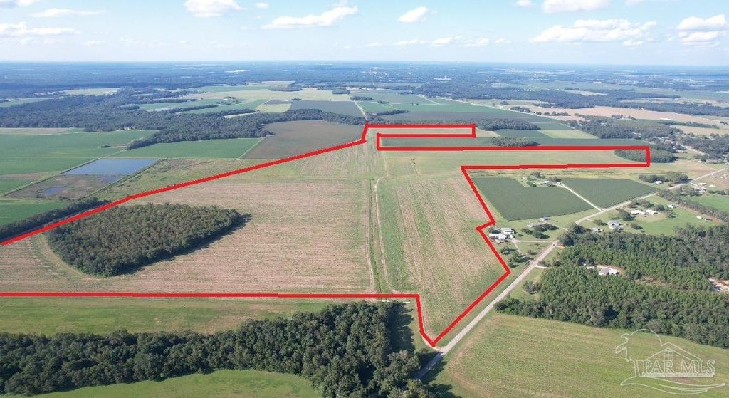
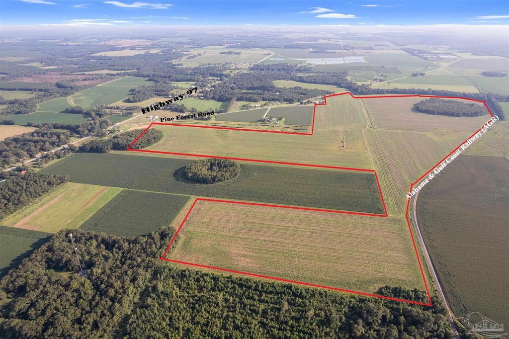
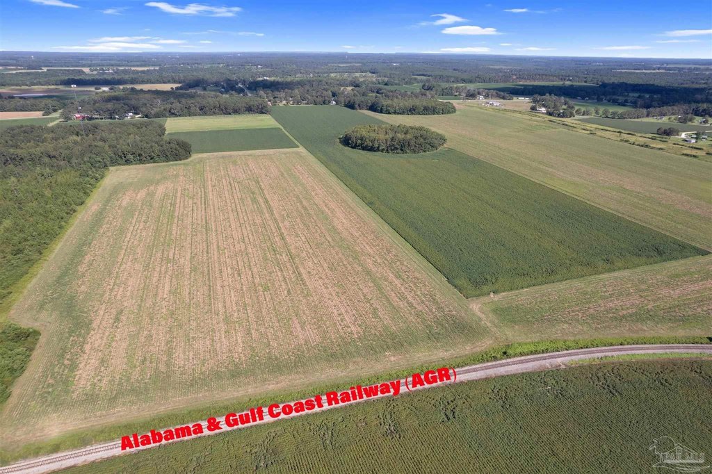
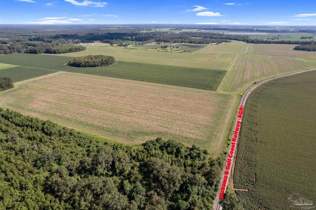
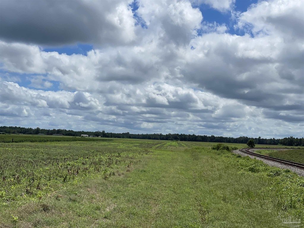
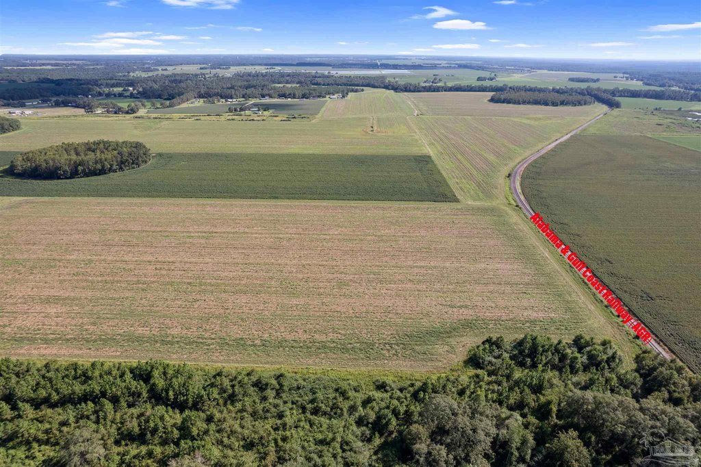
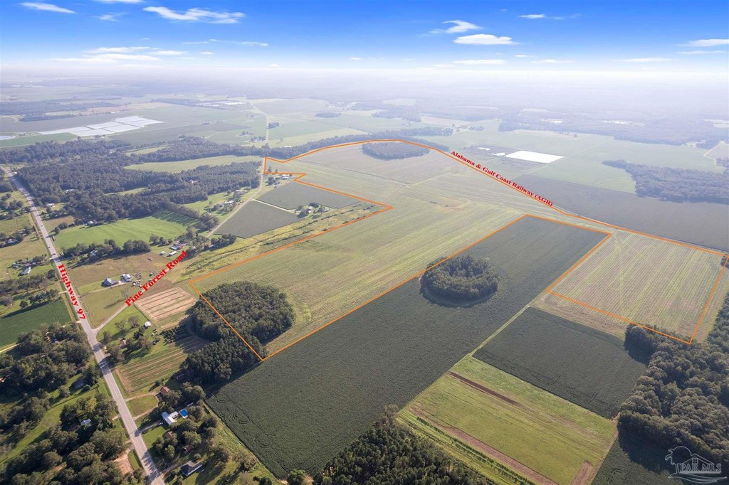
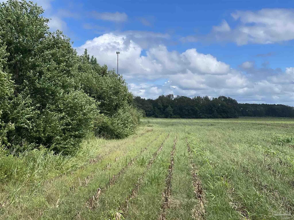
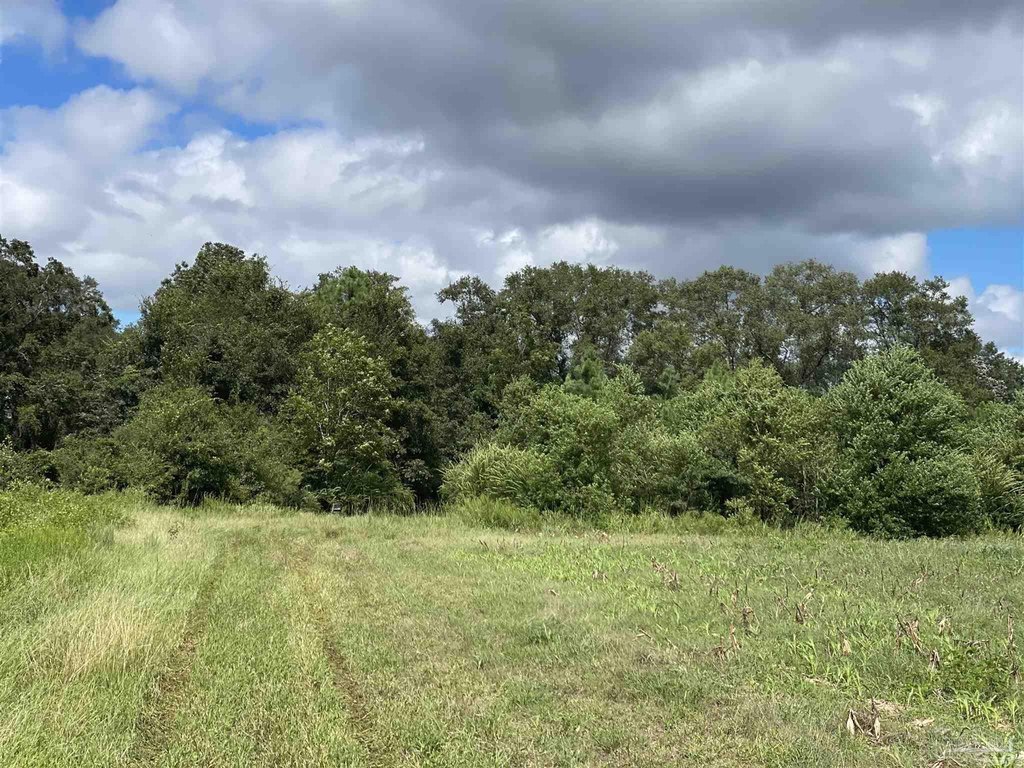
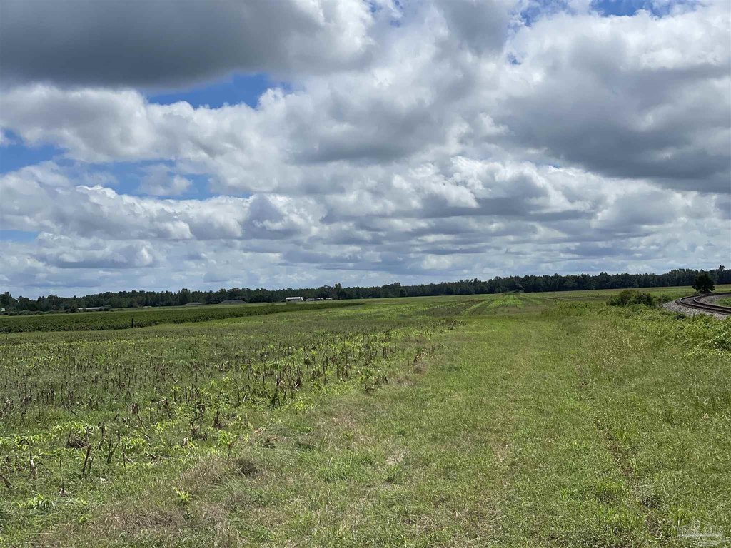
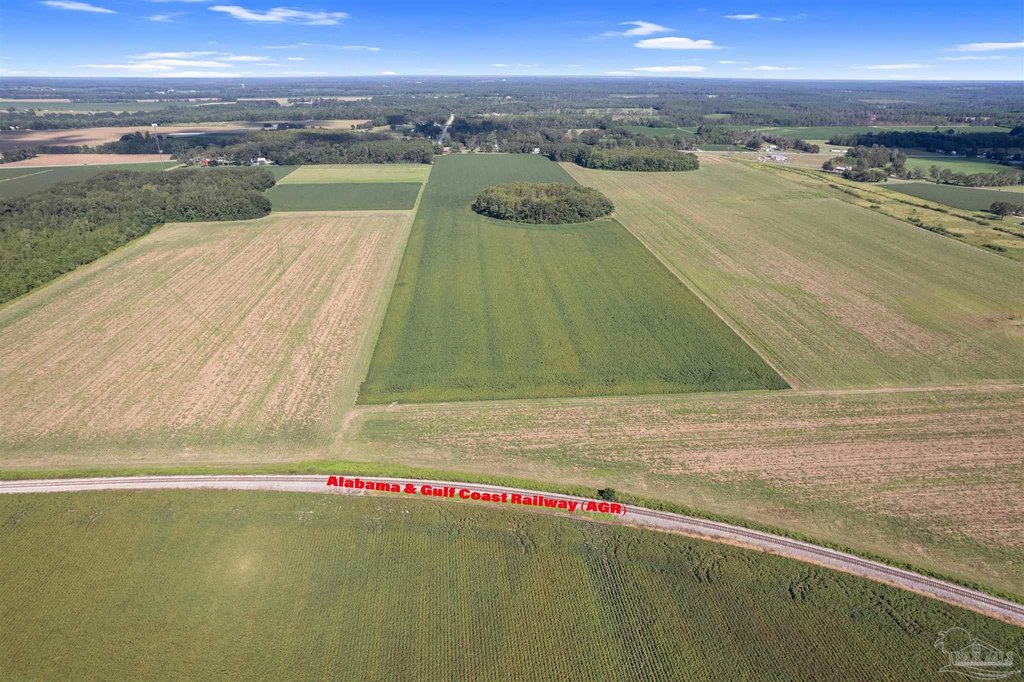
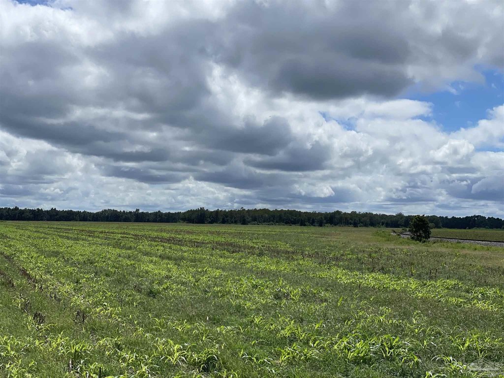
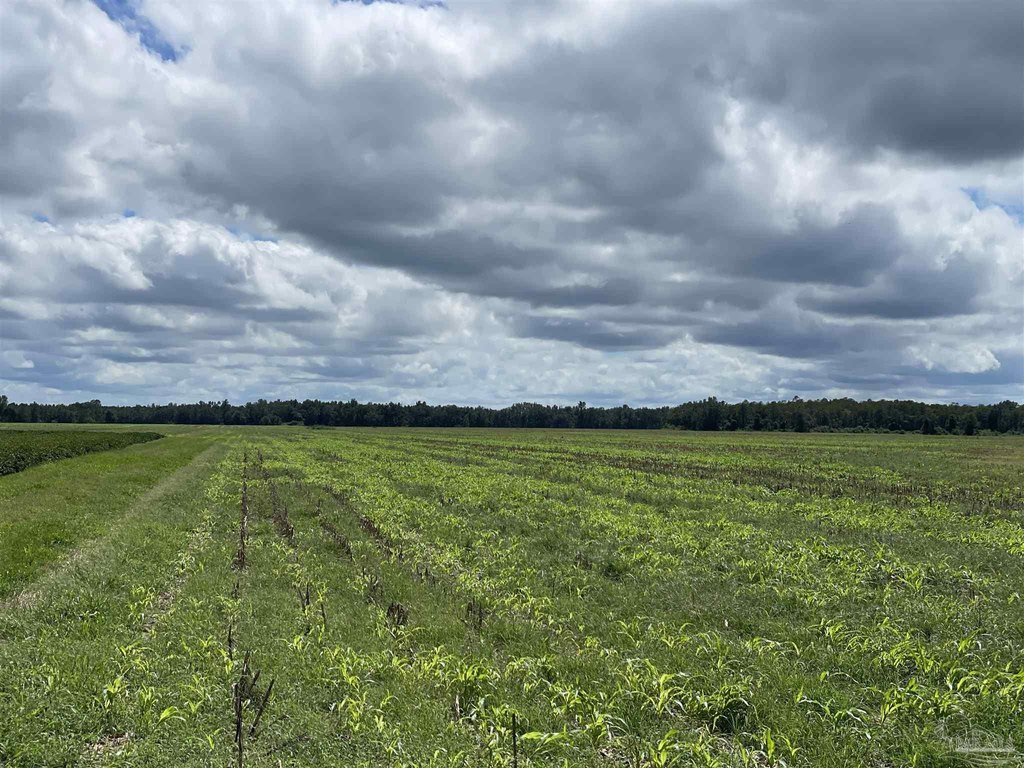
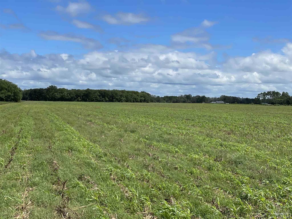
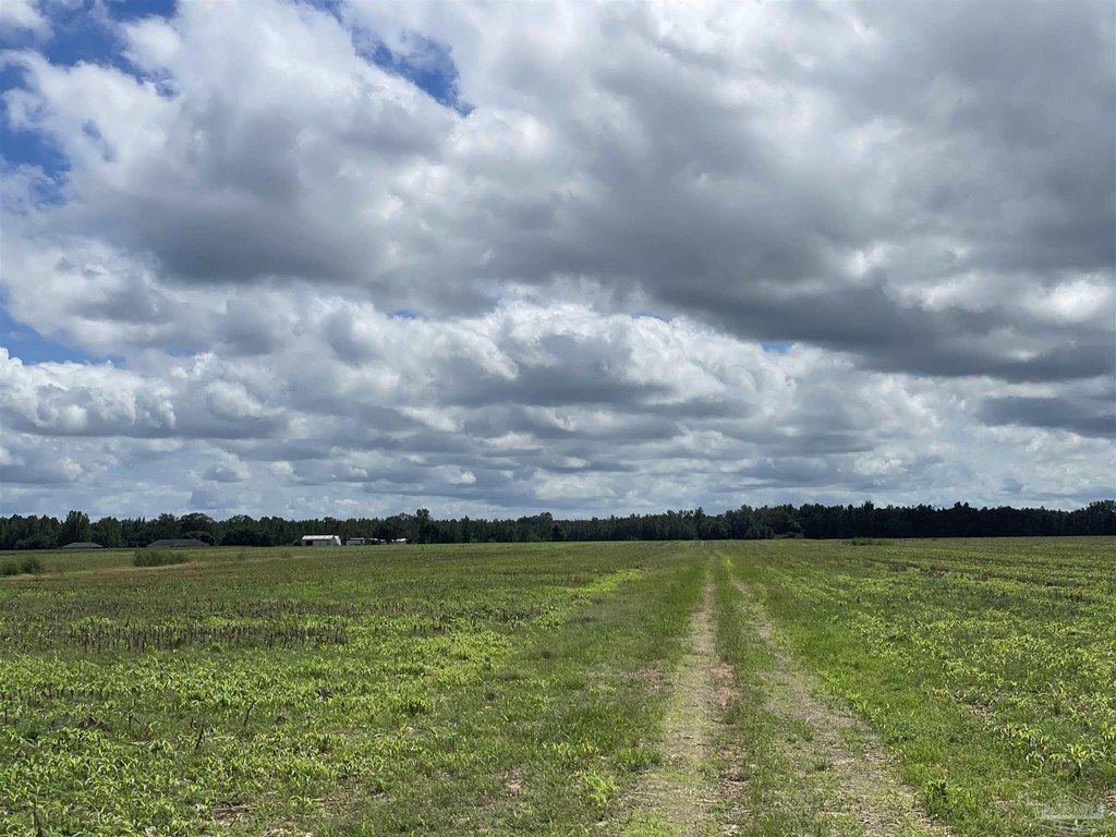
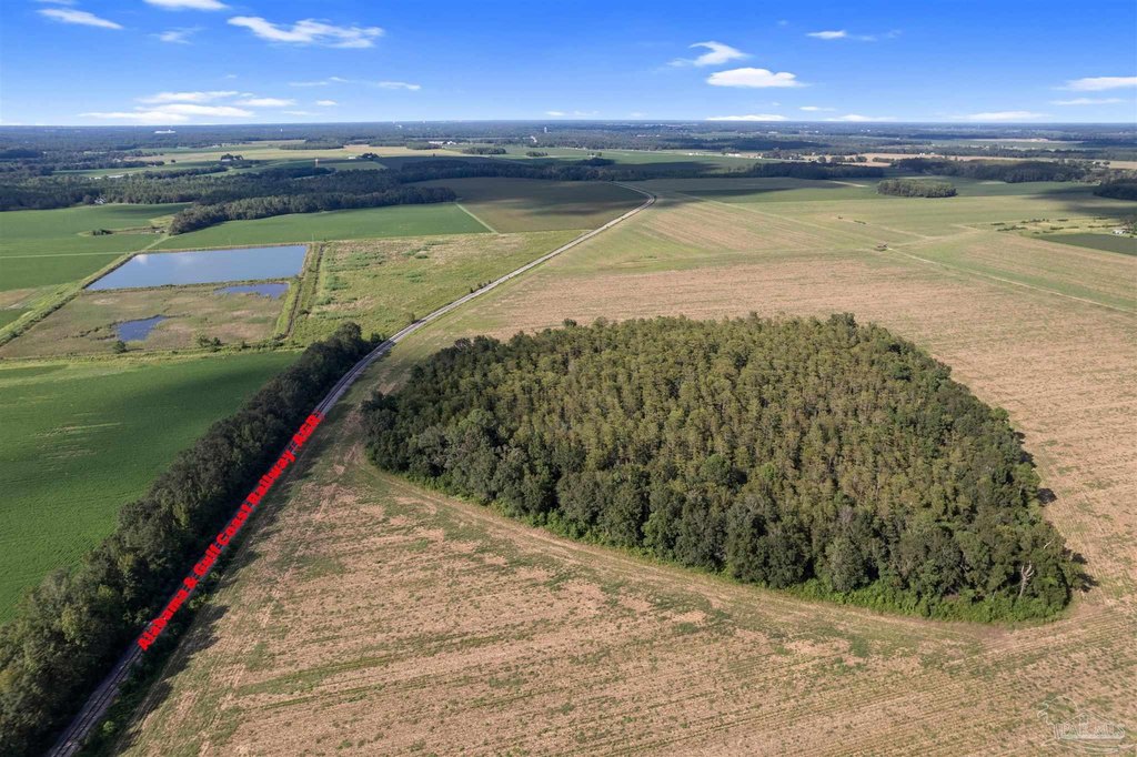
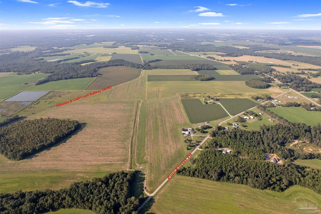
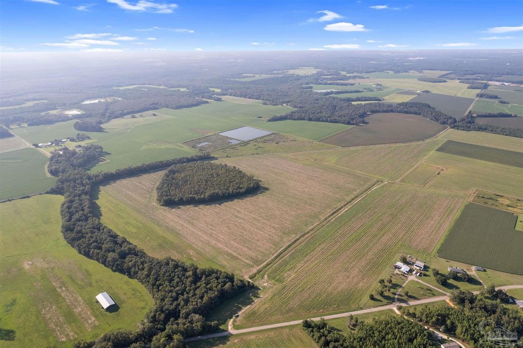
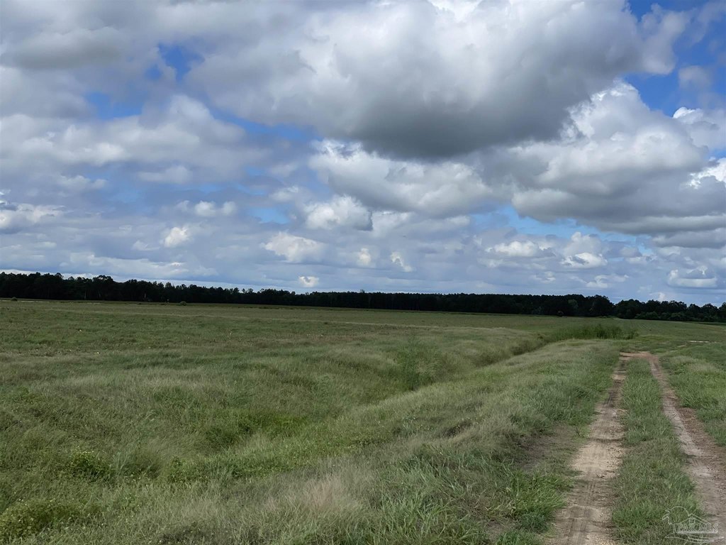
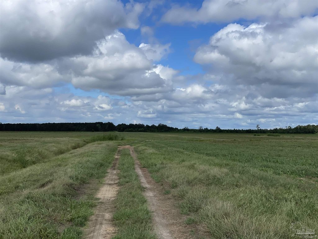
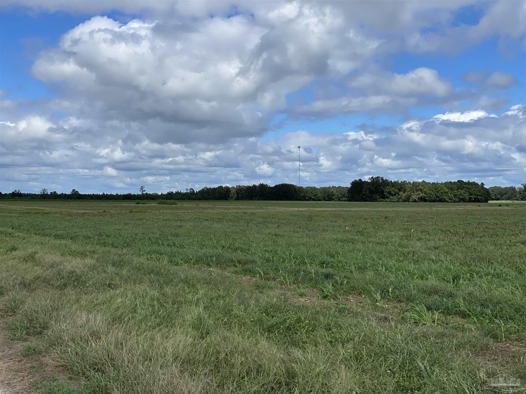
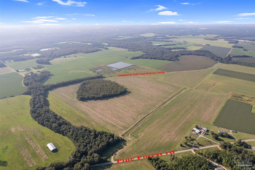
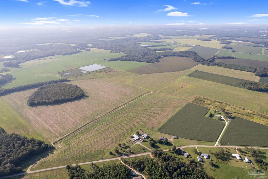
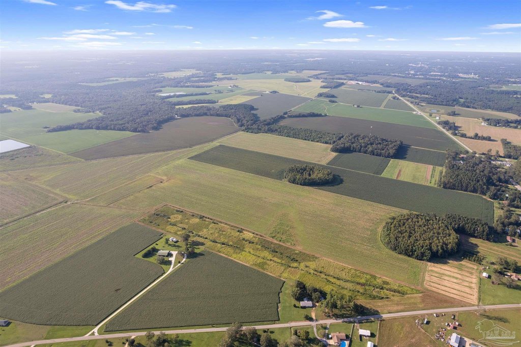
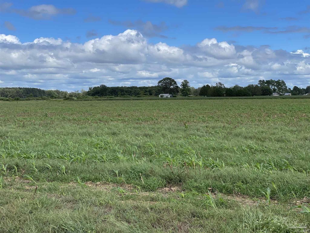
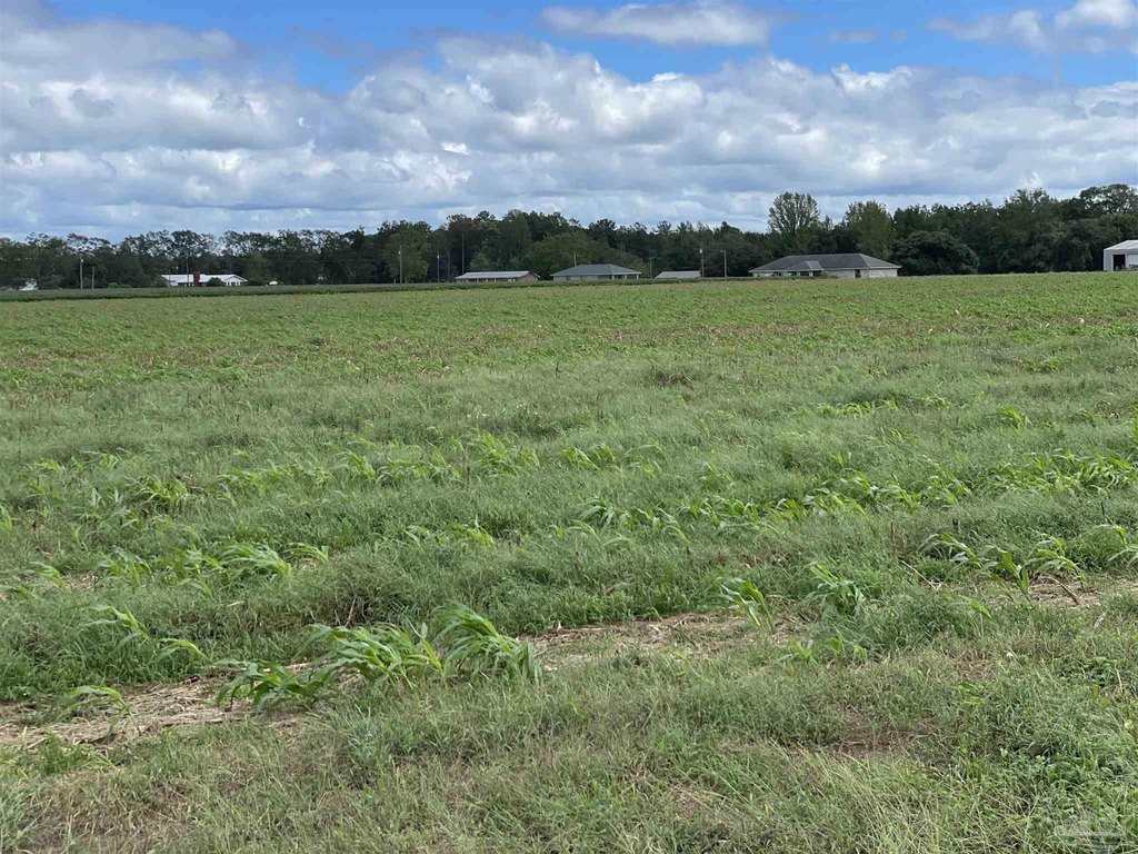
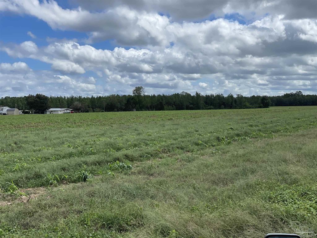
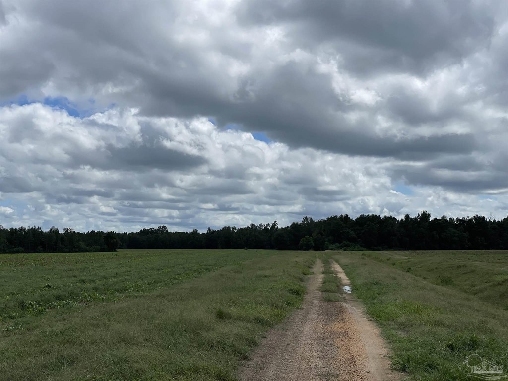
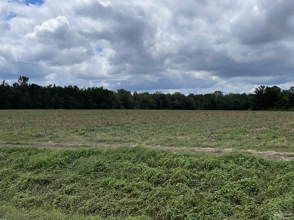
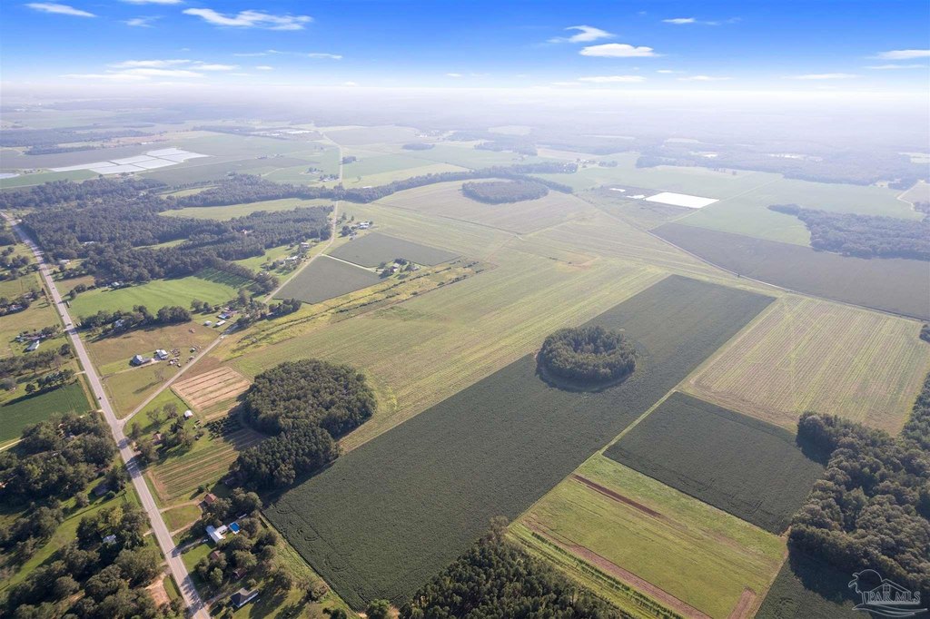
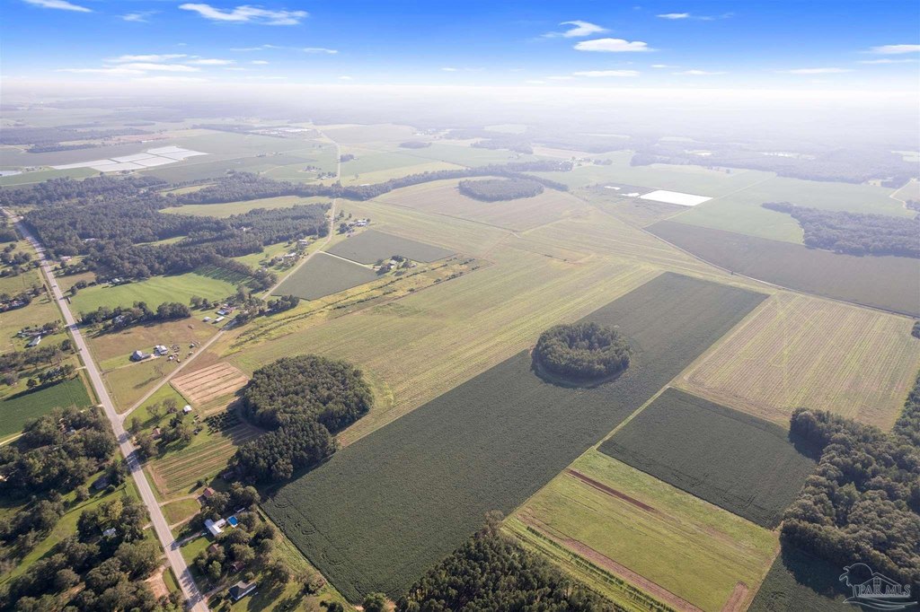
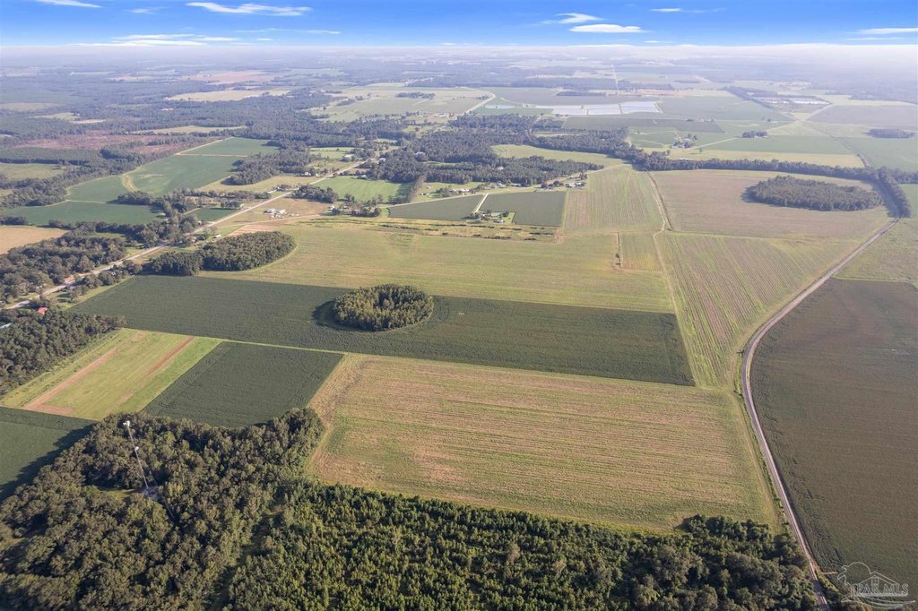
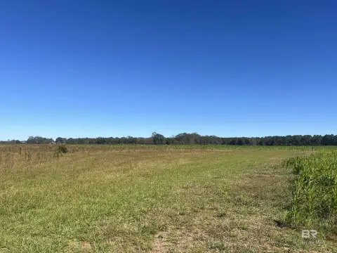
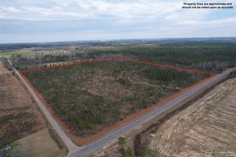
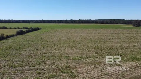
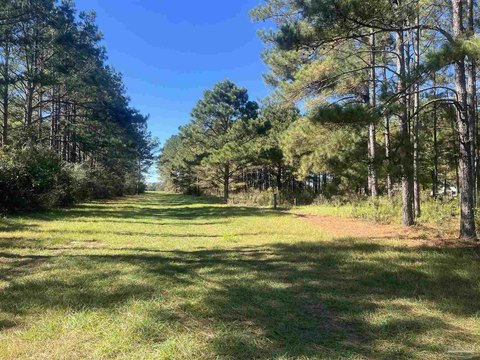
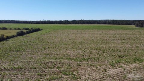
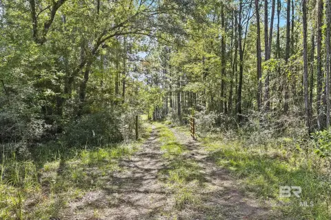
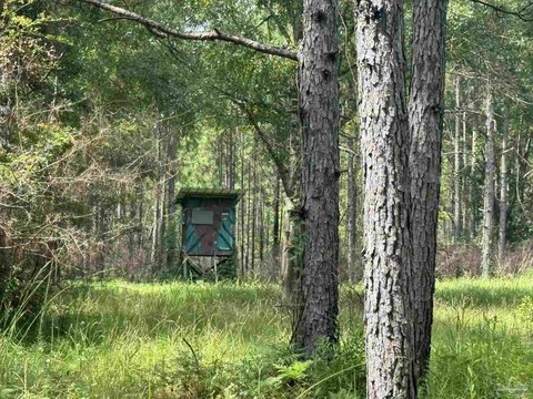
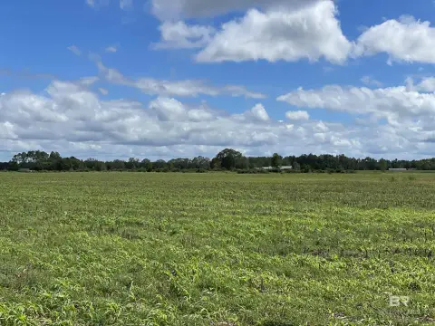
248 Acres with Railroad Frontage
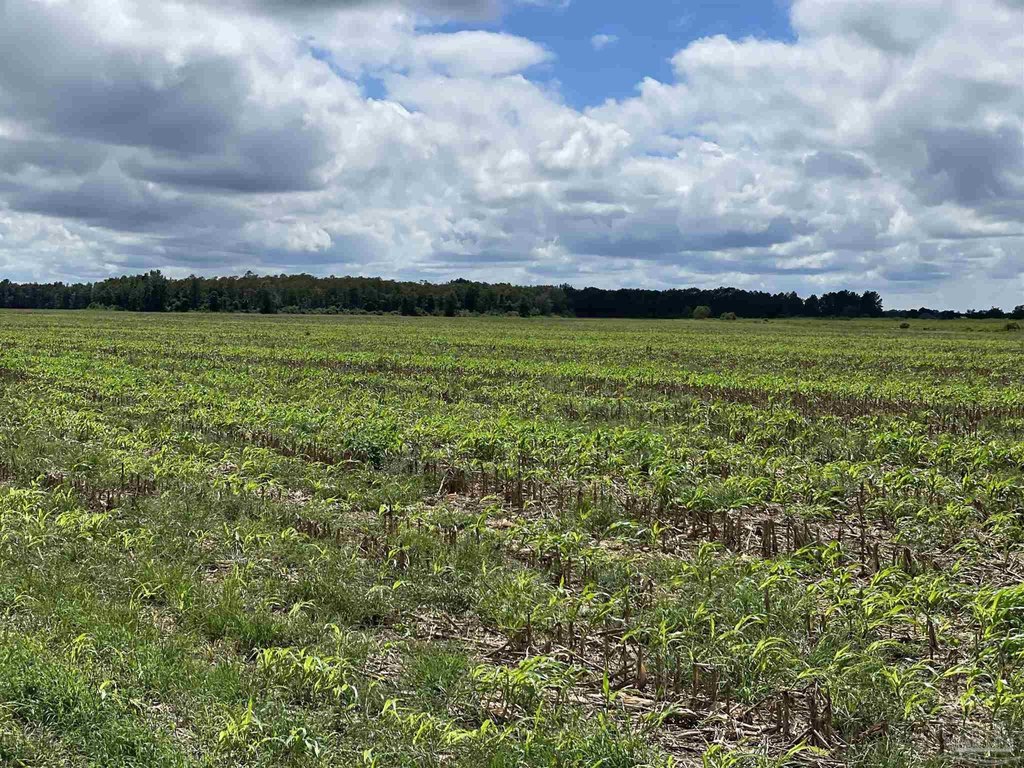
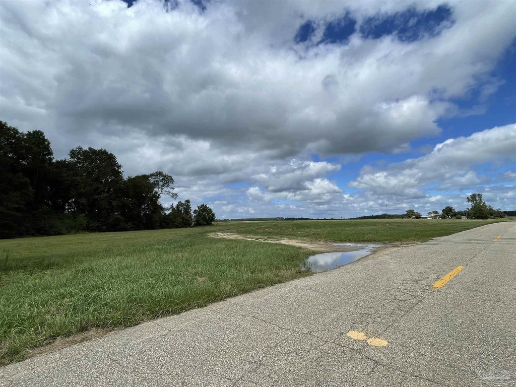
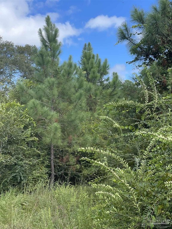
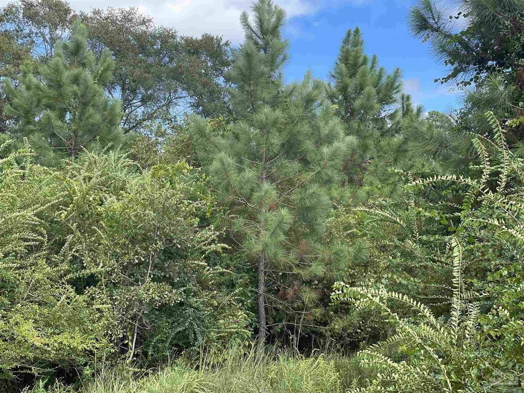
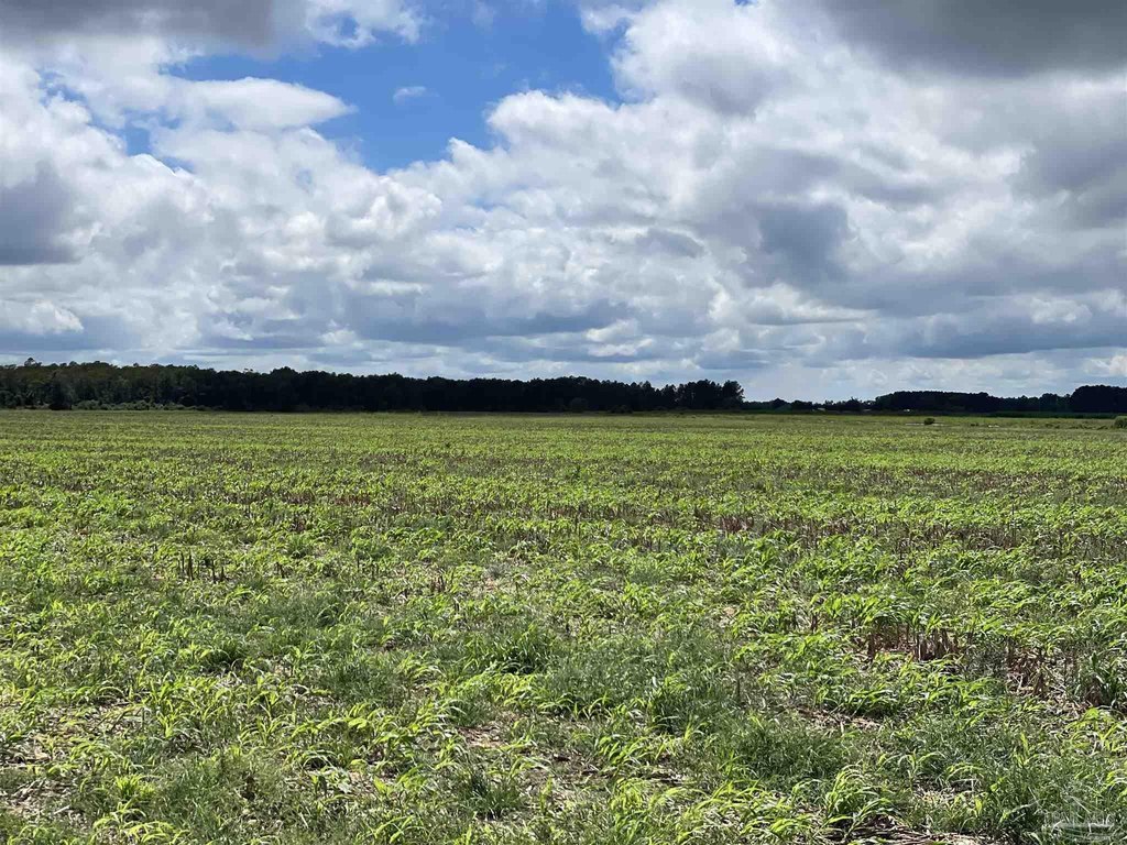
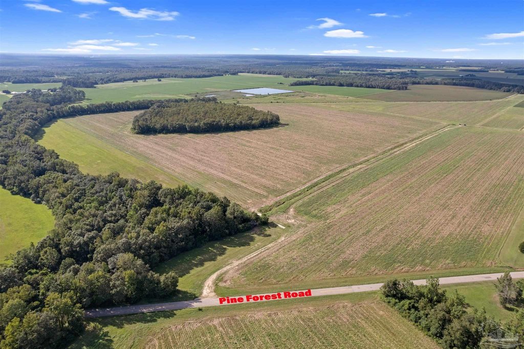
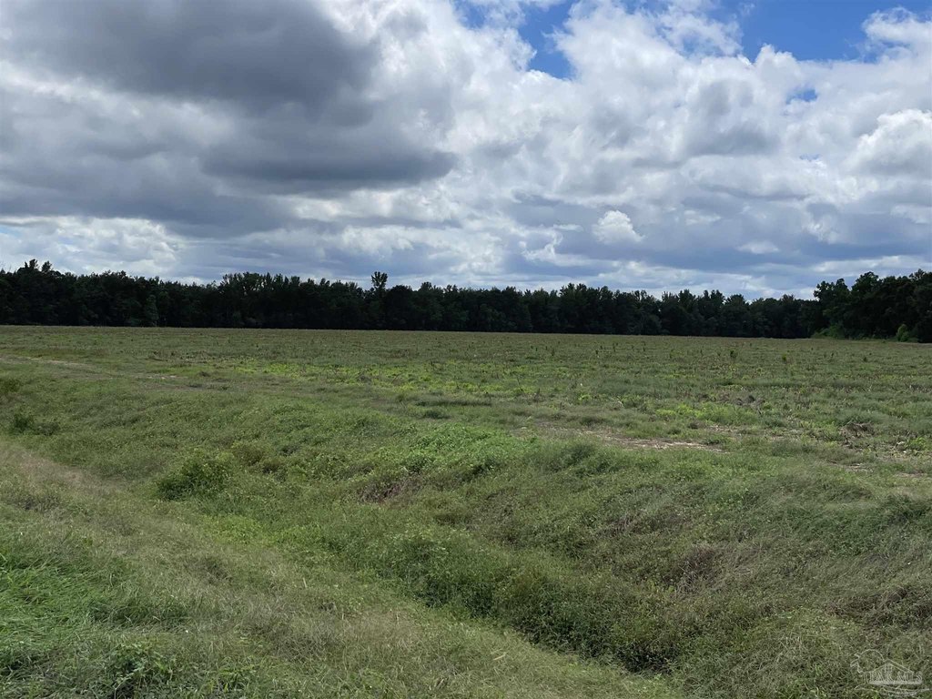
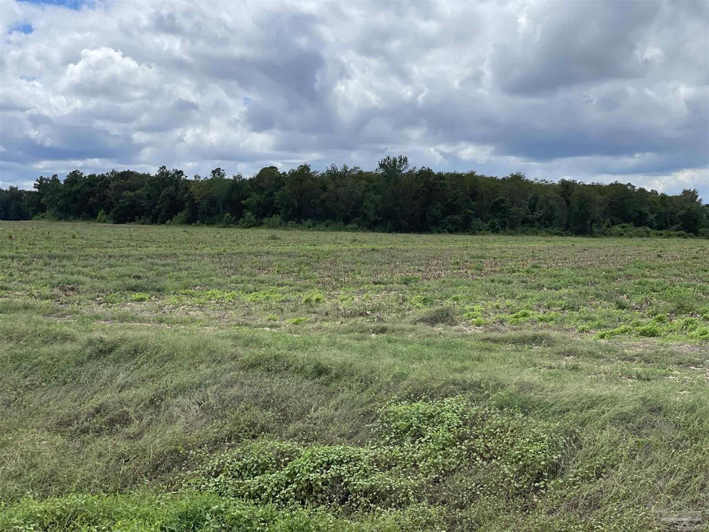
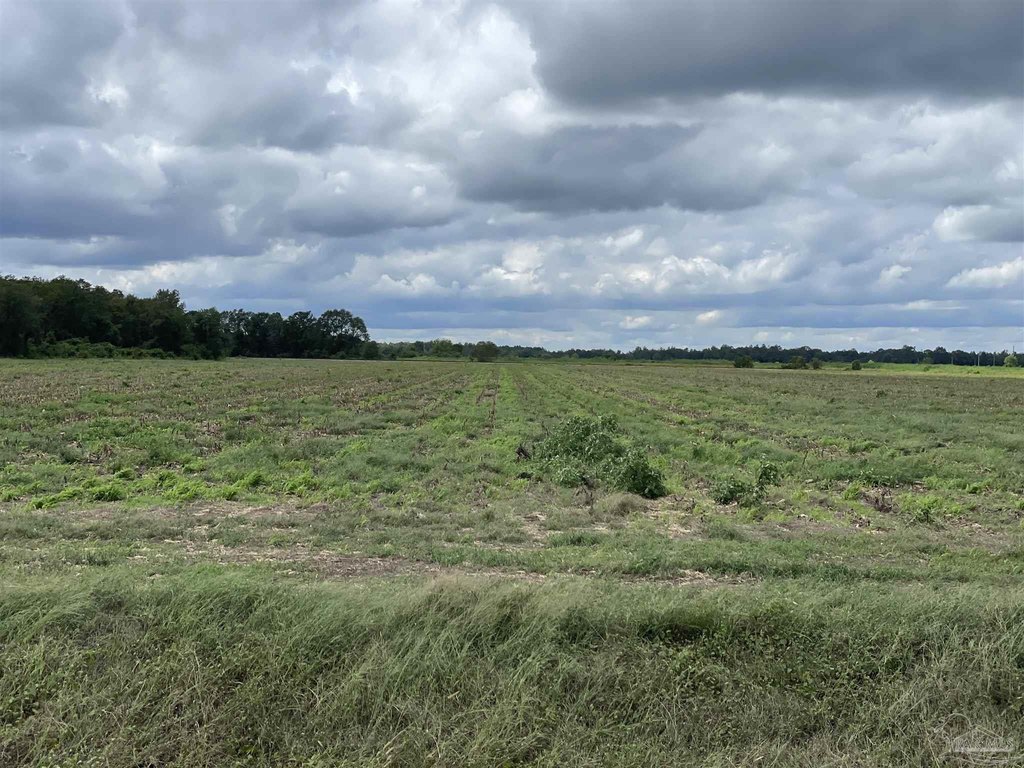
Located in Walnut Hill, Florida, this 248+/- acre tract in the Davisville community features 6,000+/- feet of direct railroad frontage, power and water access, and convenient access to major highways and nearby cities. Zoned AGR, the property is suitable for row crops, livestock, development, or building a private homestead. The land features fertile, well-drained soil. The AGR zoning allows for agricultural and low-density residential use. The property is located just off State Road 97, 20 miles to I-65, and less than 15 minutes to U.S. Highway 29. It is also 10 minutes to Atmore, Alabama for shopping, dining, and business services, and under an hour to Pensacola, Perdido Key, and Orange Beach. This property is suitable for farming and agricultural operations, long-term investment, or development. Mineral rights do not convey.
Property Profile
Insight Report
Location Intelligence
Current Use by Public Records
Agricultural land / Farmland
Map
- City
- Walnut Hill
- County
- Escambia
- State
- Florida
- Longitude
- -87.4663
- Latitude
- 30.8697
Nearby Similar for Sale


FAQs
What type of property is this?
Agricultural land / Farmland - 248 acres in Walnut Hill, FL with railroad access.
Where is this agricultural land / farmland located?
The property is located at 5700 Block Pine Forest Rd Walnut Hill, FL.
What is the asking price?
The asking price for this property is $2,480,000.
What are key features of this property?
This property features: 248+/- acres of high‑quality agricultural land with AGR zoning, suitable for farming, livestock, development, or residential use.; **6,000+/- feet of direct railroad frontage, valuable for transport, shipping, or future development.**; Convenient location: easy access to State Road 97, I‑65, U.S. Highway 29, and nearby cities (Atmore, Pensacola).


