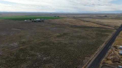
Eastern Oregon Land with Water
TL 400 Off Highway 78, Burns, OR 97720


- Added:
- May 22, 2024
- Days on Market:
- 742
- Last Refresh:
- Jun 2 at 6:06 am
Property Features for TL 400 Off Highway 78
General Information
- Property type
- Land
- Property subtype
- Other
- Parking features
- Garage
- Standard status
- Active
- Lot size
- 157.67 Acres
Taxes and HOA fees
- Tax Annual Amount
- 934
Building Details
- Architectural style
- Other
Listing agent Curt Blackburn (541) 413-5777
Listing office Jett Blackburn Real Estate Inc. 707 Ponderosa Village, Burns, OR (541) 413-5660
Listing date May 22, 2024
MLS# 11320515
Listing URL
Copyright © 2026 My State MLS. All rights reserved. All information provided by the listing agent/broker is deemed reliable but is not guaranteed and should be independently verified.
HighLights
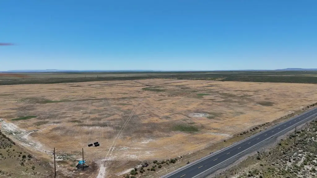
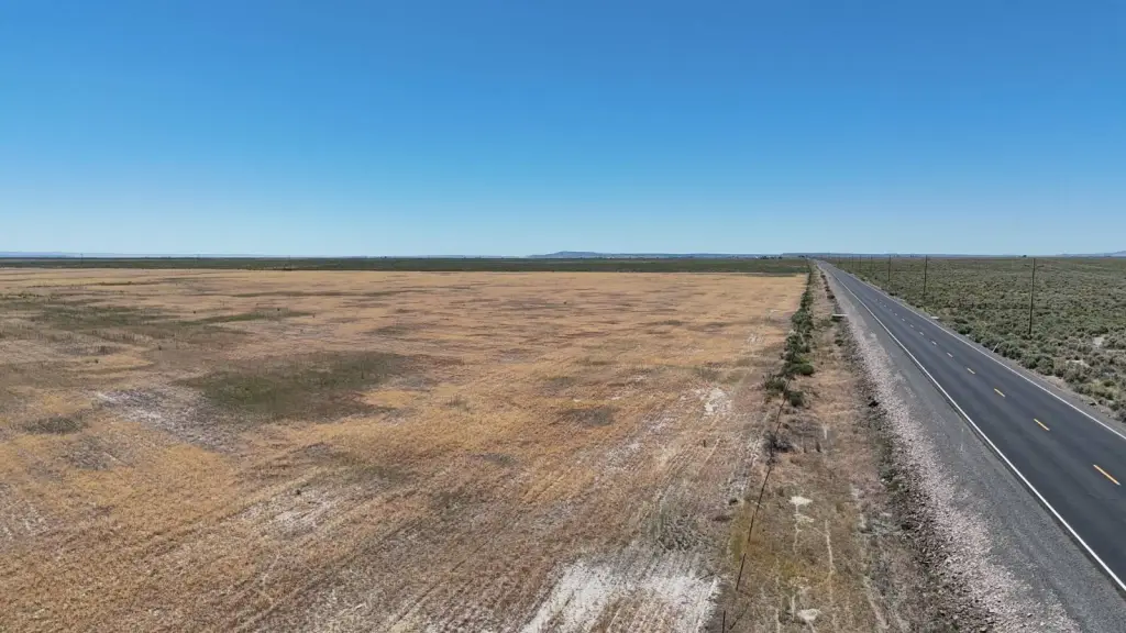
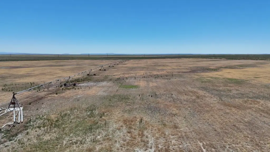
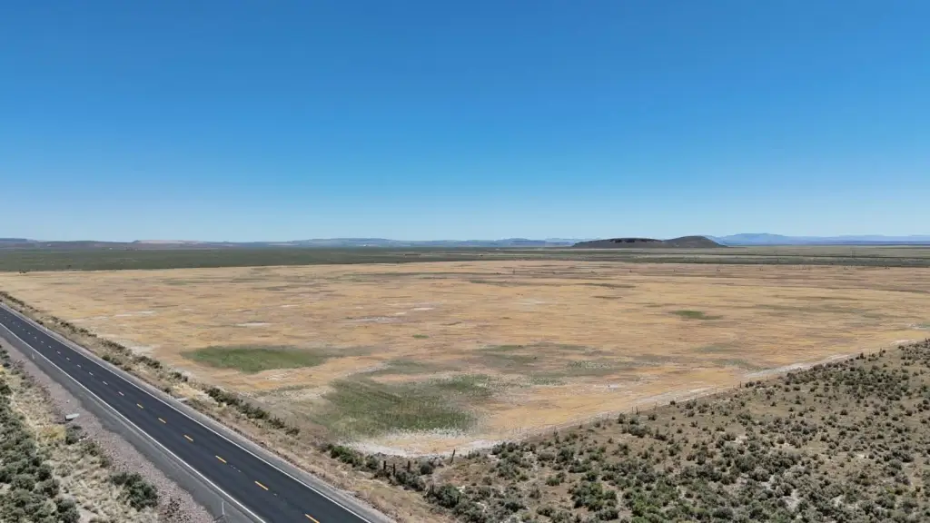
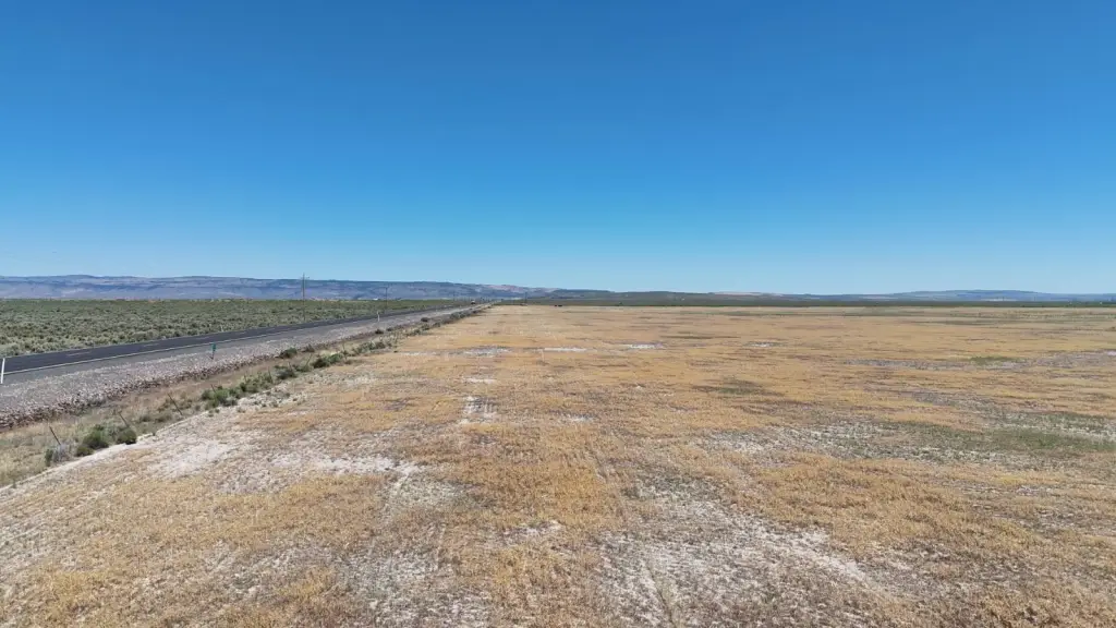
- 157 Deeded Acres with Highway Frontage: Offers excellent access and potential.
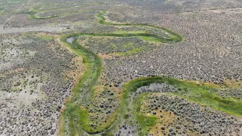
- Water Rights: Includes water rights certificate 93820 with an Oct. 29, 2008 priority date.
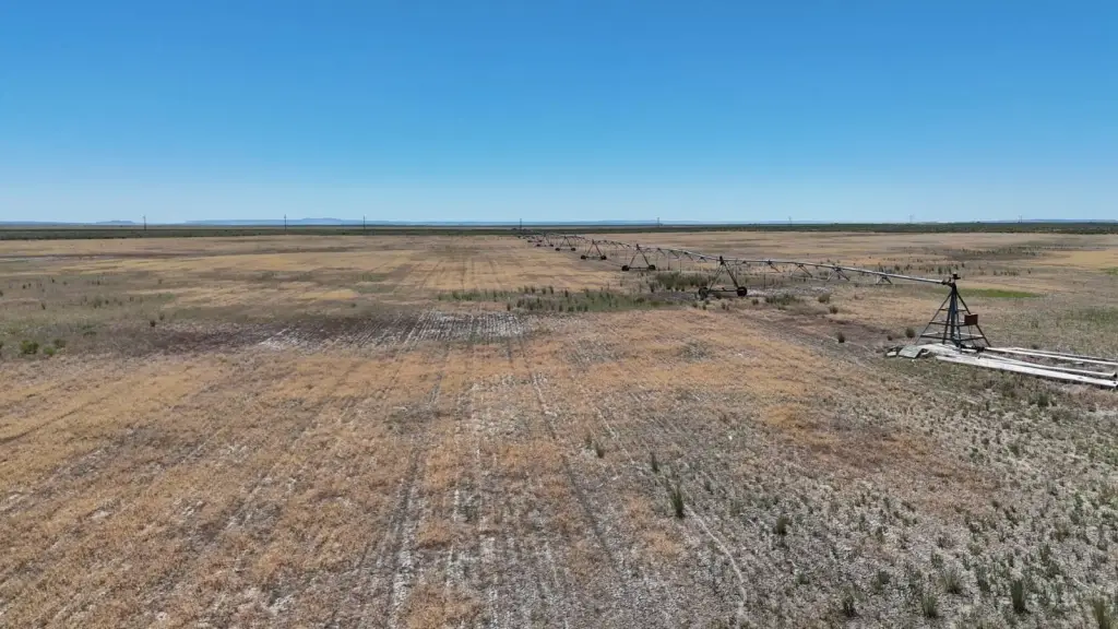
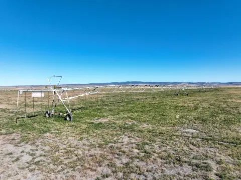
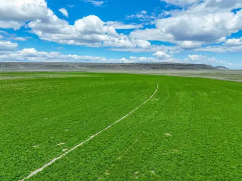
- Irrigation Pivot: Equipped with a Lockwood pivot system designed to irrigate approximately 125 acres.
- Irrigation Well: Has an existing irrigation well (Harn 50790) ready for use after cleaning.
- Stock Well: Includes a stock well (Harn 2018) located in the northeast corner.
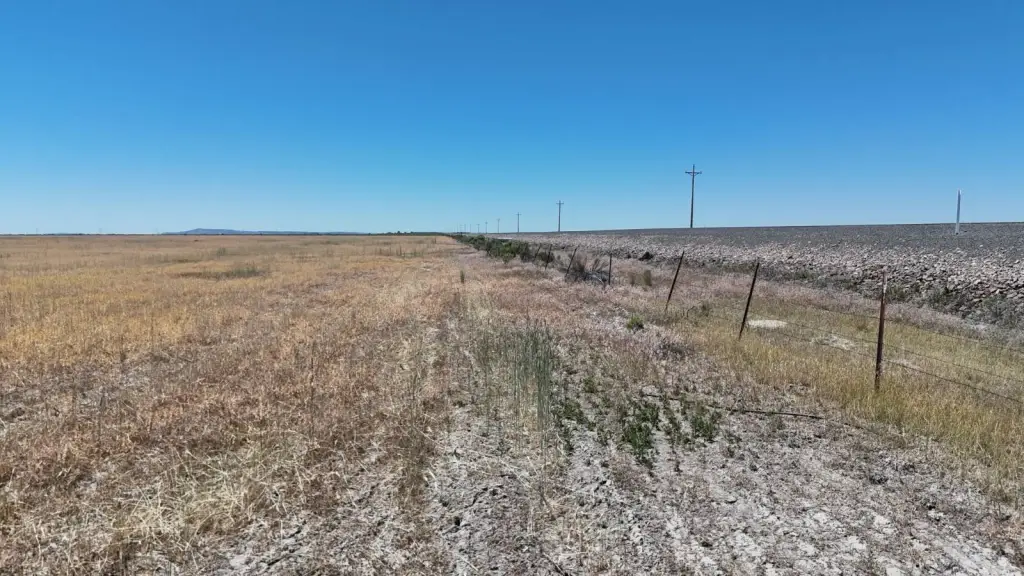
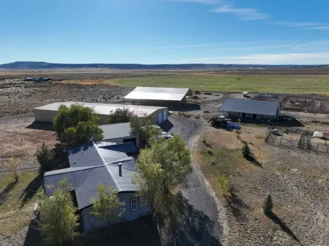
- Utilities: Connected to power via Harney Electric Co‑op.
Overview
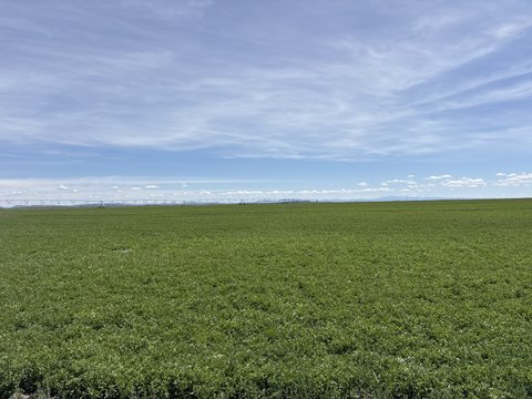
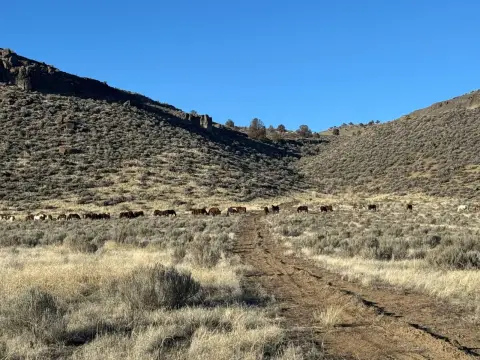
This Eastern Oregon property features 157 deeded acres with highway access, located approximately 20 miles southeast of Burns, Oregon, along Highway 78. The land includes 157 acres of water rights under certificate 93820, with a priority date of October 29, 2008. A Lockwood pivot is in place, set up to irrigate approximately 125 acres. The property also includes a stock well in the northeast corner and an irrigation well that requires cleaning. According to county records, the acreage consists of 157.67 +/- deeded acres, with approximately 125 +/- acres under pivot and 36.07 +/- acres in pivot corners. The property has two wells: one stock well (Harn 2018) and one irrigation well (Harn 50790). Power is provided by Harney Electric Co-op. The property could be a starter farm. The tax lot map is 25S32V00-00-00400. Taxes are $933.97.
Location Intelligence
Current Use by Public Records
Agricultural land / Farmland
Map
- City
- Burns
- County
- Harney
- State
- Oregon
- Longitude
- -119.047083
- Latitude
- 43.585964
Nearby Similar for Sale
FAQs
What type of property is this?
Agricultural land / Farmland - 157 acres near Burns, OR with highway access.
Where is this agricultural land / farmland located?
The property is located at TL 400 Off Highway 78 Burns, OR.
What is the asking price?
The asking price for this property is $195,000.
What are key features of this property?
This property features: 157 Deeded Acres with Highway Frontage: Offers excellent access and potential.; Water Rights: Includes water rights certificate 93820 with an Oct. 29, 2008 priority date.; Irrigation Pivot: Equipped with a Lockwood pivot system designed to irrigate approximately 125 acres.


