590 Sand Bar Ferry Rd Augusta, GA 30901
- Commercial land
- 3.82 lot acres
Current Use by Public Records
- Commercial land
Property Details for 590 Sand Bar Ferry Rd
- Lot size
- 3.82 lot acres
- Zone code
- LI
- Property type
- Commercial land
- APN
- 061-4-180-00-0
- APU
- 614180000
Description
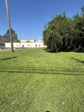
This exceptional 3.822-acre development site is strategically located at the intersection of Interstate 520 and Sand Bar Ferry Road in Augusta, Georgia (APN: 061-4-180-00-0). Zoned LI, this property presents a unique opportunity for a variety of commercial ventures. The asking price is $175,000. Its prime corner location offers excellent visibility and accessibility, making it highly suitable for a truck stop, convenience store, or warehouse distribution center. The slightly elevated position of the land provides natural storm runoff management. This versatile parcel is well-suited for residential, industrial, or retail development, presenting a compelling investment opportunity. The property's size and location in the thriving Augusta market make it an attractive prospect for developers seeking a high-impact project. Detailed site plans and zoning information are available upon request. Don't miss this chance to acquire a significant piece of commercial real estate in a rapidly growing area.
Value Estimation
-
CAP approach
-
Comparable approach
-
Alternative Use
Location Insight
- Map
- Local Demand
- City
- Augusta
- County
- Richmond
- State
- Georgia
- Longitude
- -81.9318
- Latitude
- 33.4563
- CBSA code
- 12260
- CBSA name
- AUGUSTA-RICHMOND COUNTY, GA-SC METROPOLITAN STATISTICAL AREA