Ship Channel Frontage Land
SH 82, Port Arthur, TX
Call to check price and availability
Land with deep water channel frontage near Gulf of Mexico.
Type:LAND
Lot size:
37.99 Acres- Added:
- Nov 24, 2025
- Days on Market:
- 181
- Last Refresh:
- May 20 at 8:36 pm
Property Features for SH 82
General Information
- Standard status
- Active
- Lot size
- 37.99 Acres
- Property subtype
- LAND

Listing agent Fred Ghabriel License #449020 (713) 823-2121
Listing office Bejjani & Associates (713) 823-2121
Listing date Nov 24, 2025
Source Moodyscre
Displayed information is deemed reliable but is not guaranteed and should be independently verified.
All listing content including descriptions, pricing, images are the copyrighted material of Bejjani & Associates
HighLights
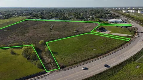
- 2600 feet of deep water channel frontage on the Ship Channel, only 10 miles from the Gulf of Mexico.
- Transferable permit from the Army Corps of Engineers to sheet pile and dredge the water frontage up to a 40‑foot depth.
- Located on Pleasure Island, Port Arthur.
- Proximity to the intracoastal canal and the turning basin, across from Texaco Island.
- Apron width of 1,000 ft on the North side and 300 ft on the South side.
- Highway access via a 22‑foot wide highway traversing the property.
Overview
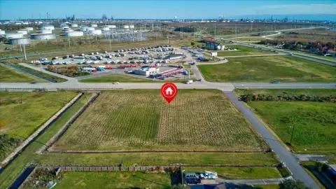
This property is located on the Ship Channel and SH 82, near the intracoastal canal and the turning basin, across from Texaco Island, on Pleasure Island in Port Arthur. It features 2,600 feet of frontage on the deep water channel, situated only 10 miles from the Gulf of Mexico. The seller possesses a transferable permit from the Department of the Army Corps of Engineers, allowing for sheet piling and dredging of the water frontage to a depth of up to 40 feet along the 2,600 feet of the east bank of the Port Arthur Ship Channel. The apron width measures 1,000 feet on the north side and 300 feet on the south side. A 22-foot wide highway, formerly Highway 82, traverses the property. This highway was rerouted in the early 1980s and now runs alongside the easterly boundary line of the subject property.
Location Intelligence
Current Use by Public Records
Commercial land
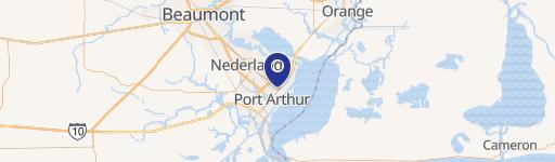
Map
- City
- Port Arthur
- County
- Jefferson
- State
- Texas
- Longitude
- -94.1898
- Latitude
- 29.7569
Nearby Similar for Sale

FAQs
What type of property is this?
Land - Land with deep water channel frontage near Gulf of Mexico.
Where is this land located?
The property is located at SH 82 Port Arthur, TX.
What are key features of this property?
This property features: 2600 feet of deep water channel frontage on the Ship Channel, only 10 miles from the Gulf of Mexico.; Transferable permit from the Army Corps of Engineers to sheet pile and dredge the water frontage up to a 40‑foot depth.; Located on Pleasure Island, Port Arthur.


