HWY 43 N, Picayune, MS 39466
- Added:
- Jan 16, 2026
- Days on Market:
- 144
- Last Refresh:
- Jun 9 at 5:06 pm
Property Features for HWY 43 N
General Information
- Property type
- Land
- Property subtype
- Other
- Standard status
- Active
- APN
- 5186140000000326
- Lot size
- 17.11 Acres
Taxes and HOA fees
- Tax Description
- 16.13 AC IN N1/2 NE1/4 & .98 AC IN NE1/4 NE1/4 &
Utilities
- Utilities
- Water Available
Listing agent Heather DeJurnett (601) 569-0262
Listing office The Real Estate Company, LLC 111 Hwy 11 S Ste B, Carriere, MS (601) 590-1246
Listing date Jan 16, 2026
Copyright © 2026 Pearl River County Board of Realtors. All rights reserved. All information provided by the listing agent/broker is deemed reliable but is not guaranteed and should be independently verified.
HighLights
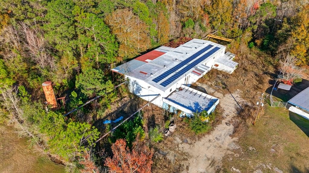
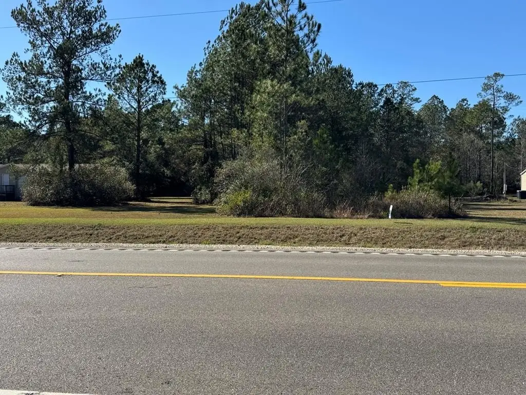
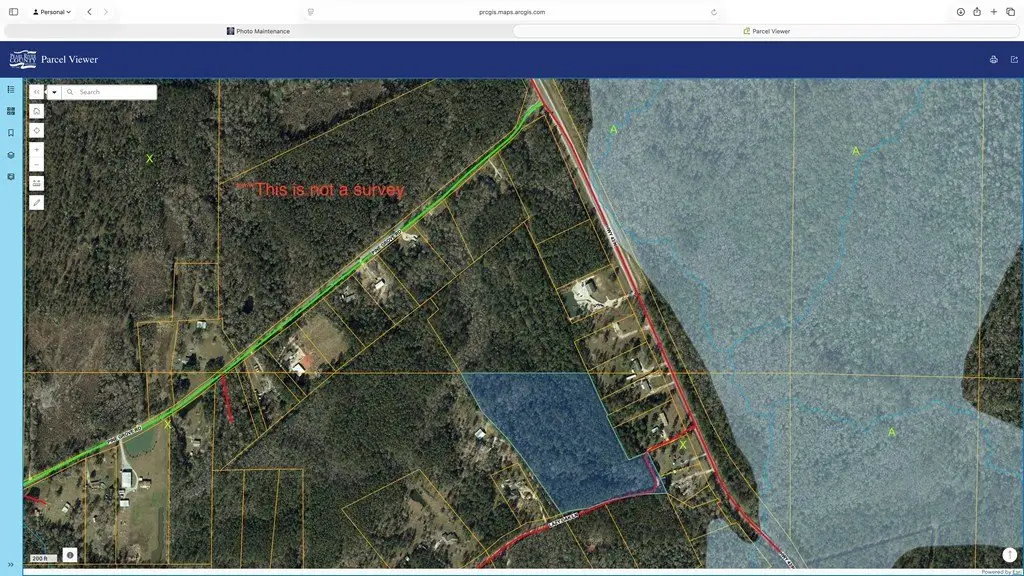
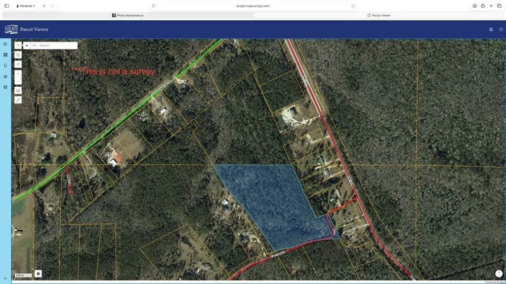
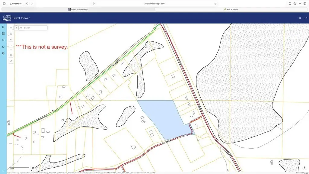
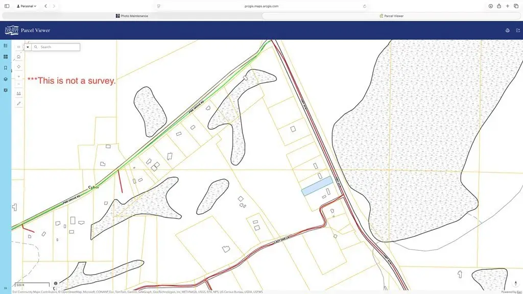
- 16.13‑acre wooded tract in Pearl River County, located south of Pine Grove Road on Hwy 43
- Two parcels sold together, including a 0.98‑acre parcel that provides an easement connection
- Road frontage on Lazy Oak Lane plus additional access toward Hwy 43
- Outside city limits in the Pic‑Westside school district; mobile homes allowed with no known restrictions
- Flood Zone X per listing; utilities including electricity, water, and sewer available at the road (buyer to verify)
- Scheduled to be cleared; suitable for residential, multi‑family, timber, or recreational use
Overview
The tract is located south of Pine Grove Road on Hwy 43, with road frontage on Lazy Oak Lane. Additional access toward Hwy 43 is described as providing both privacy and convenience. The property is outside city limits and is in the Pic-Westside school district. The listing also indicates Flood Zone X.
This site may fit buyers seeking flexible use for residential, multi-family, timber, or recreational development, with clearing planned to support future improvements. With access via road frontage and an easement connection, the property offers practical entry points while remaining outside city limits. Buyers should verify utility availability at the road and confirm use requirements and any development criteria relevant to their intended plan.
Current Use by Public Records
Map
- City
- Picayune
- County
- Pearl River
- State
- Mississippi
- Longitude
- -89.76719715
- Latitude
- 30.61991