
0 Clarks Run Rd, Mt Sterling, OH 43143
- Added:
- Mar 12, 2026
- Days on Market:
- 90
- Last Refresh:
- Jun 9 at 12:06 pm
Property Features for 0 Clarks Run Rd
General Information
- Property type
- Farm
- Property subtype
- Farm
- Parking features
- Garage
- Standard status
- Active
- APN
- G17-0-001-00-067-00, G17-0-001-00-044-11
- Lot size
- 358.70 Acres
Taxes and HOA fees
- Tax Annual Amount
- 12834
Building Details
- Architectural style
- Other
Listing agent Brandon Wilson (800) 450-3440
Listing office Wilson National LLC 8845 State Route 124, HILLSBORO, OH (937) 393-3440
Listing date Mar 12, 2026
Copyright © 2026 My State MLS. All rights reserved. All information provided by the listing agent/broker is deemed reliable but is not guaranteed and should be independently verified.
HighLights
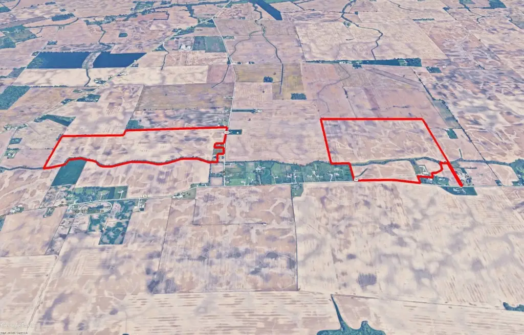
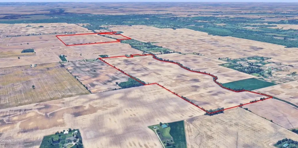
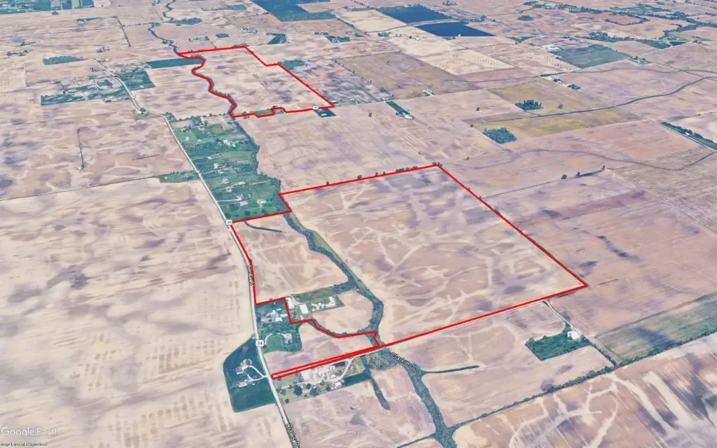
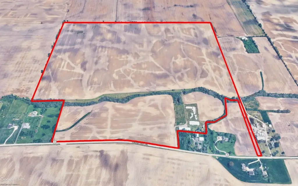
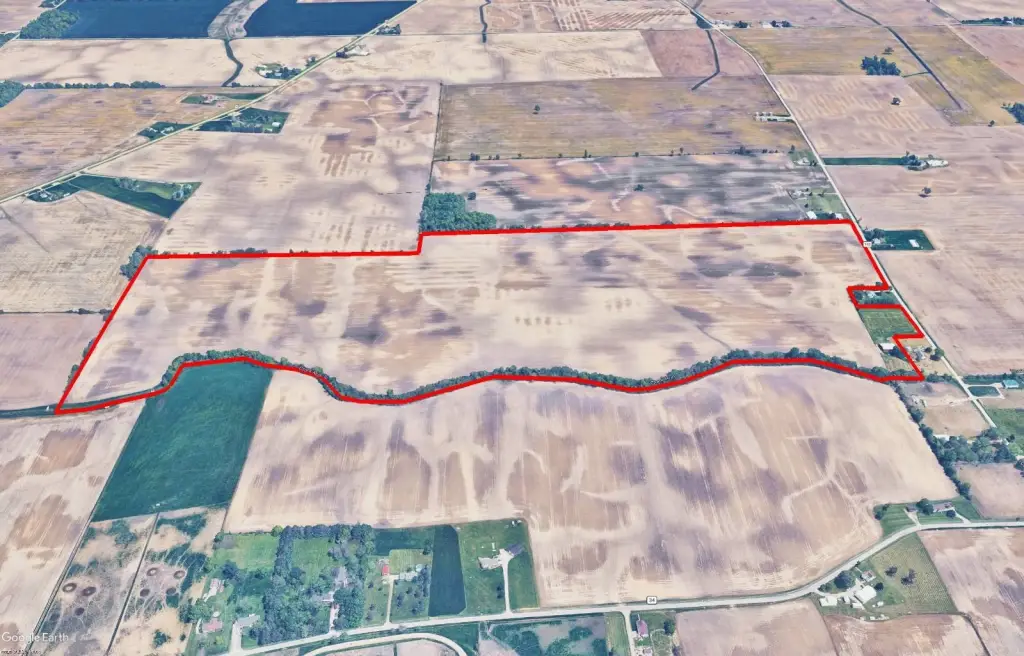
- 358.7‑acre productive farmland in Monroe Township, Pickaway County, OH
- 337.41 FSA tillable acres across two tracts: 184.50 acres (Clarks Run Road) and 152.91 acres (Call Road)
- Level terrain with random tiling; tracts border Clarks Run, serving as the drainage outlet
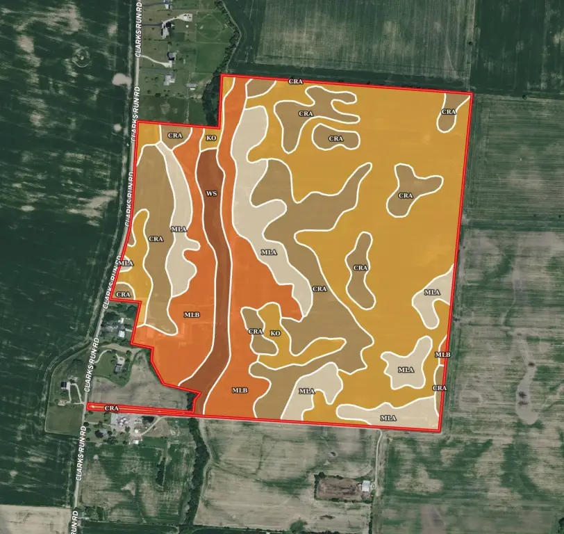
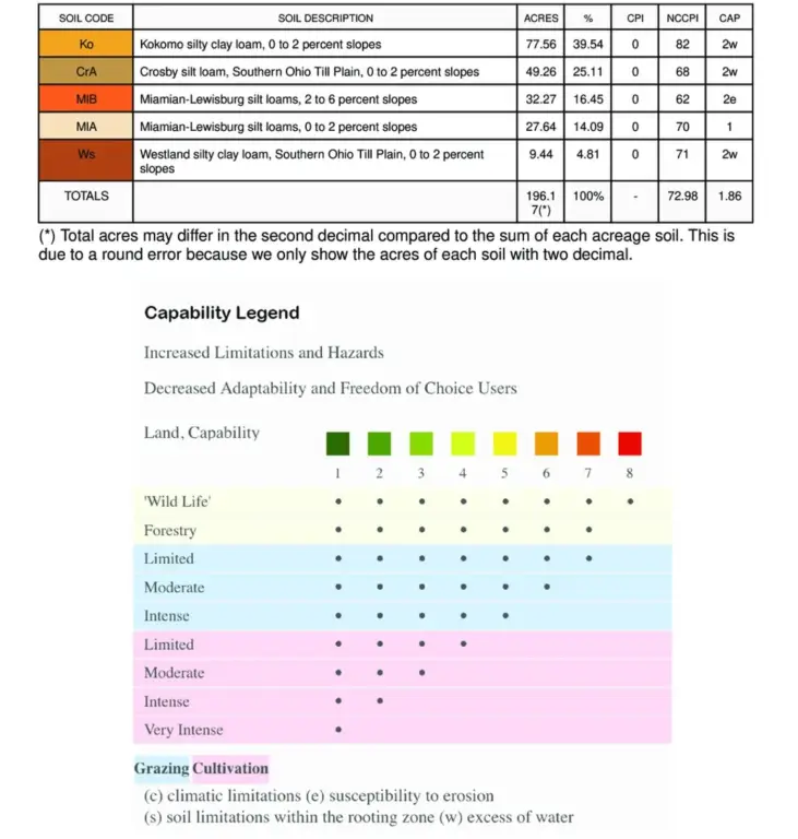
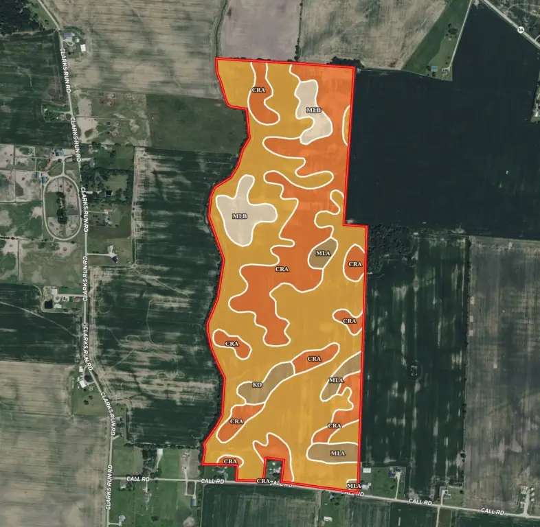
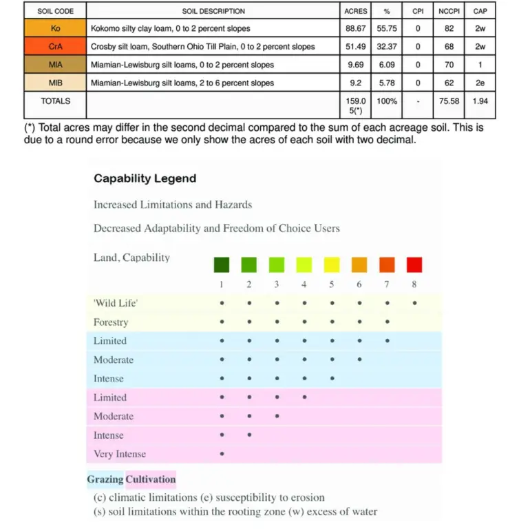
- Soils are approx. 50% Kokomo and Westland silty clay loam and 50% Crosby and Miami silt loams
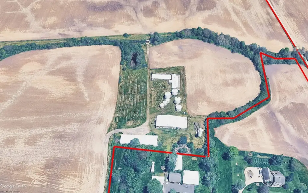
- Clarks Run Road tract includes seven grain bins totaling ~35,888 bu of storage and a 40'x150' Butler Steel machine barn with enclosed shop
- Currently cash rented for the 2026 crop year
Overview
Both tracts border Clarks Run, which functions as the drainage outlet. The Clarks Run Road tract includes seven grain bins with approximately 35,888 bushels of storage, a 40’ x 150’ Butler Steel machine barn with an enclosed shop, a hog barn, a stock barn, and additional pole barn storage. The Call Road tract includes a 60’ x 75’ open-front machine and stock pole barn.
For operators and investors seeking working farmland, this property is currently cash rented for the 2026 crop year. Its mix of tillable acreage and established farm improvements supports ongoing crop production and storage on-site, with convenient access to regional markets and nearby recreational amenities noted in the remarks.
Current Use by Public Records
Map
- City
- Mt Sterling
- County
- Madison
- State
- Ohio
- Longitude
- -83.2360399
- Latitude
- 39.6806658


